
According to the National Center for Hydro-Meteorological Forecasting, at 1:00 pm on July 5, the center of storm No. 2 was located at about 0.5 degrees North latitude; 117.4 degrees East longitude. The strongest wind near the center of the storm was level 9 (75-88 km/h), gusting to level 11. The storm slowly moved north at a speed of about 5 km/h.
At 1:00 pm on July 6, the storm was in the northeastern part of the East Sea with strong winds of level 10-11, gusting to level 13 and likely to strengthen.
The storm is moving in a North-Northeast direction at a speed of 5-10km/h. The affected area is the northeastern sea area of the North East Sea. Disaster risk level 3.
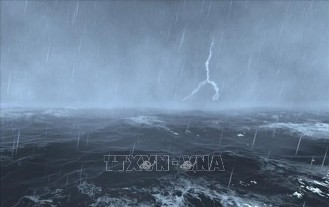
At 1 pm on July 7, the storm was in the sea of Fujian province (China) with strong winds of level 10, gusts of level 12. The storm moved in a North-Northeast direction at a speed of 15-20 km/hour. The affected area was the northeastern sea area of the North East Sea. Disaster risk level 3.
At 1:00 pm on July 8, the storm was on land in Zhejiang province (China) with strong winds of level 8, gusting to level 12. The storm moved in a North-Northeast direction at a speed of 15km/hour.
From the next 72 to 96 hours, the storm moved in the West Northwest direction at a speed of about 10-15km/hour and gradually weakened into a low pressure area.
Due to the impact of the storm, the northeastern sea area of the North East Sea has stormy rain and strong winds of level 7-8, the area near the storm's center has winds of level 9-11, gusts of level 13, rough seas, waves 4-6m high.
Ships and boats operating in the above-mentioned dangerous areas are likely to be affected by storms, whirlwinds, strong winds and large waves.
Source: https://baolangson.vn/ngay-6-7-bao-so-2-doi-huong-va-co-kha-nang-manh-them-5052297.html


Comment (0)