
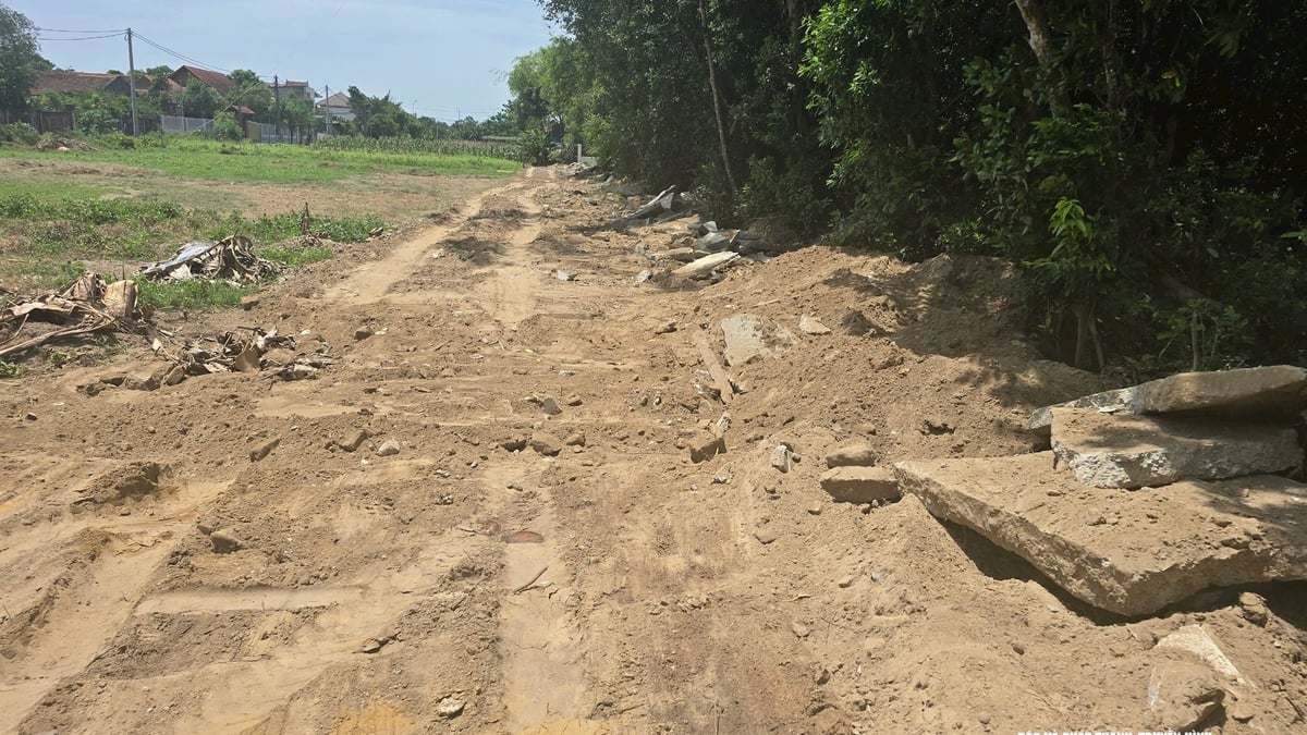
The 3.9 km long dike protects nearly 90 hectares of crops of 20 households. During inspection on July 7, authorities and local people discovered landslides at the foot of the dike, the dike roof and the riverside of the dike.
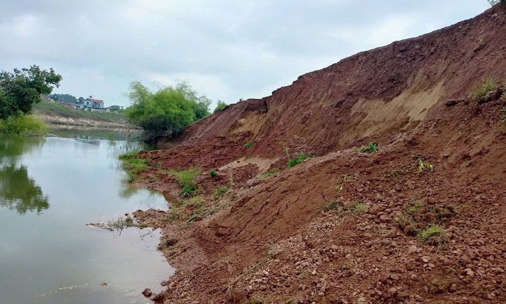 |
The dike has landslides and landslides. |
Specifically, the area where the landslide arc K2+300 appears belongs to the left Thuong dike, the riverbank is 3-5 m wide and is planted to protect against waves, the field side is cultivated fields and residential areas. The landslide area has a total length of 265 m, of which the widest landslide arc is 5-6 m, 1-1.5 m deep into the dike body, the height from the top of the landslide arc to the water's edge is 8-9 m, with the risk of further development.
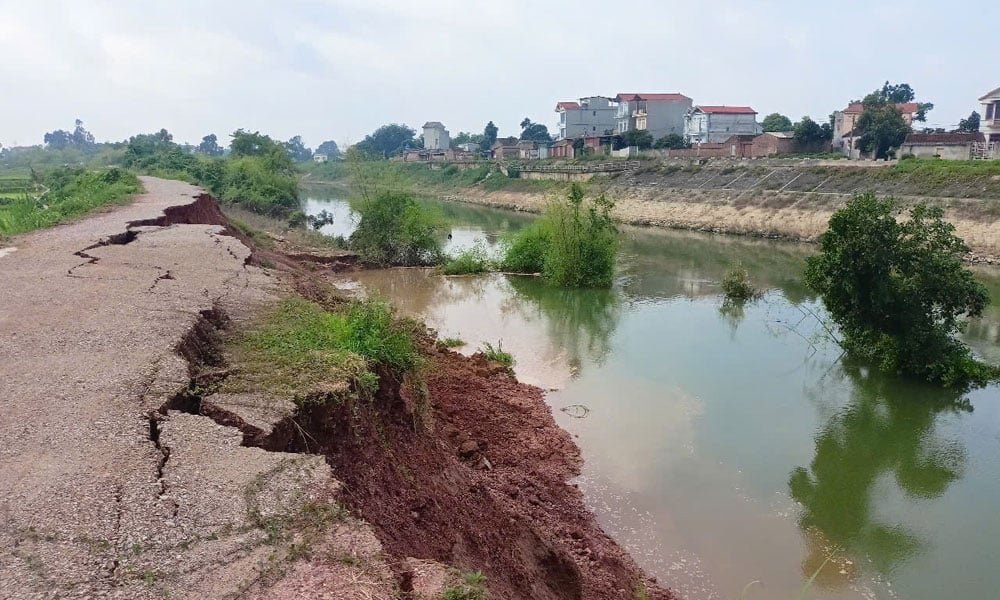 |
The landslide position is 1-1.5 m deep into the dike body. |
Immediately after discovering the incident, the local dike management department coordinated with the People's Committee of My Thai commune to inspect and assess the cause; at the same time, they put up warning signs and cordoned off the dangerous area. At the same time, they arranged for local authorities to regularly monitor the incident.
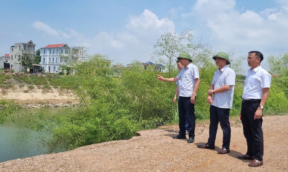 |
Representatives of the Provincial Steering Committee for Natural Disaster Prevention, Control and Search and Rescue inspected the incident. |
In response to the above incident, representatives of the Provincial Steering Committee for Natural Disaster Prevention, Control and Search and Rescue went to the scene to inspect and assess the situation. Assessing that this was a dangerous incident, the landslide had eaten into the dike and continued to develop, the My Thai commune government recommended that the relevant agencies and the Provincial People's Committee promptly take remedial measures to ensure the safety of people's lives and property during the rainy and stormy season.
Source: https://baobacninhtv.vn/bac-ninh-xuat-hien-su-co-sat-lo-de-boi-postid421509.bbg


Comment (0)