
High level disaster risk warning
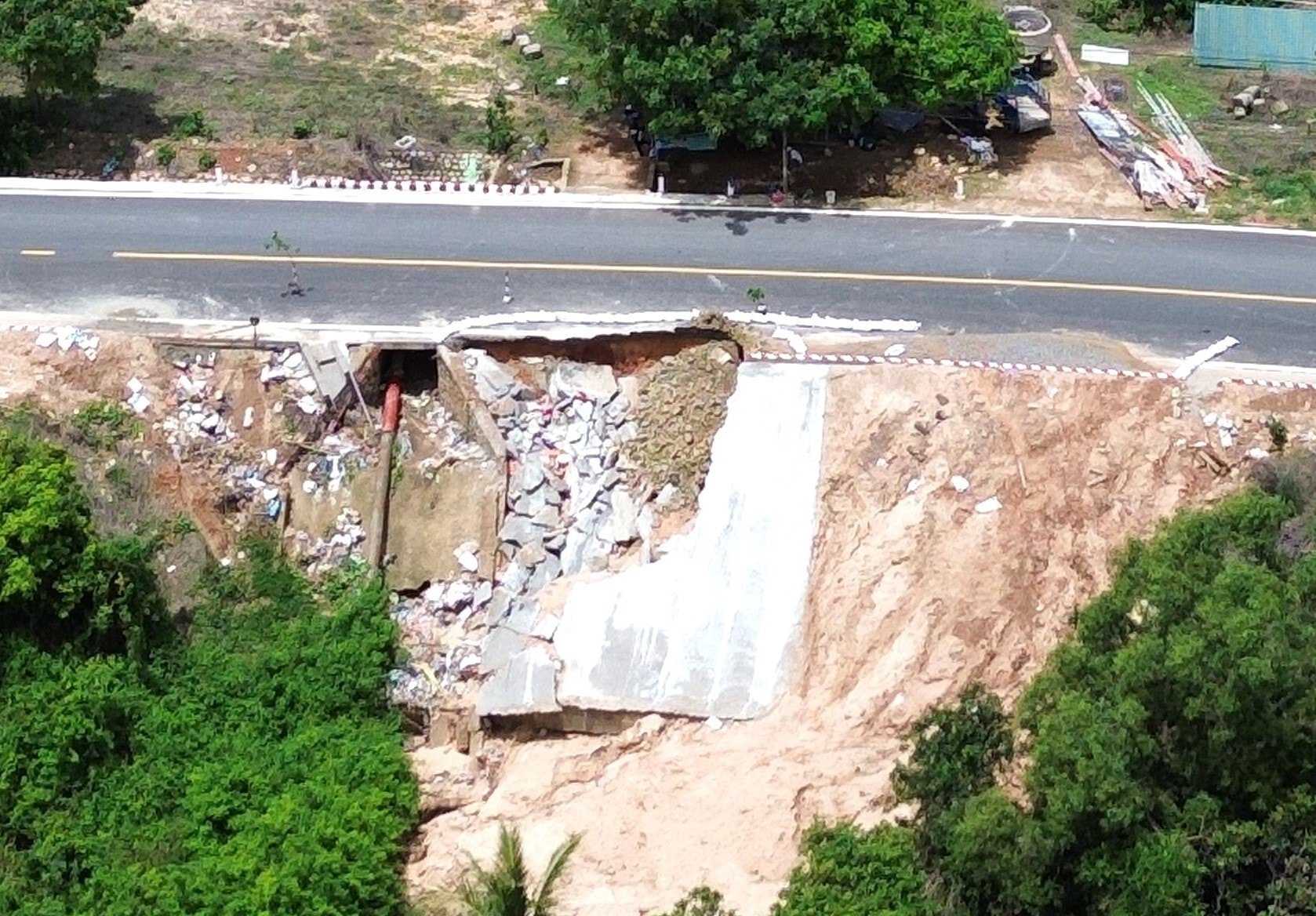
According to information from the National Center for Hydro-Meteorological Forecasting , the northern mountainous areas are facing a high risk of dangerous natural disasters including flash floods, landslides and land subsidence on steep slopes and small stream areas.
This is an emergency level warning issued by meteorological experts based on the analysis of current weather factors and forecast weather developments in the coming hours. Flooding or runoff is being identified as the main cause of these risks.
Nghe An faces widespread risks
Nghe An province is identified as the area with the highest number of risk locations with 24 areas included in the warning list. These areas include Muong Xen, Huu Kiem, Bac Ly, Chau Binh, Chau Hong, Chau Tien, Chieu Luu, Hung Chan, Huoi Tu, Keng Du, Luong Minh, Muong Long, Muong Quang, My Ly, Na Loi, Na Ngoi, Nam Can, Que Phong, Quy Chau, Tam Quang, Thong Thu, Tien Phong, Tri Le, Tuong Duong.
To ensure the most accurate and continuous information updates, the National Center for Hydro-Meteorological Forecasting has deployed an online monitoring system at luquetsatlo.nchmf.gov.vn. Here, people and authorities can monitor the risk map which is updated in detail and continuously.
Meteorological experts advise people in at-risk areas to closely monitor weather developments and strictly follow the instructions of local authorities.
In areas at risk of landslides and land subsidence, people should stay away from steep slopes, not travel through high-risk areas and be ready to move to a safe place when notified by the authorities.
It is extremely important to monitor warning information and maintain contact with local authorities in this situation. Residents should also be prepared with necessary items for emergency evacuation if necessary.
Source: https://baonghean.vn/nghe-an-canh-bao-khan-nguy-co-lu-quet-va-sat-lo-dat-10301528.html


Comment (0)