

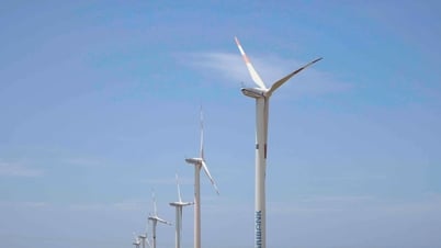
The Ba River, before flowing into the East Sea through Tuy Hoa, is also called the Da Rang River. A railway bridge across the river also bears that name. The railway through Phu Yen (now Dak Lak) commemorates an event in the history of Vietnam's railway industry: in 1936, King Bao Dai and French officials in Central Vietnam turned the last screw at Hao Son station, north of Ca Pass, the last rail connection point of the Trans-Indochina railway at that time. The first train to enter Tuy Hoa station on October 1, 1936, contributed to the expansion of trade in this city.
Villages on both banks of the Da Rang River were formed when Mr. Luong Van Chanh brought migrants to reclaim wasteland. In 1578, Commander Luong Van Chanh, following the order of Lord Tien Nguyen Hoang, brought about 4,000 migrants from Thanh Hoa, Nghe An and Thuan Quang to reclaim and establish villages in the Tuy Hoa plain. In 1689, Mr. Luong Van Chanh was posthumously awarded the title of Bao Quoc Chi Than - the guardian god of the country. In 1693, he was once again awarded the title of Bao Quoc Ho Dan Chi Than - the guardian god of the country and the people.
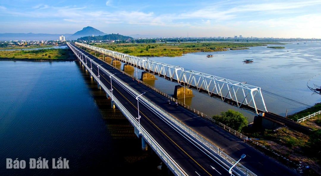 |
| Da Rang Bridge on Ba River. Photo: Le Ngoc Minh |
In the late 16th and early 17th centuries, along with the process of Vietnamese residents coming to reclaim and build Phu Yen land, the Tuy Hoa area today began to form the first residential units of Vietnamese people. Pagodas in Tuy Hoa such as Ho Son, Bao Tinh, Kim Cang, Long Quang were built in the late 17th and early 18th centuries. This shows that before that, there was a long process of residents coming to settle down and live here.
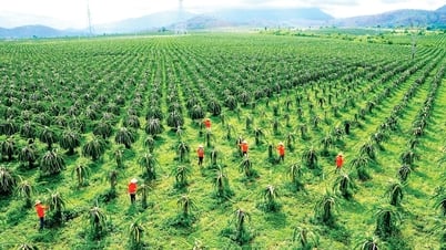
Thanks to its extremely favorable location, with mountains, rivers, fields, and seas, the ancient Tuy Hoa land quickly developed agriculture , fishing, and commerce. Phu Cau village, located close to the sea, specialized in fishing. Other villages engaged in agriculture and soon formed specialized vegetable and flower growing areas that still exist today, such as Binh Ngoc, Binh Kien, Hoa Kien, etc. Right from the beginning of the formation of that village, some handicrafts such as mat weaving, pottery making, and fish sauce processing were also formed.
Thanks to its extremely favorable geographical location, Tuy Hoa has attracted many Chinese merchants since the mid-19th century. They came here in increasing numbers and settled in the area at the foot of Nhan Mountain, close to the North bank of Chua River in Nang Tinh village. The Chinese community settled in Tuy Hoa to trade and also left many cultural marks, especially in ancient urban architecture and religious architecture. Quan Thanh Temple was built in 1874, Thien Hau Temple was built in 1882 and many other architectural relics were mainly built in the late 19th and early 20th centuries.
In 1899, Phu Yen was divided into new administrative units with 2 prefectures and 2 districts, the provincial capital was located in Song Cau. Tuy Hoa was promoted to a prefecture governing Son Hoa. In 1915, the capital of Tuy Hoa was moved from Dong Phuoc Hoa An to Nang Tinh village. The presence of a prefecture-level administrative center at that time had a huge impact on promoting economic development, attracting a high density of residents, and market activities became more and more vibrant. At that time, people everywhere often called Tuy Hoa Dinh, the big market here was also called Dinh market. In the first decades of the 20th century, commercial activities in Tuy Hoa continued to develop strongly, especially after the North-South railway and National Highway 1 through Phu Yen, National Highway 25 connecting Tuy Hoa with the Central Highlands were completed.
According to the book “Du dia chi Phu Yen”, in the late 1930s, Dinh market (now Tuy Hoa market) was the largest market among 58 markets in Phu Yen. The types of goods bought and sold at that time were very diverse: Chinese and Western goods were available. At the end of 1946, a large part of Tuy Hoa urban infrastructure was burned to serve the resistance war against French colonialism. In the early 1960s, Tuy Hoa was the provincial capital of Phu Yen province with very significant changes, the streets were opened, the commercial center was bustling and bustling, especially the area of Nga 5 today.
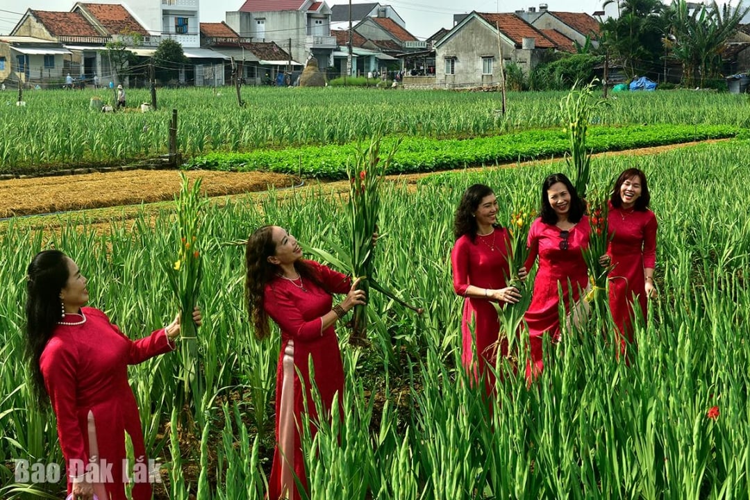 |
| Spring colors of Binh Ngoc flower village . Photo: Le Ngoc Minh |
After the liberation of the South on April 30, 1975, the two provinces of Phu Yen and Khanh Hoa merged into Phu Khanh province, with the provincial capital located in Nha Trang city, but Tuy Hoa city remained a major center in the North. In 1989, Phu Yen was re-established as a province, and Tuy Hoa returned to its provincial capital position.
Today, implementing the policy of administrative unit arrangement, Phu Yen and Dak Lak are united under the name of Dak Lak province, the administrative center is located in Dak Lak; Tuy Hoa city becomes Tuy Hoa, Phu Yen, Binh Kien wards. With this arrangement, it is expected that the potential and advantages of socio-economic development of the urban area on the East Sea coast will be exploited more effectively...
Before flowing into the sea, the Ba River has drained all its silt to create a wide riverbank. As if to beautify the river, Tuy Hoa people have turned that riverbank into the famous Ngoc Lang vegetable and flower village. After the annual flood season, it will be the Tet flower season. Along the riverbank, brilliant with gladiolus and yellow chrysanthemums, in the memories of Tuy Hoa people, are windy sails, sails that represent the aspirations of a land from deep within its roots. In the future, we will continue to cultivate so that before flowing into the sea, the Ba River will be happy because the path it has traveled has had such fertile land...
Source: https://baodaklak.vn/van-hoa-du-lich-van-hoc-nghe-thuat/202507/kien-tao-do-thi-tu-dong-song-ba-4da1009/
![[Photo] Multi-colored cultural space at the Exhibition "80 years of the journey of Independence - Freedom - Happiness"](https://vphoto.vietnam.vn/thumb/1200x675/vietnam/resource/IMAGE/2025/8/26/fe69de34803e4ac1bf88ce49813d95d8)
![[Photo] Prime Minister Pham Minh Chinh chairs meeting of National Steering Committee on International Integration](https://vphoto.vietnam.vn/thumb/1200x675/vietnam/resource/IMAGE/2025/8/26/9d34a506f9fb42ac90a48179fc89abb3)
![[Photo] Prime Minister Pham Minh Chinh receives CEO of Samsung Electronics](https://vphoto.vietnam.vn/thumb/1200x675/vietnam/resource/IMAGE/2025/8/26/373f5db99f704e6eb1321c787485c3c2)


Comment (0)