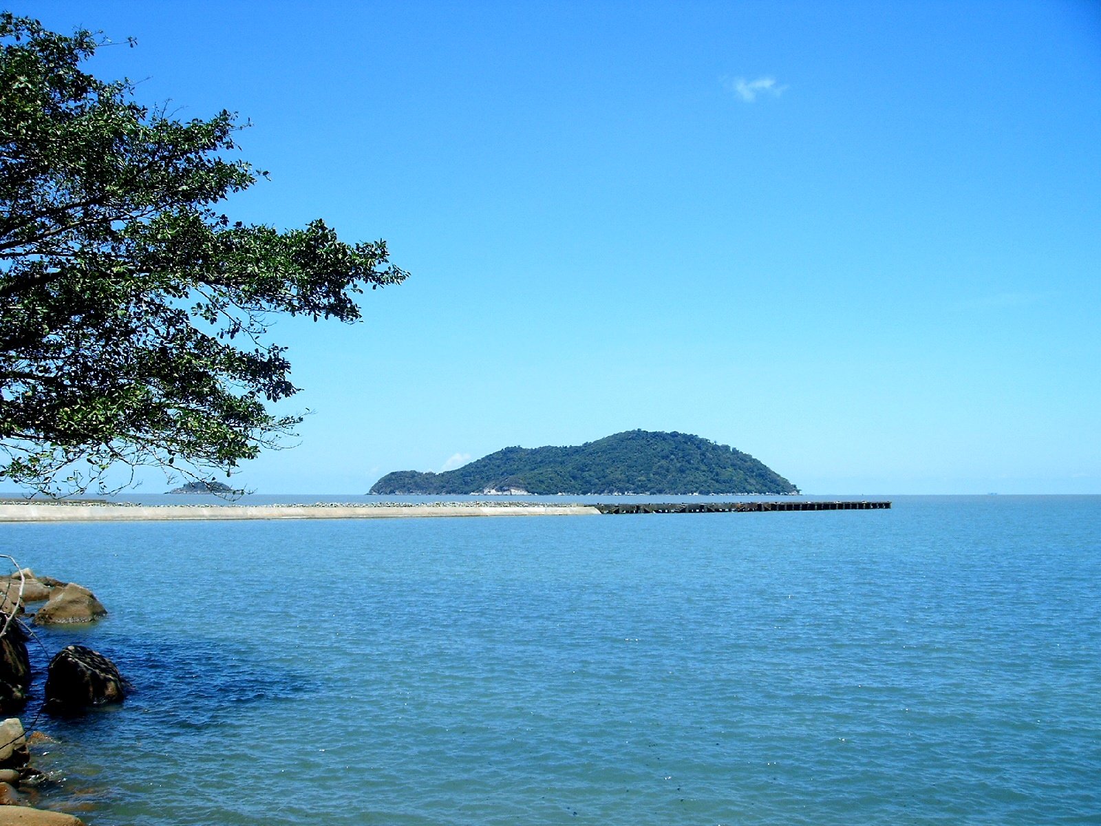
Hon Khoai is about 25km from the mainland at Rach Goc estuary.
The boat took us to Hon Khoai ( Ca Mau ). On both sides of the Rach Goc River, fishing villages were still sleeping in the misty fog. To the East, the sky was a light orange. A new day had begun. At 6:15, the boat stopped at Rach Goc Border Control Station. The captain and owner of the CM 8163 TS boat presented his papers and completed the procedures. The border guards counted the people and checked the buoys. The boat backed up, then headed straight towards the estuary. The sun had risen, the sea was vast and sparkling. The boat turned towards Hon Khoai. On the mainland, there were only mangrove forests standing tall like a wall blocking the sea. Hon Khoai was already visible, a cluster of blue in front. Hon Khoai was about 25km from the mainland at the Rach Goc estuary. The fishing boat carrying us was traveling at a speed of 6 nautical miles. "We will arrive at Hon Khoai in two hours" - Someone on the boat said.
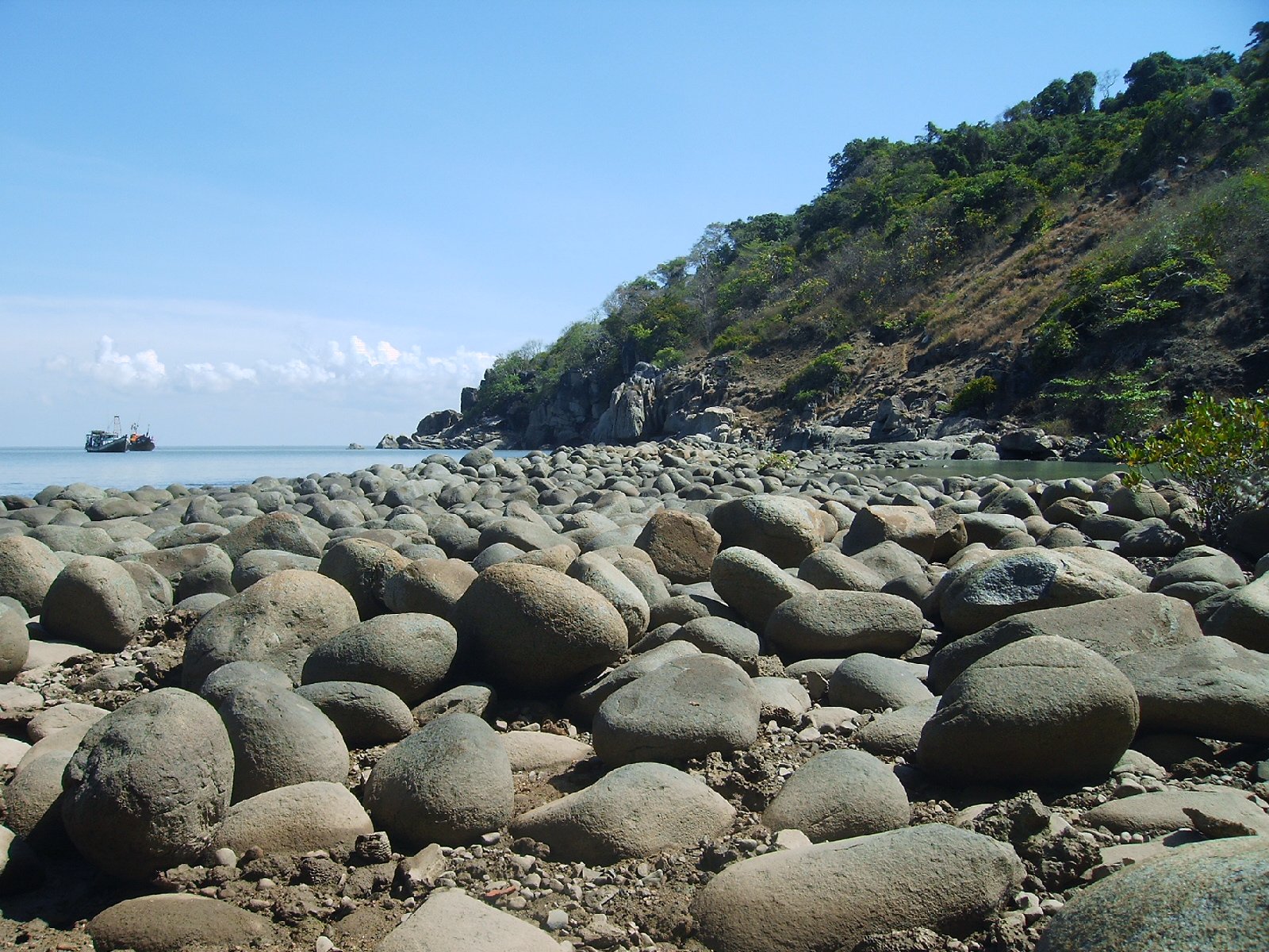
The sea water gradually changed to a light blue color, not as murky as near the shore. Hon Doi Moi, Hon Tuong, Hon Sao gradually appeared,... then Hon Khoai. Millions of years of rock were eroded by the waves at the foot, creating strange shapes! Hon Tuong looked like a giant elephant half submerged in the sea. The boat stopped at Bai Nho in the southwest of the island. The trees on the mountain were dense, giving a wild, poetic appearance,... Bai Nho was shallow so the boat could not dock close to the dock. Passengers had to get on a small boat to get to shore about 40m away. On the right side of the dock was a beautiful egg-shaped rock beach as if arranged by someone!
Border Guard Station 700 is located close to the cliff. The Hon Khoai Forest Protection Department is also located next to it. In fact, there are no residents on Hon Khoai. The Navy is stationed at Bai Lon, on the east side of the island. A working group of the Maritime Safety Assurance Company looks after the lighthouse at 8.25.36 degrees North latitude 104.50.06 degrees East longitude, on a peak of 317.5m.
I and some young people from Doan Tan An commune, Ngoc Hien district (formerly Ca Mau) started climbing the mountain road to go up to the lighthouse on the top of Hon Khoai. The road through the forest was quite dangerous with steep slopes and scattered with egg-shaped rocks. Yet the trees were green and unusually strong! I stood there, looking at the forest's mu u trees, about seven or eight people could not hug them. Going through the forest canopy, there were many ancient Lagerstroemia trees. Sao, Dau, Spoon, and Rang Vang (lim) were scattered everywhere along the mountainside. Birds chirped on the forest's tram trees with clusters of ripe, dark black fruits. The scent of jade spread faintly among the mountains and forests. Occasionally, we crossed small streams and creeks, the water so clear that it reflected people's faces. The road to the lighthouse was winding, about 3km long but it took nearly 2 hours to get there. Hon Khoai lighthouse had a diesel generator. In addition, there is also a solar panel system that converts solar energy into electricity for lighting, watching TV, etc.
Hon Khoai Lighthouse is part of the Can Gio - Con Dao - Phu Quoc lighthouse system, built by the French in 1939, and has been upgraded and repaired. The lighthouse is 15.7m high, each side is 4m, built of rubble, with a spiral staircase inside, and a headlight that can reach 35 nautical miles.
On the top of Hon Khoai, next to the lighthouse, there is a stele recording the Hon Khoai uprising of teacher Phan Ngoc Hien. Several rows of stone houses built during the French colonial period stand alone, desolate as evidence of time. We went back down the mountain, going around the east side of Hon Khoai along the gently sloping asphalt road, between the canopy of the "giao du" forest trees(*). There were a few sharp and steep turns. Bai Lon appeared like a miniature Nha Trang. The sea was blue, in the distance the waves were rippling, sparkling. Fishing boats bobbed on the waves, the wind blew into the bay. The sea, the forest, and the rocks intertwined to create a poetic and wild natural picture.
We took a shortcut up the mountain to Bai Nho, exhausted with the steep mountain road. Hon Khoai has only 561 hectares, fresh water is available all year round. In the dry season, coastal people of Ca Mau and fishing boats often stop by Hon Khoai to get water. Scientists , environmental activists as well as those interested in Hon Khoai have legitimate concerns for this small island. If not strictly preserved, the flora and fauna of Hon Khoai will be at risk of becoming poor because the forest area here is small and far from the mainland, lacking exchange and supplementation between species and breeds. Human impact is also worth noting when considering tourism for the island. Exploitation and conservation must be two parallel, strict criteria for the natural environment. We stopped by the ranger station on the mountainside at noon. Rice was served with braised pineapple fish, sour soup with sea bass head cooked with sliced wild banana, boiled sea crab with chili salt, stingray cooked with fermented rice, boiled mantis shrimp, steamed tiger prawn with beer,... Hon Khoai seemed to lack nothing, except for the silhouette of people! We boarded the boat to the mainland. The station chief, deputy station chief and soldiers stood on the wharf waving to see us off. The green signboard with the words "Border Guard Station 700" gradually faded away in the afternoon light on the sea.../.
(*) canopy (local word): Trees spread out on both sides, covering the road, river, canal, stream, or path like a dome.
Hoang Tham
Source: https://baolongan.vn/hon-khoai-hoang-so-hon-ngoc-tho-a198111.html



![[Photo] People eagerly lined up to receive special publications of Nhan Dan Newspaper](https://vphoto.vietnam.vn/thumb/1200x675/vietnam/resource/IMAGE/2025/8/30/53437c4c70834dacab351b96e943ec5c)






















































Comment (0)