
 |
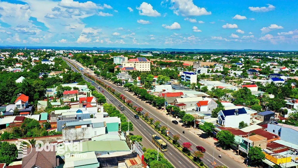
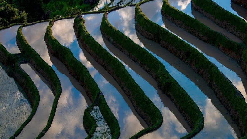
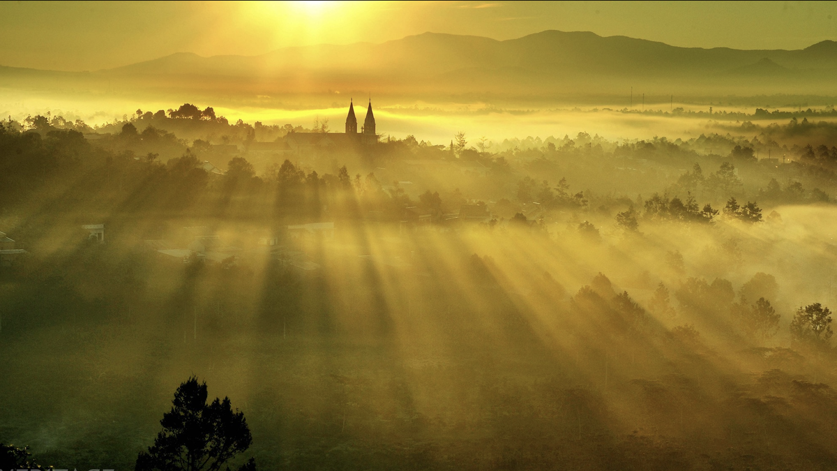
| View of Dong Xoai ward from above. Photo: Phu Quy |
The road from Bien Hoa to Dong Xoai is about 90km long. Then dozens of more kilometers up to Phuoc Long, Bu Gia Map, down to Bu Dang... I encountered almost all the familiar scenes... of Dong Nai . The endless rubber forests, the rice fields preparing for the summer - autumn crop... like on both sides of National Highway 1, National Highway 20 of Dong Nai; durian farms like in Long Khanh, Long Thanh; Ba Ra mountain reminds me of Chua Chan mountain; Thac Mo hydroelectric plant reminds me of Tri An hydroelectric plant; offices, houses, streets in Dong Xoai are familiar... But in the end, the "familiar yet strange" impression still remained with me during my short trip.
Squirrel Janap on the border
Soc is a residential unit of the Stieng ethnic group, certainly not as large and populous as a district (old). I think that is why calling a district "soc" is not as reasonable as calling it "bu" in the language of the people. And "soc Jamap" became the place name Bu Gia Map of the large land with many small "socs"; similarly, Bu Dop district on the left, Bu Dang district on the right extends to Dong Nai.
Sitting down to drink water, listening to stories about Bu Gia Map land, listening to stories about the Stieng people in the highlands and lowlands who are called by different names, looking towards the distant border with three provinces of Cambodia more than 20km away, unfortunately the sun has gradually set, so we have to make another appointment to go to that remote place or to Bu Dop with Hoang Dieu National Border Gate, Tan Tien Secondary Border Gate or Hoa Lu International Border Gate, Loc Thinh Border Gate in Loc Ninh.
Listening to the story and reading the documents in advance, I learned: The indigenous ethnic group in the Southern Central Highlands is the Stieng, with over 100,000 people throughout Vietnam, the largest of which is in Binh Phuoc . The Stieng can be temporarily divided into two main groups: the Bu Deh group in the lowlands, who have known how to grow wet rice and use buffaloes and oxen to plow for a long time, and the Bu Lo group in the highlands, who mainly cultivate fields. The housing of the Stieng people varies between regions. The Bu Lo people live in long houses with large families following the patriarchal system; the Bu Deh people live in large families following the matriarchal system. In addition to stilt houses, there is also a rudimentary earthen house, just like a hut, with a thatched roof extending close to the ground. The entrance doors are very low, opening at both gable ends and one door in the front of the house, the roof above the door is cut short or curved like in a house.
Ma people
Famous figures during the war of the Stieng people include the hero of the people's armed forces, the brave soldier who defeated the Americans, Dieu Ong, and now the female National Assembly delegate, Dieu Huynh Sang, of the 13th and 14th terms.
***
I hope that one day after Dong Nai and Binh Phuoc are one, I will have the opportunity to visit a communal house and chat with my Stieng friends like I did with my close Choro friends in Dong Nai.
The story of Bo Nam Bra mountain
In a fairy tale of the Stieng people, long ago, there was a giant father who had three daughters. He wanted to give each daughter a piece of land so that they could take turns governing the village. He tried his best to build hills (Bo Nam) for his children to live on. To distinguish their status, he created mountains of different heights. The older sister, he used a Lung (the largest type of basket of the Stieng people) to pour a Lung of soil to create Gia Lao mountain (Xuan Loc, Dong Nai) today. The younger sister, he used a Xa (a smaller type of basket than the Lung) to pour a Xa of soil, creating Bo Nam Woen (or Veng) - which is Ba Den mountain in Tay Ninh today. The youngest sister, he used a Khieu (the smallest type of basket of the Stieng people) to build a hill next to Dak Lung river (upstream of Be river today) to create Bo Nam Bra - which is Ba Ra mountain. Therefore, today Ba Ra mountain is the lowest of the three mountains in the Southeast.
Another legend says that the giant had only two daughters, the older one lived in Ba Den mountain area, and the younger one lived in Ba Ra mountain area.
***
According to the story of the Stieng people, in the past, the Stieng, Khmer, and Choro communities lived mainly in the Ba Den mountain area. Later, due to disagreements, the Stieng group led by Mrs. Gieng headed east to find a new place to live. On the way, the group stopped twice, once at Soc Bung (Thanh Phu commune, Binh Long today), where they sat down to rest. Because the group was large and they sat down to rest for too long, the land where they sat sank, creating a place called Bo Nam Cam Beng, which is the Thanh Phu circular earthen citadel site. Later, when they reached the Bu Tam area (Loc Quang commune, Loc Ninh), about 30km from the first stop, the group continued to rest, creating a place with a similar shape in Soc Bung hamlet - which is the Loc Quang 2 circular earthen citadel site today. Finally, the group reached the Bo Nam Bra area - Ba Ra mountain. Realizing that this place has high mountains, big rivers and many streams flowing through, beautiful scenery, suitable for people to cultivate and live long-term, the Stieng people chose this place as their residence until now.
***
Ba Ra Mountain today is an interesting tourist destination, from Dong Xoai going north about 50km to Phuoc Long is Ba Ra Mountain.
From the foot of the mountain, the car took us to Bang Lang hill, which is about 1/5 of the height of the mountain top. The road was paved, but we had to stop because the next section was under repair. At Bang Lang hill, there is a memorial stele to worship heroic martyrs. Ba Ra used to be a revolutionary base and a battlefield during the anti-American war. Ba Ra mountain was recognized by the Ministry of Culture and Information as a national historical and cultural relic in 1995. Hearing the story, we know that Ba Ra mountain has a cable car system built to serve tourists on pilgrimages from the foot of the mountain to the top (currently no longer in operation). From Bang Lang hill, we have to climb 1,767 stone steps to reach the top (previously, there were only dirt steps). A friend here "boasted": Standing on the top of Ba Ra, you can see the whole plain of Binh Phuoc, Thac Mo town and Thac Mo hydropower plant quite clearly".
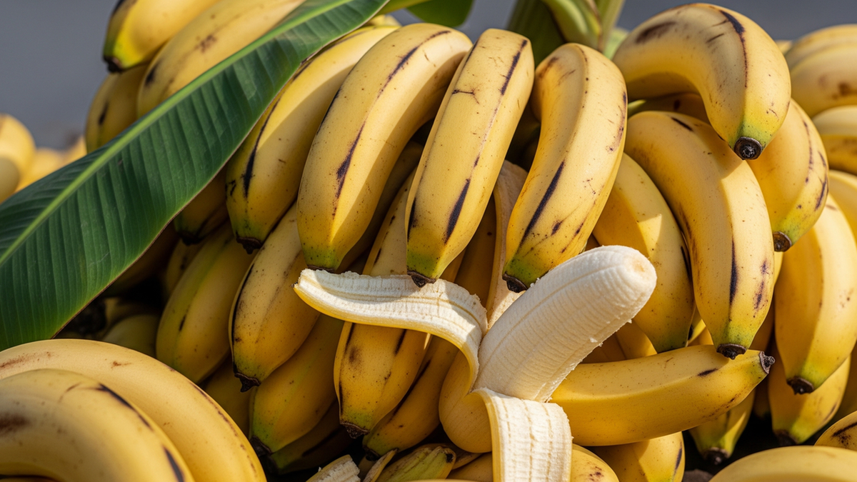
Durian in Phu Tin
The big surprise of my trip was to visit Phu Tin, Phu Nghia in Phuoc Long to visit a 30-hectare durian farm of a farmer and businessman of the same age as me. At the age of Canh Dan, 76, he still rides a motorbike, walks quickly, speaks lively and is especially clear-headed and meticulous when talking about durian. His name is Truong Van Dao, originally from Cu Chi, who moved to Binh Phuoc to start a business more than 30 years ago. My friend, from Long Khanh - Dong Nai, confided that he has always been proud of his hometown as the "capital" of durian with large farms growing this tree, each season exporting large quantities to everywhere. But here, Ba Dao Company surprised him because it has a whole factory processing durian into dozens of export products, including frozen whole durian exported to China.
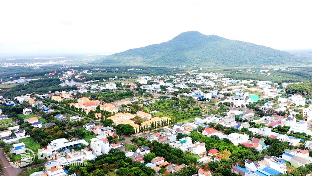 |
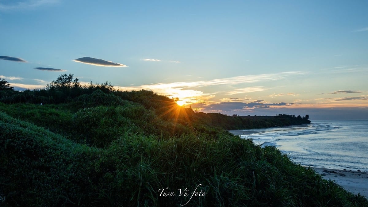
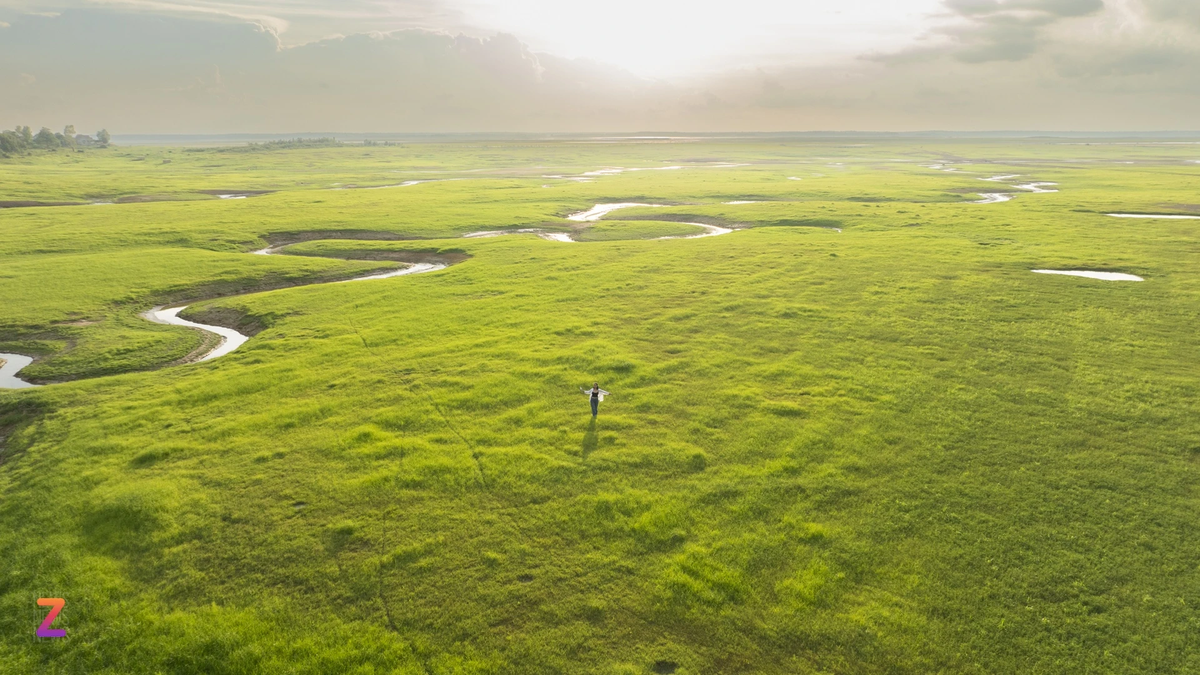
| Phuoc Long Ward seen from above. Photo: Phu Quy |
The farm owner's durian garden looks very ordinary, consisting entirely of low-canopy trees, quite different from the familiar image I have of durian trees 20m high in Long Thanh and Long Khanh. Mr. Ba explained: "I treated the trees to grow many branches from the bottom, making it easier to harvest the fruit."
It was not harvest season, the factory was quiet when we were taken on a tour. To have modern production lines for sorting fruit, packing durian segments to the area where all the fruit is frozen with liquid nitrogen..., Mr. Ba Dao had to overcome many difficulties in terms of licensing, capital, technology, management... to have today. He used many words that were both professional and popular, which made me pay attention and ask again to get a detailed explanation, which was "pleasant" to listen to and enriched my common language. He talked about artificial pollination for durian, saying that he had to hire seasonal workers, wait for the right time to "release the stamens" and then "release the males". That is, the workers used specialized tools to rub the stamens, causing pollen to fall onto the female pistil stalk, increasing the percentage of segments when the fruit set.
I thought to myself: "Why can't a durian farm model like Mr. Ba Dao's develop in Dong Nai when the two provinces are one!"
The sound of pestle clack cum clack cum
Bom Bo Soc is an indispensable destination on the trip. It is located in the territory of Bu Dang district (old), a small village. Bom Bo Soc Museum is spacious and has many artifacts and images depicting the Bom Bo people pounding rice to provide food for the army. There is both an original lithophone and a smaller one. The guide, a Stieng woman, also performed the song "The pestle on Bom Bo Soc" by musician Xuan Hong, accompanied by music on this small lithophone.
I heard that during the Bom Bo Squirrel Festival that was just held, a lot of people from everywhere and locals came to attend. "This is the first time Binh Phuoc has had a traffic jam that lasted for hours around Bom Bo!" - a friend from Binh Phuoc proudly said.
June 2025.
A new Dong Nai
A short 2 day trip. We visited many places so the car was almost constantly rolling.
On the third morning, sitting drinking coffee on the sidewalk, I thought about many things. Why does Binh Phuoc have so many images similar to Dong Nai? Hydroelectric power plants on the Be River and the Dong Nai River, rubber and cashew plantations, the two “sister” mountains of Chua Chan and Ba Ra, the two indigenous ethnic minorities of the two regions…
The owner of the restaurant heard us talking and knew we were Dong Nai guests. He quickly started a conversation about the province's merger. He said that if the new Dong Nai province had Xuyen Moc district of Ba Ria - Vung Tau, it would be great. The new province would stretch from the border to the sea, with mountains, forests, plains, and sea. It turned out that ordinary people in Binh Phuoc were also interested and updated about the merger, not indifferent.
I thought of the two ethnic groups Stieng and Choro of the new Dong Nai province. So Dong Nai has two large indigenous ethnic groups of the Southeast region. It is even more interesting that the majority of the Stieng and Choro people have the surname Dieu.
Dong Nai has enough wings!
Notes of writer Khoi Vu
Phuoc Long Ward seen from above.
Source: https://baodongnai.com.vn/dong-nai-cuoi-tuan/202507/mot-mai-nha-chung-801147a/


![[Photo] Gia Lai provincial leaders offer flowers at Uncle Ho's Monument with the ethnic groups of the Central Highlands](https://vphoto.vietnam.vn/thumb/1200x675/vietnam/resource/IMAGE/2025/7/9/196438801da24b3cb6158d0501984818)


Comment (0)