
SGGP
The National Aeronautics and Space Administration (NASA) has just released the first images taken from the air analysis instrument that NASA put into geostationary orbit earlier this year.
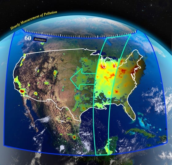 |
| Pollution measurement image in the US from Tempo |
The instrument, called Tempo, is mounted on a communications satellite in geostationary orbit at an altitude of more than 35km above the equator and is dedicated to monitoring atmospheric pollutants across North America. Tempo measures sunlight reflected and scattered from the Earth's surface and atmosphere during the day to assess levels of various pollutants including ozone, nitrogen dioxide (NO2), sulfur dioxide (SO2), gases and water vapor.
The first images from Tempo show high NO2 levels in cities in the morning and on major roads. However, pollution tends to ease during the day before rising again in the late afternoon, when traffic is at its peak. The data is reported hourly. Similar systems will soon be rolled out in Europe and Asia.
Source


Comment (0)