
Updated data as of the afternoon of July 17 from the National Center for Hydro-Meteorological Forecasting, a tropical depression off the Pacific Ocean is approaching Luzon Island (Philippines), and may strengthen into a storm in the next 24 hours. In the immediate future, the storm may reach level 10, gusting to level 12.
Specifically, the tropical depression is moving west-northwest at a rapid speed of 15-20km/hour. On the afternoon of July 17, the center of the tropical depression was at about 15.1 degrees north latitude and 126.9 degrees east longitude. The strongest wind near the center reached level 7, gusting to level 9.
It is forecasted that in the next 24 hours, the tropical depression will continue to approach Luzon Island (Philippines). The forecast intensity will increase to level 8-9, gusting to level 11, becoming a storm. In the next 48 hours (around the morning of July 19), this cyclone system will enter the northeastern region of the East Sea. On the afternoon of July 19, the center of the storm will be at about 18.8 degrees north latitude and 119.1 degrees east longitude. At this time, the storm intensity can reach level 10, gusting to level 12.

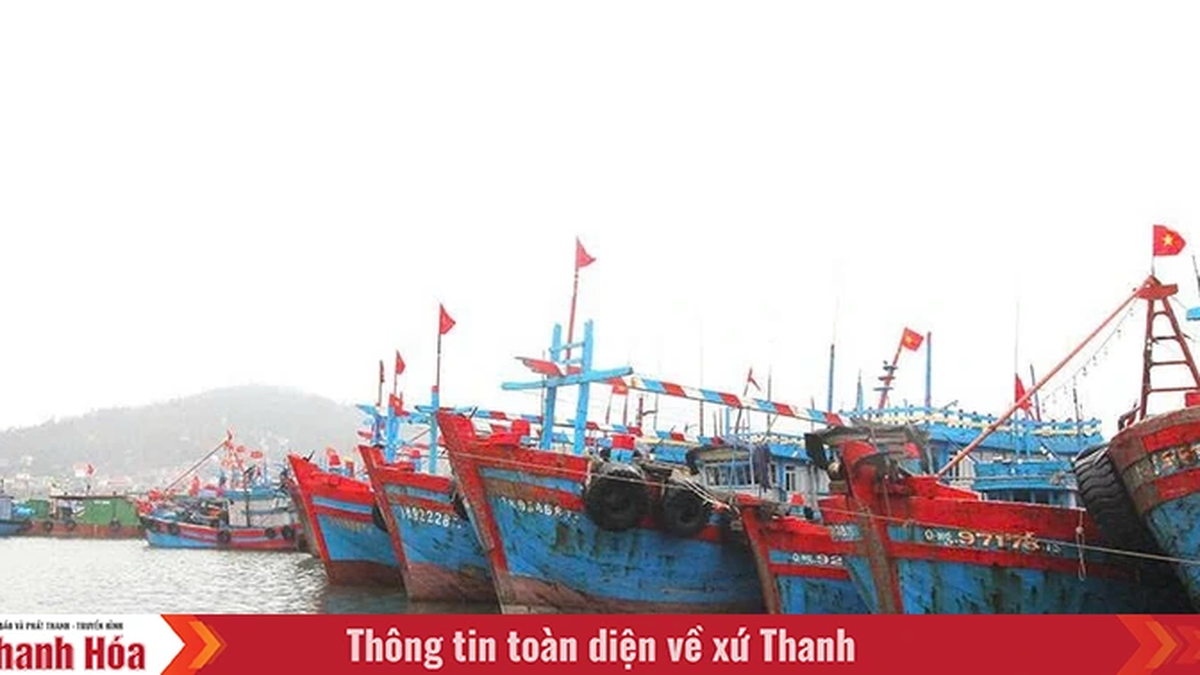
According to weather experts, in the next 2-3 days, the storm will continue to move in a West-Northwest direction at a speed of 20-25km/h and may even become stronger. Fishermen operating at sea, especially in the Northeast of the East Sea, need to closely monitor the developments of this storm to take timely response measures.
This afternoon, July 17, Deputy Minister Nguyen Hoang Hiep, on behalf of the Ministry of Agriculture and Environment, signed a telegram to localities from Quang Ninh to Dak Lak , requesting immediate implementation of measures and readiness to respond to the tropical depression approaching the East Sea and potentially strengthening into a storm.
The Ministry of Agriculture and Environment recommends closely monitoring the development of tropical depressions, promptly informing ships of their location and direction of movement to proactively avoid them; checking and ensuring safety for coastal works, aquaculture activities, power systems, factories, industrial parks, dykes, and reservoirs.
Along with that, localities are ready with forces and means to respond according to the "4 on-site" motto. Local authorities proactively review and notify each household at risk of being affected to promptly evacuate when necessary.
Press agencies and radio systems increase warning information to help people grasp and prevent.
In the dispatch, the Ministry of Agriculture and Environment also directed the units on duty to seriously update the situation regularly and report to the Ministry of Agriculture and Environment.
On the afternoon of July 17, the Department of Dyke Management and Natural Disaster Prevention informed that on the afternoon of July 18 in Hanoi , Deputy Minister of Agriculture and Environment Nguyen Hoang Hiep will chair a meeting with relevant ministries, branches, units and localities to jointly deploy measures to respond to storms and floods caused by storms.
Source: https://www.sggp.org.vn/san-sang-ung-pho-bao-vao-bien-dong-post804208.html


Comment (0)