
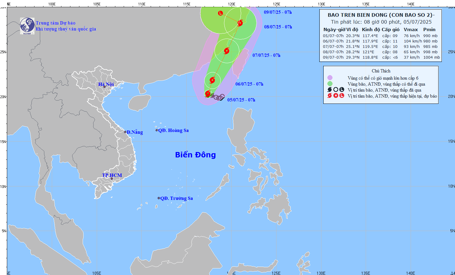
Forecast until 7am tomorrow, July 6, the storm will move north, at a speed of 5-10km/h and is likely to strengthen. The storm's center is in the northeastern sea of the East Sea. Intensity level 10-11, gust level 13. The affected area is the northeastern sea of the North East Sea.
At 7:00 am on July 7, the storm moved in a North-Northeast direction, at a speed of about 15 km/h. The center of the storm was located in the sea of Fujian province (China). The intensity was level 10, gusting to level 12. The affected area was the northeastern sea area of the North East Sea.
At 7:00 am on July 8, the storm continued to move north-northeast, at a speed of about 15 km/h. The center of the storm was on the mainland of Zhejiang province (China). The intensity was level 8, gusting to level 12.
From the next 72 to 96 hours, the storm will move in the West Northwest direction at a speed of about 10km/h and gradually weaken into a low pressure area.
Due to the storm's influence, the northeastern sea area of the North East Sea has stormy rain, strong winds of level 7-8, the area near the storm's center has levels 9-11, gusting to level 13. The sea is rough, with waves 4.0 - 6.0m high. Ships operating in the dangerous area are at high risk of being affected by storms, whirlwinds, strong winds and big waves.
Source: https://quangngaitv.vn/bao-so-2-giat-cap-11-du-bao-tiep-tuc-manh-them-6504547.html


![[OCOP REVIEW] Bay Quyen sticky rice cake: A hometown specialty that has reached new heights thanks to its brand reputation](https://vphoto.vietnam.vn/thumb/402x226/vietnam/resource/IMAGE/2025/7/3/1a7e35c028bf46199ee1ec6b3ba0069e)


Comment (0)