
On the afternoon of July 5, the Department of Meteorology and Hydrology ( Ministry of Agriculture and Environment ) provided a national weather forecast bulletin from July 5 to 11.
In the North, the weather at the beginning of the week is quite mild, with only scattered showers and thunderstorms in some places, with the Northwest region having the possibility of scattered showers in the late afternoon. From July 7 to 9, the sun will return, with some places feeling slightly hot during the day, but there will still be showers in the late afternoon and at night, possibly accompanied by thunderstorms.
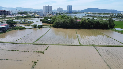
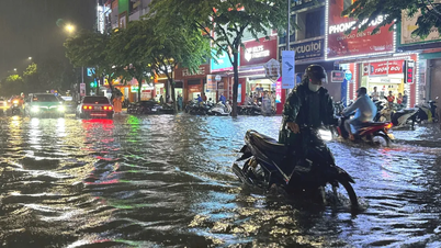
Notably, from July 9 to 11, thunderstorms will increase sharply over a wide area, with some areas experiencing very heavy rain, accompanied by the risk of tornadoes, lightning and gusts of wind. Warnings are being issued that localized flooding may occur on small rivers and streams in the northern mountainous region.

In the Central region, from Thanh Hoa to the South Central region, sunshine will prevail throughout the week, especially from the middle of next week onwards, there will be hot weather in some places. However, due to the edge of the monsoon circulation, there is still a possibility of scattered thunderstorms in the evening, with some places having moderate to heavy rain.
In the Central Highlands and the South, the typical pattern is still sunny during the day, with the possibility of showers and thunderstorms in the late afternoon and at night. Some areas may experience localized heavy rain, with the potential risk of tornadoes and lightning.
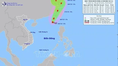
* Information on storm No. 2, updated at 5:00 pm on July 5 from the National Center for Hydro-Meteorological Forecasting, says the storm is continuing to strengthen but is likely to move inland to China, without directly affecting Vietnam. The storm is currently at level 9-10, gusting to level 12, with its center at approximately 20.6 degrees North latitude and 117.6 degrees East longitude, moving very slowly in a North-Northeast direction (about 5km/hour).

Vietnam's Meteorological Agency forecasts that storm No. 2 will continue to move in a north-northeast direction at an increasing speed and is likely to strengthen in the next 1-3 days (possibly reaching level 10-11, gusting to level 13). By the afternoon of July 7, the storm's center will enter the sea area of Fujian province (China) and by the afternoon of July 8, it will make landfall in Zhejiang province (China) with its intensity decreasing to level 8, gusting to level 10.
According to the National Center for Hydro-Meteorological Forecasting, although storm No. 2 has not made landfall in Vietnam, it will continue to have a negative impact on the weather in the East Sea, especially the northeastern sea of the North East Sea. In this area, storm rain, strong winds of level 7-8, near the storm center, strong winds of level 9-11, gusting to level 13. Ships should avoid operating in this dangerous sea area due to large waves of 4-6m.
Source: https://www.sggp.org.vn/nang-nong-lan-mua-dong-sap-quay-lai-mien-bac-va-mien-trung-post802603.html


![[OCOP REVIEW] Bay Quyen sticky rice cake: A hometown specialty that has reached new heights thanks to its brand reputation](https://vphoto.vietnam.vn/thumb/402x226/vietnam/resource/IMAGE/2025/7/3/1a7e35c028bf46199ee1ec6b3ba0069e)


Comment (0)