

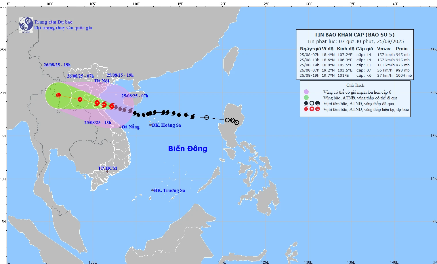
Forecast map of storm No. 5's path and intensity at 7:30 a.m. on August 25.
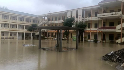
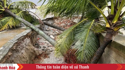
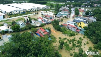
Due to the influence of storm No. 5, in Bach Long Vi there were strong winds of level 7, gusting to level 9; Co To level 6, gusting to level 9; Bai Chay level 6, gusting to level 8; Hon Ngu level 7, gusting to level 9; Con Co level 6, gusting to level 8. The provinces of Ha Tinh - Quang Tri had moderate rain, heavy rain, in some places very heavy rain over 150mm.
At 7:00 a.m. on August 25, the storm center was at 18.4 degrees North latitude, 107.2 degrees East longitude, 145 km east of Ha Tinh. The strongest wind was level 14 (150-166 km/h), gusting to level 17. The storm moved west-northwest at a speed of 20 km/h.
Risk level: Level 3 in the Northern Gulf of Tonkin, sea areas from Thanh Hoa to Quang Tri (including Hon Ngu island, Con Co special zone); Level 4 in coastal waters and mainland provinces from Southern Thanh Hoa to Northern Ha Tinh.
It is forecasted that the storm will continue moving in the West-Northwest direction, at a speed of about 20km/h, and at 1pm the center of the storm will be at 18.6 degrees North latitude, 106.3 degrees East longitude; over the sea of Thanh Hoa - Ha Tinh provinces. The strongest wind is level 13-14, gusting to level 16.
At 7 p.m., the storm center was at 18.8 degrees North latitude, 105.5 degrees East longitude, on the mainland of Thanh Hoa - Ha Tinh provinces. The strongest wind speed decreased to level 10-11, gusting to level 14.
Risk level: Level 3 in the Northern Gulf of Tonkin, sea areas from Thanh Hoa to Quang Tri (including Hon Ngu island, Con Co special zone). Level 4 in coastal waters and mainland provinces from Southern Thanh Hoa to Northern Ha Tinh.
At 7:00 a.m. on August 26, the storm was still moving West Northwest at a speed of about 20km/h, gradually weakening into a tropical depression in the Central Laos area, with the strongest wind at level 6-7, gusting to level 9.
Risk level: Level 3 in the Northern Gulf of Tonkin, sea area from Thanh Hoa to Northern Quang Tri (including Hon Ngu island).
At 7:00 p.m. on August 26, the storm moved at a speed of 15-20 km/h and gradually weakened, over the Central Laos region, with an intensity below level 6.
NM
Source: https://baothanhhoa.vn/du-bao-19h-hom-nay-bao-so-5-vao-dat-lien-thanh-hoa-ha-tinh-259348.htm

![[Photo] General Secretary To Lam attends Meeting with generations of National Assembly deputies](https://vphoto.vietnam.vn/thumb/1200x675/vietnam/resource/IMAGE/2025/8/27/d869c6b3e4da42399e2cd0f4ca26050c)

![[Photo] Brilliant red of the exhibition 95 years of the Party Flag lighting the way before the opening](https://vphoto.vietnam.vn/thumb/1200x675/vietnam/resource/IMAGE/2025/8/27/e19d957d17f649648ca14ce6cc4d8dd4)
![[Photo] Prime Minister Pham Minh Chinh chairs meeting of National Steering Committee on International Integration](https://vphoto.vietnam.vn/thumb/1200x675/vietnam/resource/IMAGE/2025/8/26/9d34a506f9fb42ac90a48179fc89abb3)
![[Photo] Prime Minister Pham Minh Chinh receives CEO of Samsung Electronics](https://vphoto.vietnam.vn/thumb/1200x675/vietnam/resource/IMAGE/2025/8/26/373f5db99f704e6eb1321c787485c3c2)


Comment (0)