
According to the National Center for Hydro-Meteorological Forecasting, this morning (June 11), the tropical depression in the eastern area of Hoang Sa archipelago has strengthened into a storm, storm number 1 in 2025, internationally named Wutip.
At 7:00 a.m., the center of the storm was located at about 16.1 degrees North latitude; 113.7 degrees East longitude in the sea east of Hoang Sa archipelago. The strongest wind near the center of the storm was level 8 (62-74 km/h), gusting to level 10; moving slowly in the West Northwest direction at a speed of about 5-10 km/h.
Storm No. 1 is forecast to move mainly northwest, towards Hainan Island (China).
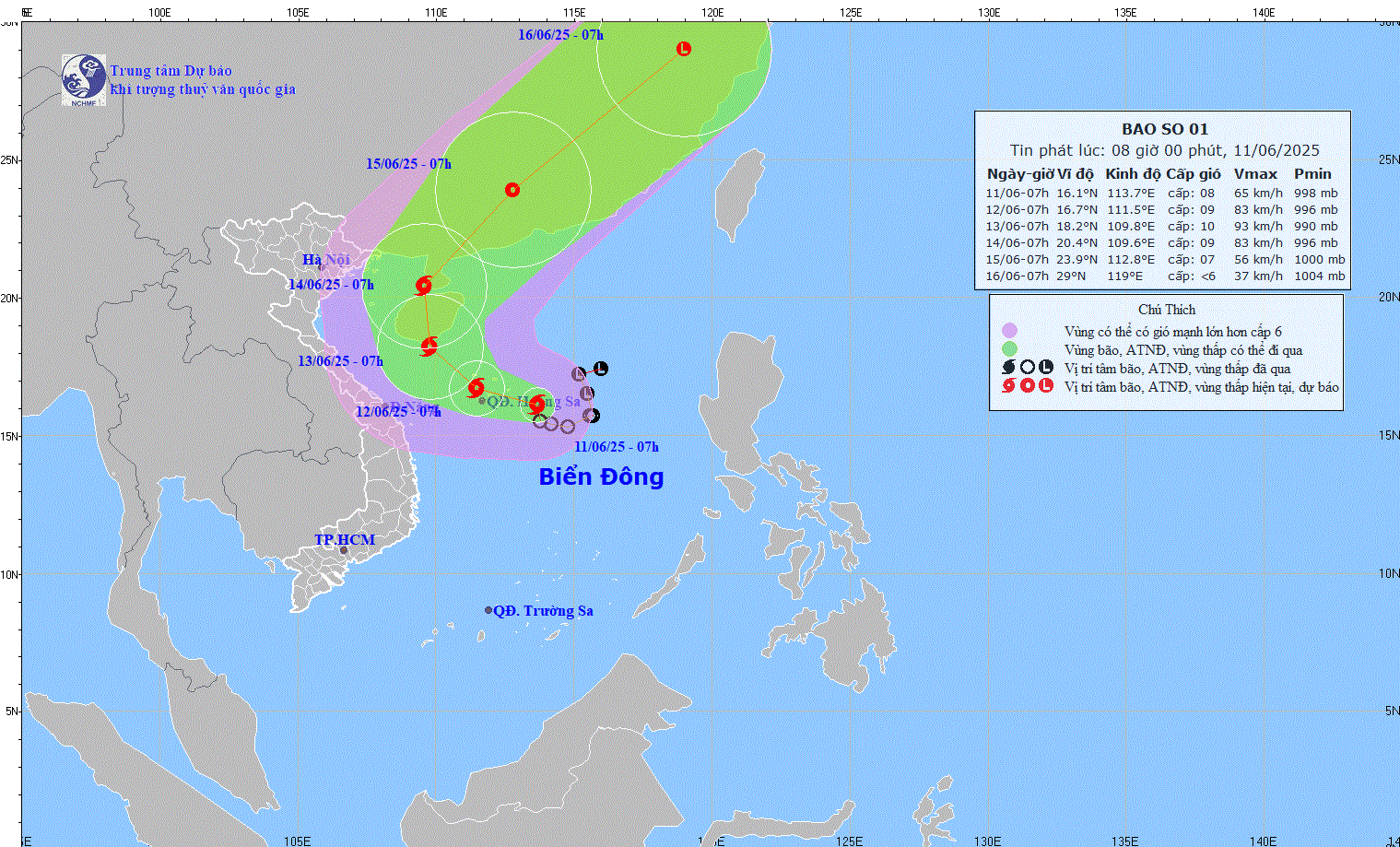
Direction of movement of storm No. 1. Source: NCHMF
Storm forecast (in the next 24 to 72 hours) :
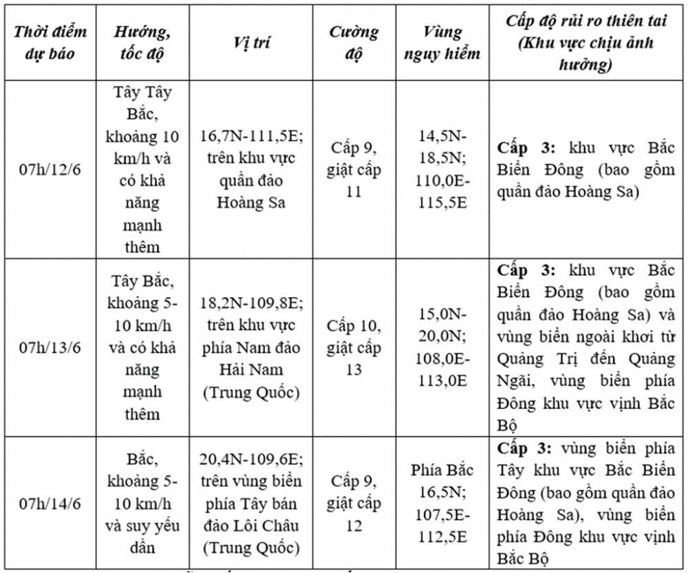
From the next 72 to 120 hours, the storm moved in the North Northeast direction then changed to the Northeast direction at about 20km per hour.
Impact of storms
At sea : The North East Sea area (including the waters of Hoang Sa archipelago), the North of the Central East Sea area has thunderstorms and strong winds of level 6-7, the area near the storm's eye has winds of level 8-9, gusts of level 11, waves 3.0-5.0m high, very rough seas; the South of the Central East Sea area, the South East Sea area (including the waters of Truong Sa archipelago) has strong southwest winds of level 6, sometimes level 7, gusts of level 8-9, waves 2.0-4.0m high, rough seas.
Ships operating in the above mentioned dangerous areas are susceptible to the effects of storms, whirlwinds, strong winds and large waves.
On land : In the afternoon and night of June 11, the South Central, Southern Central Highlands and Southern regions will have moderate rain, heavy rain and thunderstorms, locally very heavy rain with common rainfall of 30-70mm, some places over 150mm.
On June 11, the area from Hue to Phu Yen will have showers and thunderstorms, locally heavy rain with common rainfall of 20-40mm, some places over 70mm.
From the afternoon and night of June 11 to June 13, the Central Central region will have heavy to very heavy rain with common rainfall from 100-300mm, some places over 450mm; the Northern Central Highlands region will have moderate rain, heavy rain and thunderstorms, locally very heavy rain with common rainfall from 70-150mm, some places over 200mm.
Warning of risk of heavy localized rain (>200mm/6h).
From June 14, heavy rain in the above areas will decrease.
Thunderstorms can cause tornadoes, lightning, hail and strong gusts of wind. Heavy rain can cause flooding in low-lying areas, urban and industrial areas; flash floods in small rivers and streams; and landslides on steep slopes.
Source: https://vietnamnet.vn/bao-so-1-hinh-thanh-chinh-thuc-ghi-nhan-con-bao-dau-tien-nam-2025-2410275.html


![[Infographic] In 2025, 47 products will achieve national OCOP](https://vphoto.vietnam.vn/thumb/402x226/vietnam/resource/IMAGE/2025/7/16/5d672398b0744db3ab920e05db8e5b7d)


Comment (0)