
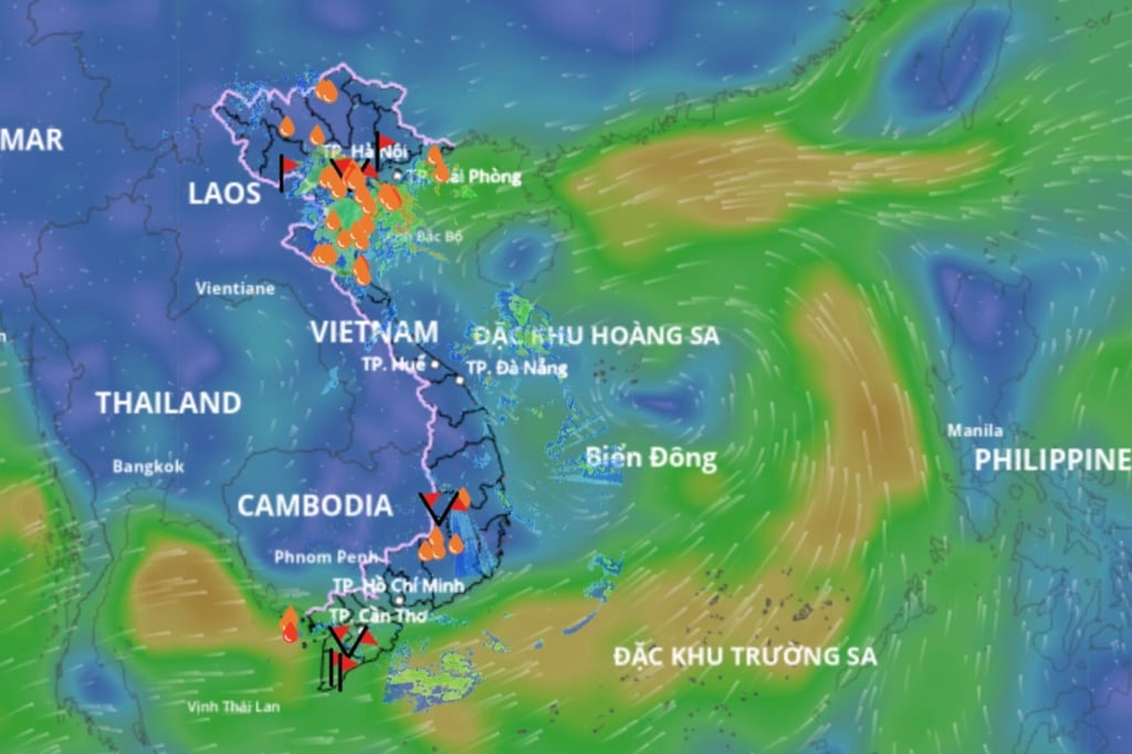
At 1:00 p.m. on August 16, a low pressure area appeared in the central East Sea, located at approximately 14.5 to 15.5 degrees North latitude and 112 to 113 degrees East longitude. At Huyen Tran station, the southwest wind was recorded at level 6, gusting to level 8 to level 9.
Forecast for the next 24 hours: The low pressure area continues to move northwest, and is likely to strengthen into a tropical depression.
The affected sea areas include: From Khanh Hoa to Ho Chi Minh City, the Central and Southern East Sea, including the Truong Sa archipelago. Here, the southwest wind will be strong at level 6, gusting to level 7 to level 8. The sea will be rough, with waves from 2 to 3.5 meters high.
Since August 17, Hoang Sa special zone has also been affected by strong winds of level 6, gusting to level 7 to 8, rough seas, and similar high waves.
Warning for the night of August 17 and 18: In the sea area from Lam Dong to Ho Chi Minh City, the Central and Southern East Sea area: Strong Southwest wind level 5, sometimes level 6, gusting to level 7 to 8. Waves from 1.5 to 3.5 meters high. Rough seas.
In the Northwest of the East Sea, including Hoang Sa archipelago: Strong winds level 6, gusts level 7 to 8, waves from 2 to 3.5 meters high.
Disaster risk level: Level 2 is issued for the sea area from Khanh Hoa to Ho Chi Minh City due to strong winds at sea.
Source: https://quangngaitv.vn/ap-thap-nhiet-doi-sap-hinh-thanh-tren-bien-dong-6506186.html


![[Photo] National Assembly Chairman Tran Thanh Man attends the program "Returning to the source - Towards the future"](https://vphoto.vietnam.vn/thumb/1200x675/vietnam/resource/IMAGE/2025/8/16/d081d9c162ee4ed9919e723aa322a53a)


![[Photo] “Moving forward with Vietnam” on the most romantic road in Vietnam](https://vphoto.vietnam.vn/thumb/1200x675/vietnam/resource/IMAGE/2025/8/16/0ee500bc59fd4468863261ee26f47fe7)
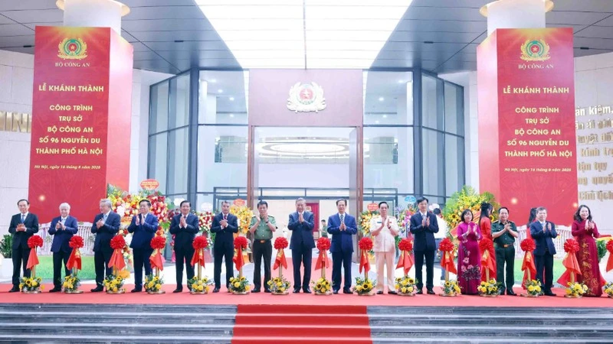
![[Photo] General Secretary attends the inauguration ceremony of the Ministry of Public Security Headquarters](https://vphoto.vietnam.vn/thumb/1200x675/vietnam/resource/IMAGE/2025/8/16/3ceec3a24ef945c18ae2b523563b749d)


Comment (0)