
 morning of July 24")
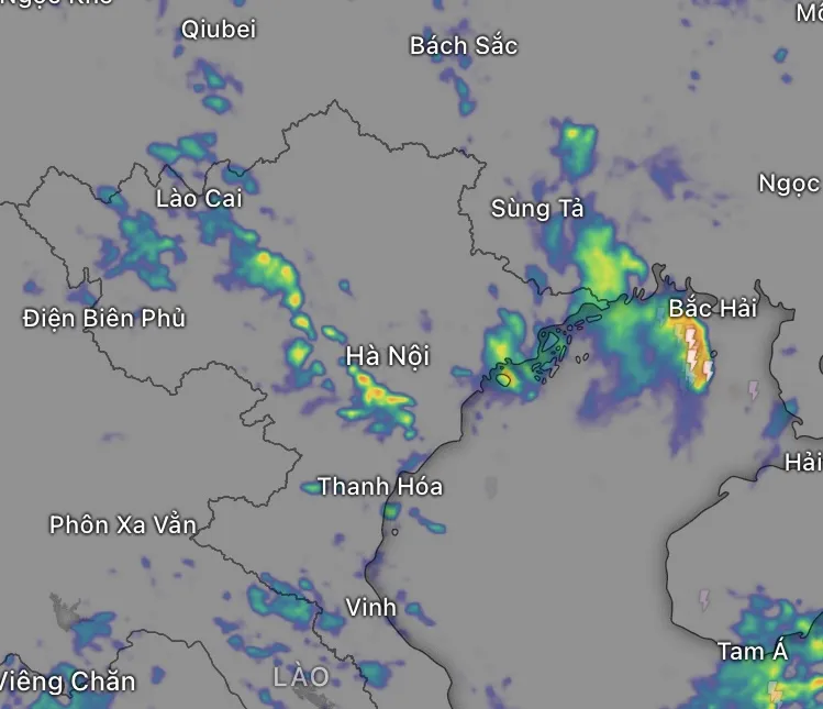
According to the National Center for Hydro-Meteorological Forecasting, at 4:00 a.m. on July 24, the center of storm No. 4 was located at 16.7 degrees North latitude - 118.3 degrees East longitude, in the eastern sea area of the North East Sea. The storm has a level 8-9 intensity, gusts of level 11, and is moving in a south-southeast direction at a speed of about 15km/hour.
 this morning, July 24")
In the coming hours, the storm will tend to change direction, moving east-southeast, then gradually moving to the northeast. On the afternoon of July 24, the storm continued to strengthen to level 9-10, gusting to level 12. By the morning of July 25, the storm is likely to enter the northern area of Luzon Island (Philippines) with its intensity decreasing to level 8, gusting to level 10, and by the morning of July 26, it will continue to move northeast at a speed of 25-30km/h, gradually weakening into a low pressure area in the offshore area east of Taiwan (China).
Thus, the storm tends to go around, gradually leaving the East Sea, not entering Vietnam's mainland.
Although the storm did not make landfall, the National Center for Hydro-Meteorological Forecasting warned that today, the weather in many places in the North and North Central regions will gradually turn bad, with sudden thunderstorms in many places. The main cause is the impact of the active tropical convergence zone combined with the southwest monsoon, not caused by storm No. 4.
 with gradually developing thunderstorm clouds. Photo by: GFS")
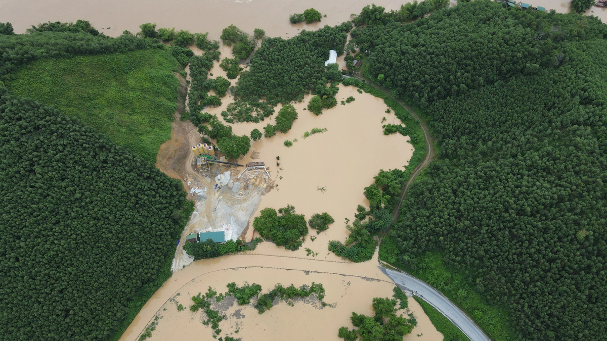
Last night and early this morning, July 24, some areas in the North had showers and thunderstorms, some places had heavy rain over 100mm, such as Lao Cai (140.6mm) and Phu Tho (128.8mm). It is forecasted that from July 24 to the end of the night of July 25, the North, Thanh Hoa and Nghe An will continue to have moderate rain, heavy rain, some places have very heavy rain, total rainfall is commonly 60-130mm, some places exceed 250mm.
“From July 26 onwards, heavy rains will tend to decrease,” the National Center for Hydro-Meteorological Forecasting said.
In the Central region, from Quang Tri to Hue and along the South Central Coast, the weather on July 24 will be mainly hot and sunny, with temperatures reaching 35-36 degrees Celsius in some places. Meanwhile, the Central Highlands and the South will experience showers and thunderstorms in the afternoon and at night, with some places experiencing heavy rain of over 80mm, along with the possibility of tornadoes, lightning and strong gusts of wind, causing the risk of flooding in urban areas.
Source: https://www.sggp.org.vn/du-bao-mien-bac-va-bac-trung-bo-tiep-tuc-mua-to-den-ngay-25-7-post805161.html


![[Photo] Signing of cooperation between ministries, branches and localities of Vietnam and Senegal](https://vphoto.vietnam.vn/thumb/1200x675/vietnam/resource/IMAGE/2025/7/24/6147c654b0ae4f2793188e982e272651)


Comment (0)