

According to Dan Tri reporters on the morning of July 24, on National Highway 7, through Nhan Hoa and Vinh Tuong communes (former Anh Son district, Nghe An province), 4 new flooding spots appeared.
Water levels at flooded areas ranged from 50cm to nearly 1m, flowing rapidly, making it impossible for small vehicles to pass through the area. Many people had to turn around or choose longer detours to travel, disrupting daily life and the transportation of goods.
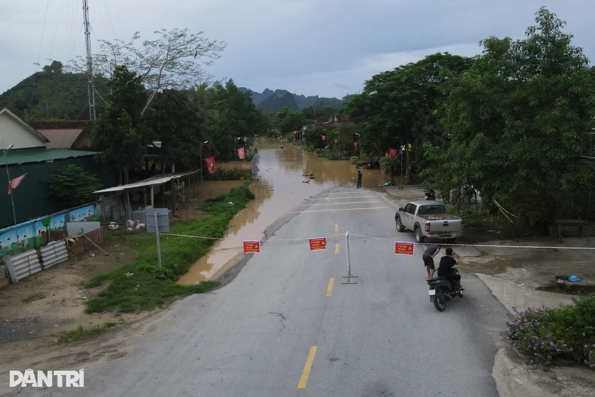
At the scene, the commune police force, Joint Stock Company 495 and local authorities of Nhan Hoa commune put up warning signs and assigned people to guard the checkpoint to guide vehicles to move safely.
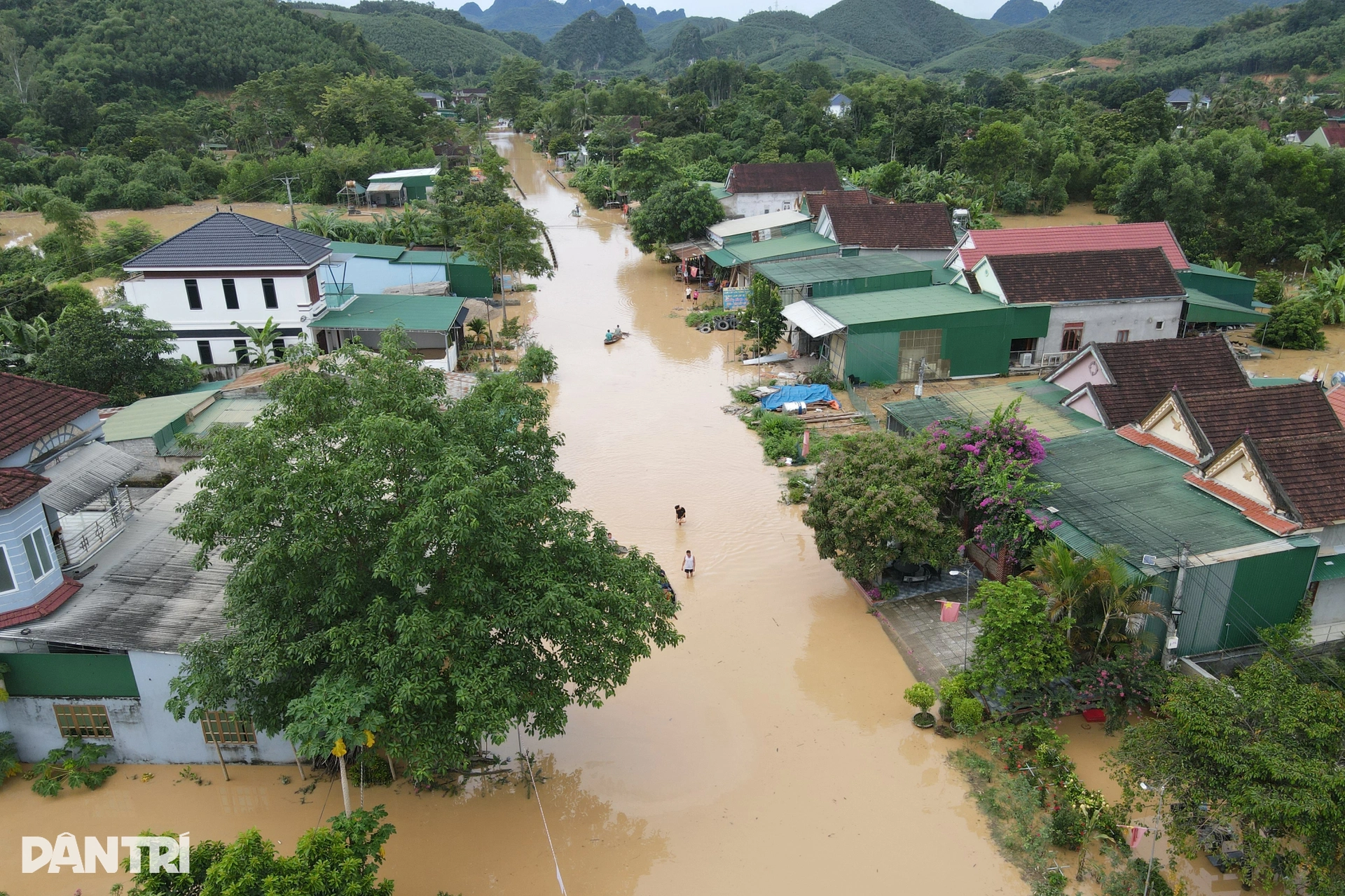
National Highway 7 through the residential area of Cam Thang village, Nhan Hoa commune was flooded from 50cm to 1m.
National Highway 7, Bam slope area, Nhan Hoa commune, water is nearly 1 meter deep.
Water surrounded the entire Bam slope area, vehicles and people could not move.
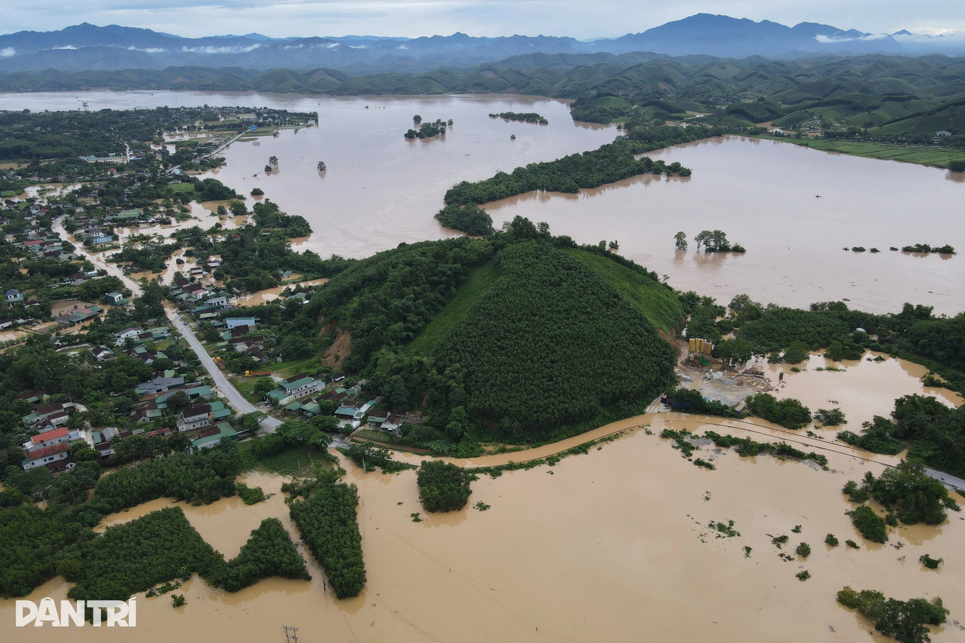
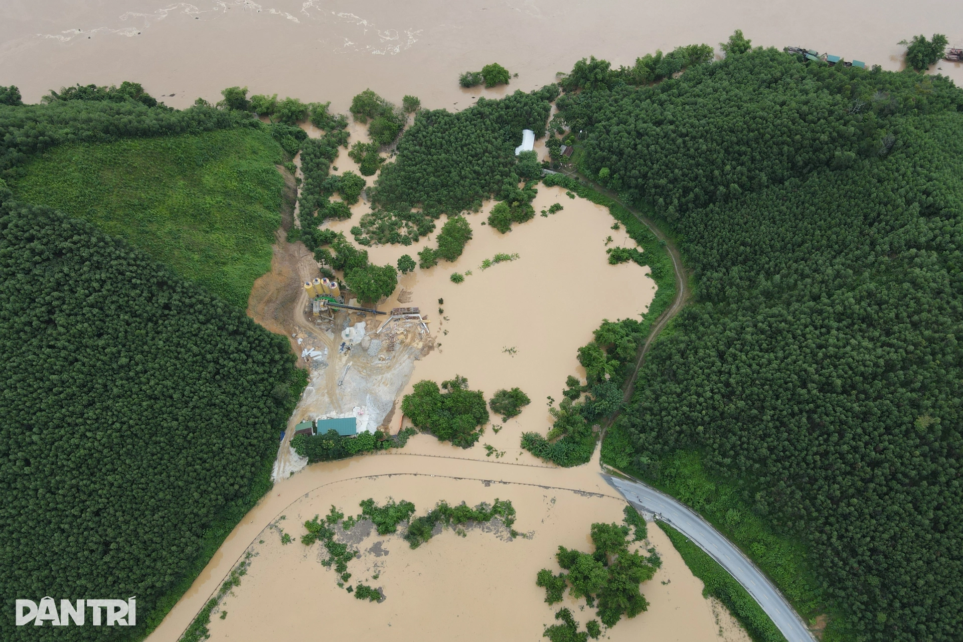
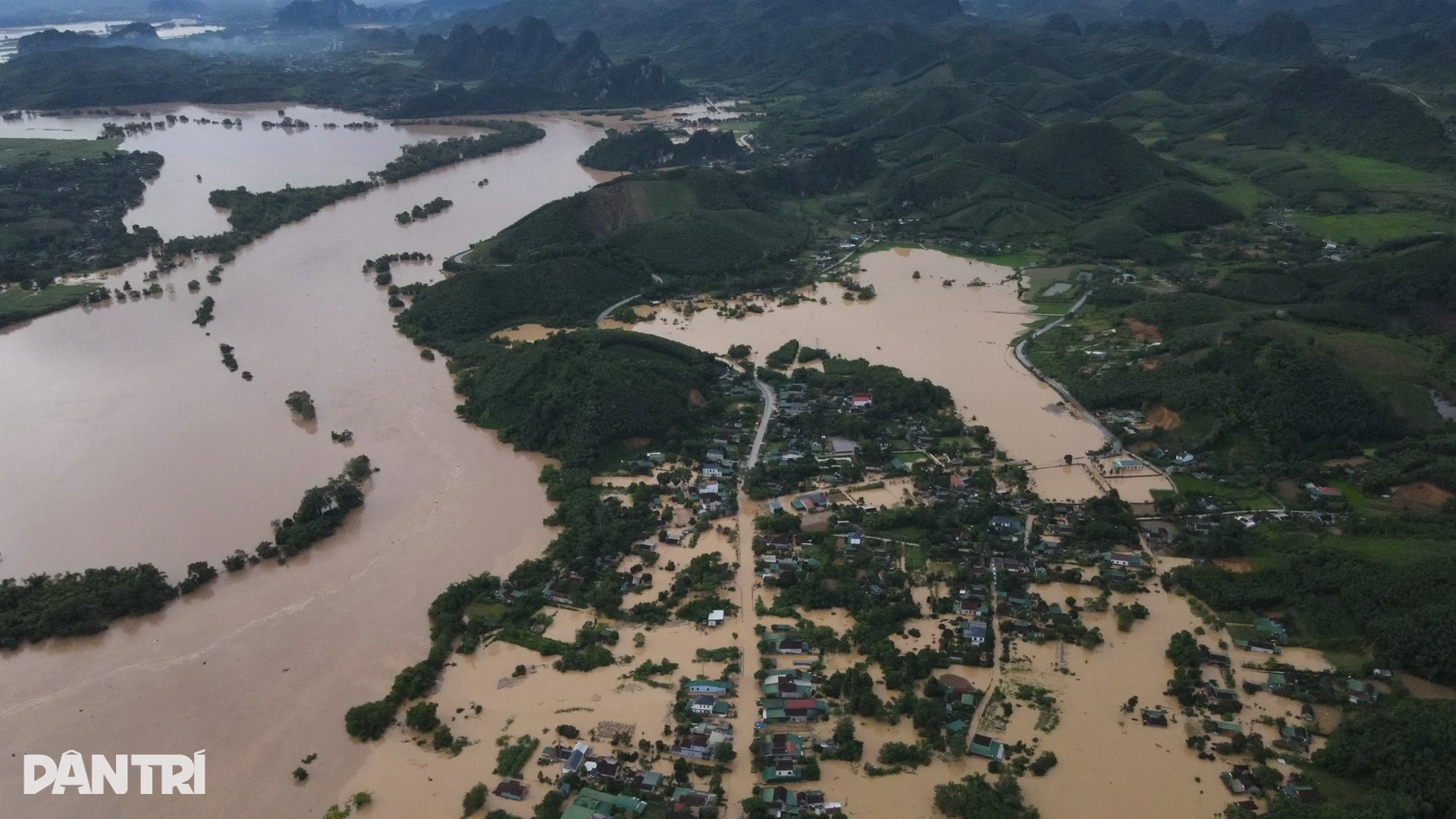
The entire Bam slope area in Nhan Hoa commune was surrounded by the rising Lam river. Many households had their houses flooded.
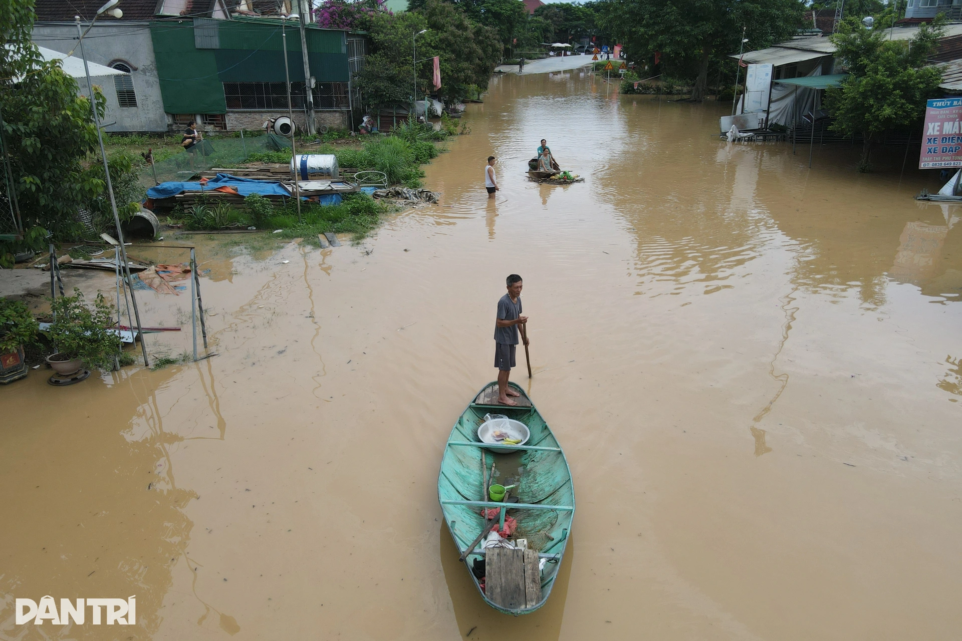
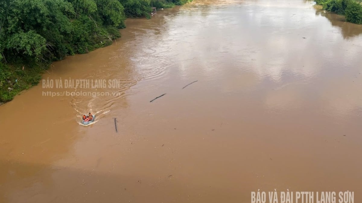
People use boats to move on the road.
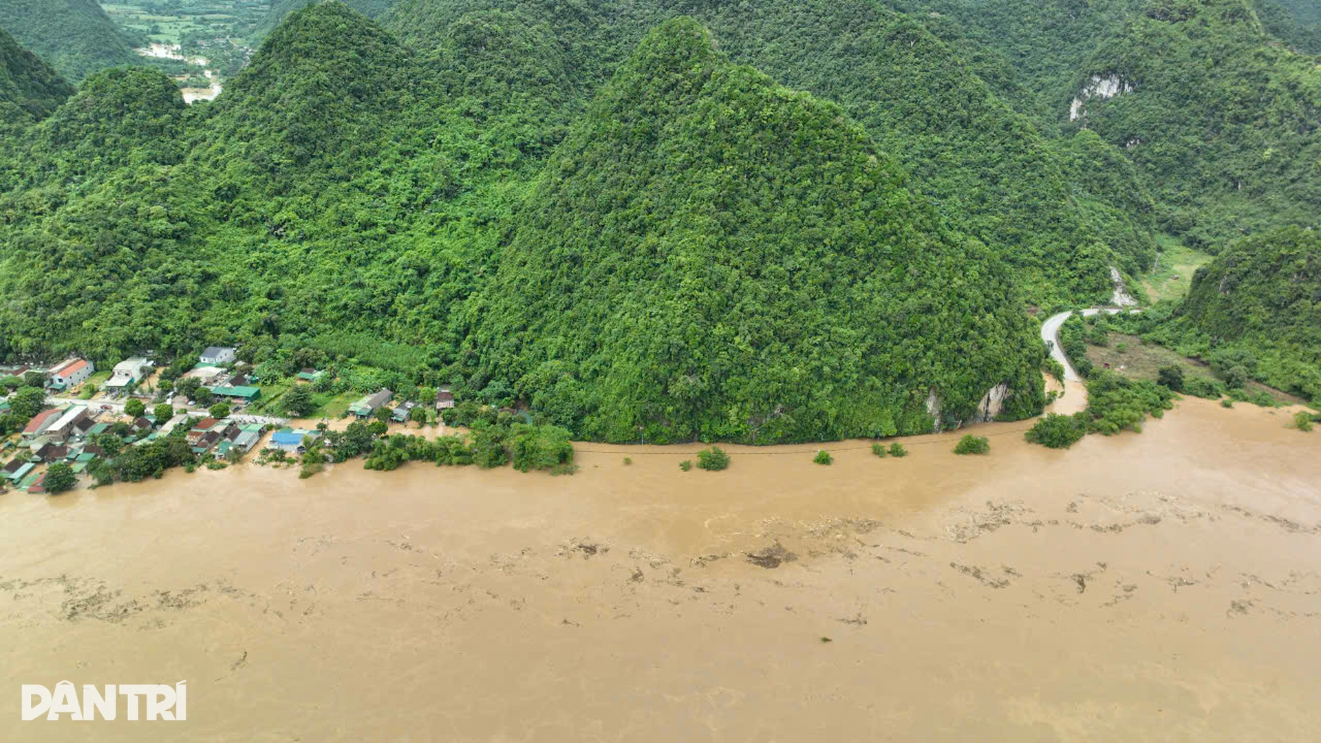
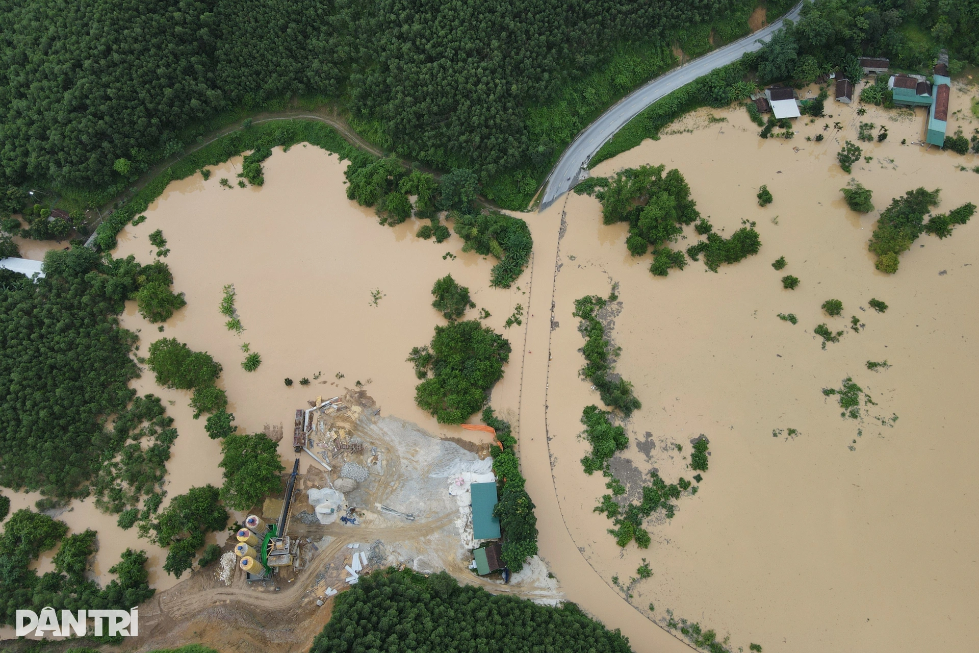
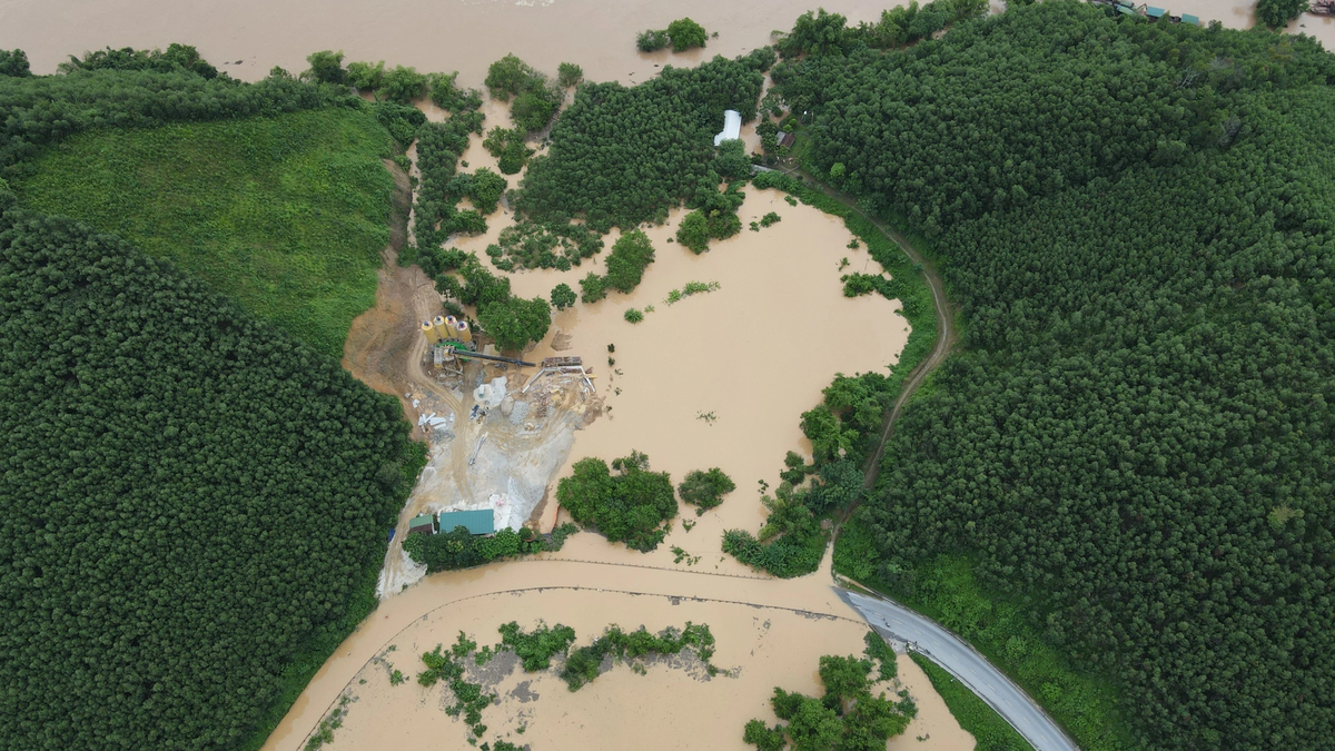
Previously, Highway 7 was completely cut off due to floodwaters from the Lam River and streams. Although the rain has stopped now, the water level in many places has not receded. In the photo, the area of Vuc Bong Strait, Con Cuong Commune is flooded.
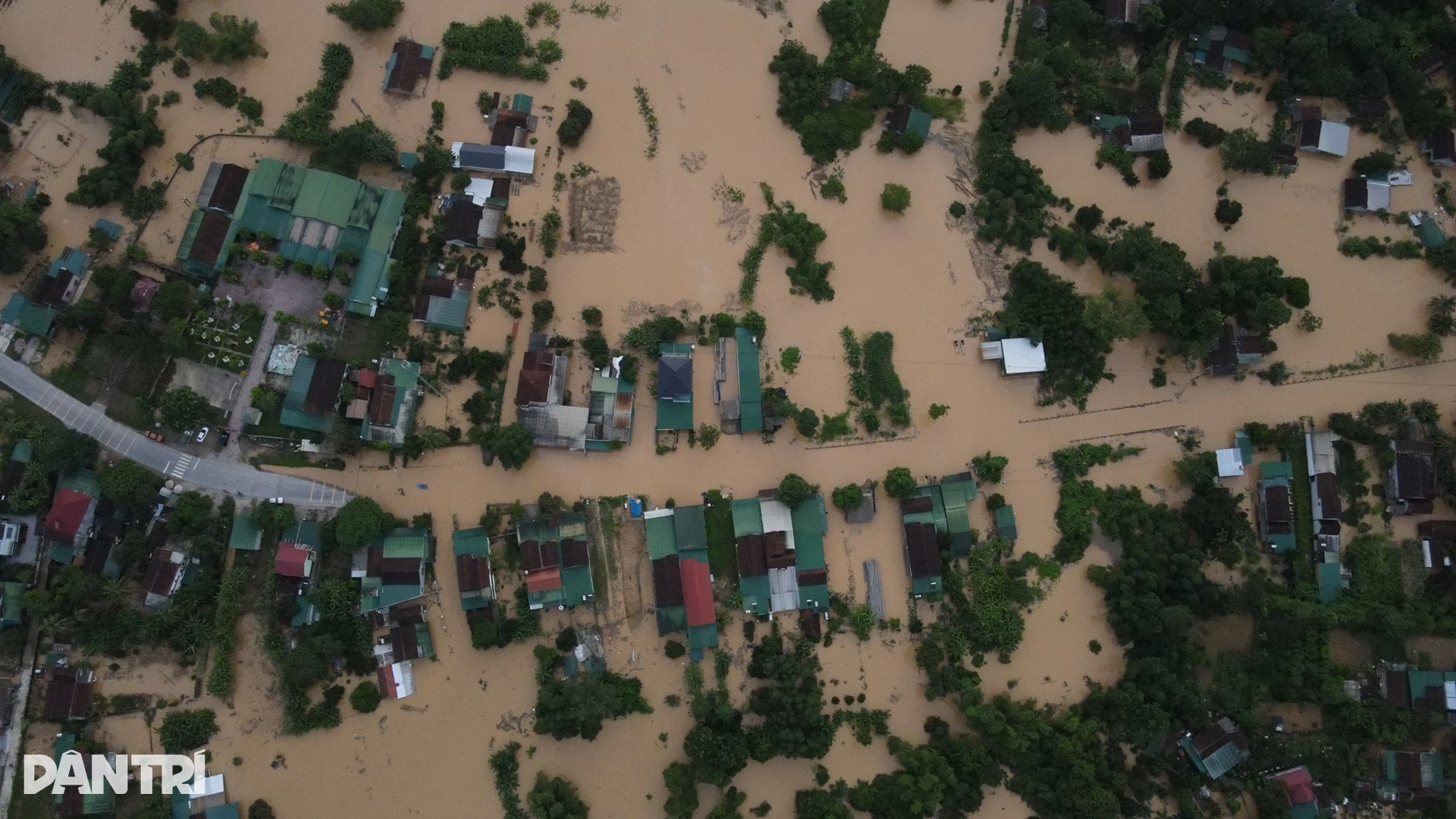
Authorities are still closely monitoring the situation and advising people not to go through flooded areas, especially at night and without guidance. Traffic control and temporary solutions are being implemented to ensure the safety of people's lives and property. In the photo, a corner of Nhan Hoa commune on National Highway 7 is submerged in water.
Dantri.com.vn
Source: https://dantri.com.vn/xa-hoi/bien-nuoc-menh-mong-chia-cat-quoc-lo-7-20250724081513110.htm


![[Photo] Signing of cooperation between ministries, branches and localities of Vietnam and Senegal](https://vphoto.vietnam.vn/thumb/1200x675/vietnam/resource/IMAGE/2025/7/24/6147c654b0ae4f2793188e982e272651)


Comment (0)