
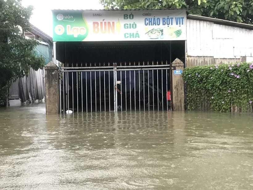
Many houses in Quang Tri town are submerged in water. (Photo: Thanh Thuy/VNA)
On the evening of June 13, speaking to a VNA reporter about the flood situation, which many people consider to be very extreme and unusual, in the Central region in recent days due to the impact of storm No. 1 (international name: WUTIP), Associate Professor, Doctor, Director of the National Center for Hydro-Meteorological Forecasting Mai Van Khiem said that the flood from the night of June 11-13 in the above area is considered rare.
Flood peaks on Kien Giang River, Thach Han River, Bo River, and Vu Gia River were observed to be the highest in the past 30 years compared to the same period.
According to Mr. Mai Van Khiem, on June 12, some traditional meteorological stations in the Central Central region recorded daily rainfall exceeding the historical value of the same period in June.
Specifically, from 11am to 1pm on June 13, the Central Central region had total rainfall of 250-400mm, while the provinces and cities from Quang Tri to Da Nang had total rainfall in 3 days of 300-650mm, with some places higher, such as Nam Dong (Hue city) 768mm.
“It is noteworthy that on June 12, in Nam Dong, there was 559mm of rainfall, exceeding the previous historical value of 411mm on June 25, 1983,” Mr. Mai Van Khiem emphasized.
Along with that, on June 11 and 12, many automatic rain gauges in the above area recorded heavy rainfall in a short period of time. A total of 32 automatic rain gauges had a cumulative rainfall of over 200mm in 6 hours, especially in the area of the two cities of Hue and Da Nang. The highest rainfall in 6 hours at Bach Ma station (Hue city) was 319.4mm.
Explaining the cause of the unusually heavy rain, Mr. Mai Van Khiem said that due to the influence of the western edge of storm No. 1's circulation, from the night of June 10 to the morning of June 13, there was very heavy and especially heavy rain in Hue city.
"This is a historic high rainfall in June in Hue, in particular, the rainfall at Bach Ma station reached 884.2mm. The rainfall on June 12 in most localities exceeded the record value of the highest daily rainfall since 1976. This is also an unusual and rare rainfall phenomenon - one can say it has never been seen before in June - the main month of summer," said Mr. Mai Van Khiem.
Referring to the current flood situation in the Central region as well as the flood developments in the coming time, Mr. Khiem said that from the night of June 11-13, a major flood appeared on the rivers from South Quang Binh to Quang Nam. This flood caused deep inundation in the districts of Bo Trach, Quang Ninh, Le Thuy (Quang Binh); Hai Lang, Cam Lo, Trieu Phong, Gio Linh, Dong Ha city (Quang Tri); Phong Dien, Quang Dien, Phu Loc, Phu Vang (Hue city).
It is forecasted that in the coming hours, the flood on Kien Giang River will continue to rise slowly and be 0.2-0.3m higher than alert level 3, then decrease. Flooding in Le Thuy district will last for the next 2-3 days. In the next 12-24 hours, floods on other rivers from Quang Binh to Quang Nam will fluctuate at alert level 1-alarm level 2 and above alert level 2; flooding in provinces and cities will gradually decrease.
Although Storm No. 1 did not affect the mainland of Vietnam, its wide circulation caused heavy rain in the Central Central region and the Northern Central Highlands. Heavy rain with high intensity caused major floods and inundation in many provinces and cities in the above regions./.
According to Vietnam+
Source: https://baothanhhoa.vn/chuyen-gia-mua-lu-o-khu-vuc-trung-bo-giua-mua-he-la-hiem-gap-bat-thuong-252073.htm


Comment (0)