

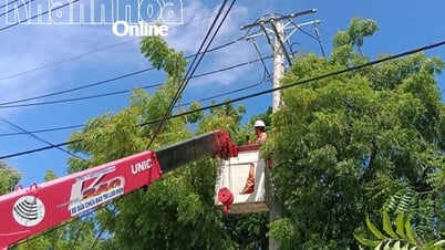
On land, according to the 4:20 p.m. bulletin on August 27 of Khanh Hoa Province's Hydrometeorological Station, through monitoring on weather radar images, convective clouds continue to develop in the areas of the western communes and wards: Anh Dung, Phuoc Ha, Lam Son, Khanh Vinh, Cam Hiep, Khanh Son, the southern sea...
Warning: From now until 6am, convective clouds will continue to develop, causing showers and thunderstorms in the above areas; then it is likely to spread to the following communes and wards: Ca Na, Cong Hai, Thuan Bac, Bac Ai Dong, Ninh Phuoc, Phuoc Huu, Phuoc Hau, Thuan Nam, Dien Dien, Dien Lam, Dien Tho, Suoi Hiep, Dien Khanh, Dien Lac, Nha Trang, Bac Nha Trang, Nam Nha Trang, Tay Nha Trang, Tay Khanh Son, Dong Khanh Son...
During thunderstorms, beware of lightning, tornadoes, hail, and strong winds; and strong currents of water flowing over spillways and roads. Agencies, departments, branches, and people are requested to pay attention to prevention and ensure safety.
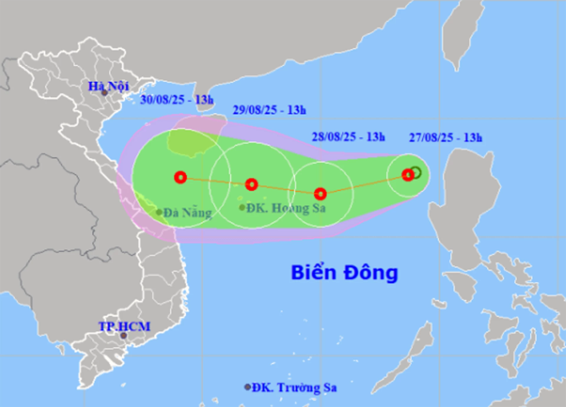 |
| Location and forecast direction of tropical depression in the East Sea. |
Previously, at 1:00 p.m. on August 27, the tropical depression in the East Sea was located in the eastern sea area of the North East Sea. The strongest wind near the center of the tropical depression was level 6 (39-49 km/h), gusting to level 8, moving west-southwest at a speed of 10-15 km/h and likely to strengthen. It is forecasted that by 1:00 p.m. on August 28, the tropical depression will be located about 380 km east of Hoang Sa special zone, with winds of level 6-7, gusting to level 9.
Due to the influence of the tropical depression, the eastern sea area of the North East Sea has strong winds of level 6-7, gusting to level 9; waves 2-4m high, rough seas. Ships operating in the above-mentioned dangerous areas are likely to be affected by storms, whirlwinds, strong winds, and large waves.
H.D
Source: https://baokhanhhoa.vn/xa-hoi/202508/canh-bao-mua-dong-gio-manh-khu-vuc-khanh-hoa-8b00b98/
![[Photo] Images of the State-level preliminary rehearsal of the military parade at Ba Dinh Square](https://vphoto.vietnam.vn/thumb/1200x675/vietnam/resource/IMAGE/2025/8/27/807e4479c81f408ca16b916ba381b667)
![[Photo] Parade blocks pass through Hang Khay-Trang Tien during the preliminary rehearsal](https://vphoto.vietnam.vn/thumb/1200x675/vietnam/resource/IMAGE/2025/8/27/456962fff72d40269327ac1d01426969)


Comment (0)