
One time to touch the sacred milestone
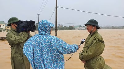
In early June 2023, I received an invitation to join the working delegation of the Provincial Border Work Steering Committee to conduct a field inspection of national border markers 567 and 568 (Lam Thuy commune, Le Thuy), on the border section between Quang Binh province and Savannakhet province (Laos).
At that time, I was a journalist in my 50s, and my health was not as strong as when I was young, so I had to think a lot. But then, with the determination to set foot on the border once, to touch the sacred border markers (except for those near the border gates), I accepted to join the group and had nearly a month to practice and improve my health.
At the end of June, our group began our journey to inspect the national border markers as planned. Before leaving, officers and soldiers at Lang Ho Border Post thoroughly briefed us on the skills and equipment needed when going into the forest, especially when patrolling the border.
 |
Accordingly, unlike a normal jungle trip, patrolling at border markers mostly requires continuous climbing without flat sections in ravines, streams or downhills. Because border markers are often located on the highest mountain peaks in the Truong Son range.
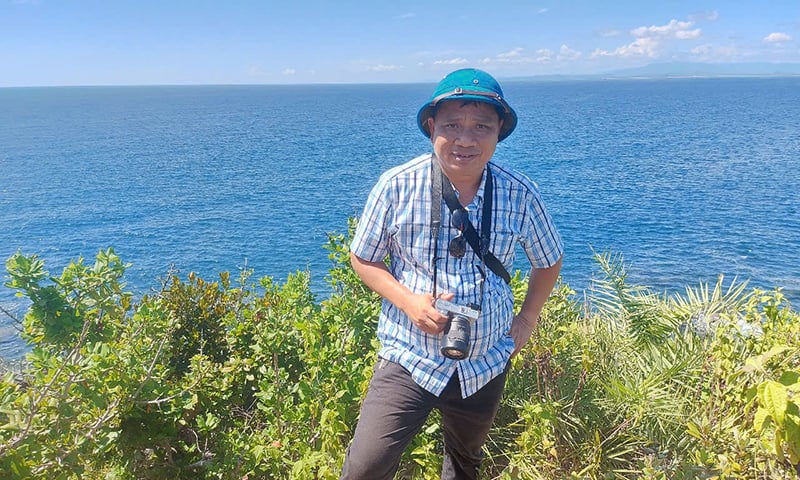
Indeed, the visit to the 567th national border marker (located at the top of the mountain with an altitude of 999.07m) was an interesting experience, challenging the perseverance and determination of the group, especially for me, a journalist in my late 50s. The road up to the national border marker was steep, seemingly endless.
After nearly 5 hours of continuous climbing, with the dedicated and thoughtful help of the border guards, the sacred national border marker 567 appeared in the middle of the Fatherland's borderland. I was overwhelmed with happiness because I had overcome the extremely difficult journey. To get here, I had really used up 200% of my strength with great determination. However, when I touched the national border marker, all the hardships and fatigue seemed to disappear, and an indescribable pride welled up in me. Perhaps, I had never felt more clearly the sacred meaning of the two words Fatherland than at that moment.
Where the Gianh River flows into Quang land
Having traveled up and down the Gianh River many times, the desire to once set foot on the “source” of my hometown river has always urged me. Having cherished it for a long time, one day in early spring 2013, a few colleagues and I decided to journey to explore the upper Gianh River...
According to the map, Gianh River originates from the area near Co Pi Mountain, 2,017m high, in the Truong Son range, flows through the districts of Minh Hoa, Tuyen Hoa, Quang Trach, Bo Trach, and then flows into the East Sea at Gianh estuary. To explore the source of Gianh River, we chose to ride a motorbike to the border commune of Dan Hoa (Minh Hoa), and from there, asked the locals to show us the way...
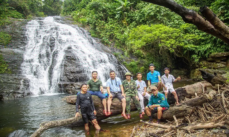
Under the guidance of the father and son of the May people (Chut ethnic group), a group that always settles at the headwaters, we had an interesting discovery trip upstream, where the Gianh River begins to flow into Quang land. Departing from K-Ai village when the jungle fowls had just begun to crow, we followed the river, weaving between the rapids, passing countless waterfalls and forests, to head upstream. At around 4:00 p.m., we arrived at Nuoc Rung waterfall.
 |
According to the guide, the Falling Waterfall is the highest point of the Gianh River that the May people can reach. Even the strongest May people have not been able to overcome this waterfall. The reason this place is called Falling Waterfall is because all year round, regardless of winter or summer, there are still streams of water falling from above. The May people believe that those drops of water fall from the sky to create rivers and streams, so the rivers and streams here never run out of water.
Maybe Nuoc Rung waterfall is not the end of Gianh river. But for some reason, when I set foot here, I was filled with a very strange feeling, a childish pride of someone who has been to the "end" of his hometown river.
In my 25-year journey as a journalist, that was not the only time I explored the upper reaches of the Gianh River. In January 2022, I followed a group of officials from Trong Hoa Commune (Minh Hoa) to explore the upper reaches of Khe Vang, another branch of the Gianh River.
Khe Vang flows from the west of the Giang Man mountain range, in Lom village, Trong Hoa commune. Exploring Khe Vang, we were able to admire the wild, majestic beauty of the old forests, of the clear, cool water flowing through each rocky rapid. In particular, on Khe Vang river, about 10km from Lom village, there are 2 waterfalls with the beauty of "fairyland" with white foam all year round, which are the 9-storey waterfall and Toc Tien waterfall.
| The trips to the Fatherland's border are arduous trips, but during that journey, we journalists always receive the wholehearted and thoughtful help of the Border Guard force and ethnic minorities living along the Fatherland's border. Without their help, we could not have completed such difficult trips. And perhaps the most valuable reward after those trips is not only the journalistic works but also the affection between the army, the people, and the pride of a strong and beautiful border. |
The 9-storey waterfall falls from a height of 100m, the waterfall is like a white silk strip across the mountainside. Standing at the foot of the waterfall and looking up, the waterfall has 9 layers of rocks protruding, so the May people call it the 9-storey waterfall. In addition, according to the May people's concept, the number 9 is an eternal number, bringing them a lot of luck...
About 30 minutes walk from the 9-storey waterfall, on another branch of the stream, is the Toc Tien waterfall. This waterfall is lower, but wider than the 9-storey waterfall. At the foot of the waterfall is a large lake, with primeval trees spreading their canopies to create shade in the middle of the lake. From the top of the waterfall, each stream of water falls down, creating a white mist like a fairy world in fairy tales...
Phan Phuong
Source: https://baoquangbinh.vn/xa-hoi/202506/di-ve-phia-bien-cuong-to-quoc-2227078/


Comment (0)