


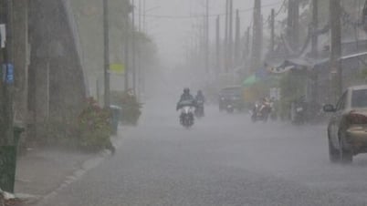
Illustrative photo. (Source: VNA)
According to the National Center for Hydro-Meteorological Forecasting, on the day and night of August 31, many dangerous weather patterns will continue to appear on land and at sea.
Localized heavy rain in many areas
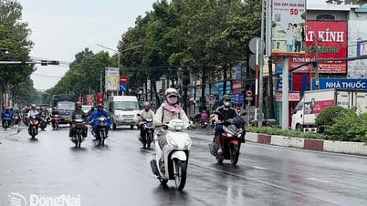
The National Center for Hydro-Meteorological Forecasting predicts that in the afternoon and night of August 31, in the midlands and the Northern Delta, the area from Thanh Hoa to Ha Tinh , the Central Highlands and the South, there will be scattered showers and thunderstorms with rainfall of 10-30mm, locally over 60mm.
Warning of risk of heavy rain over 50mm/3h, thunderstorms with possibility of tornadoes, lightning, hail and strong gusts of wind.
Localized heavy rains are likely to cause flash floods on small rivers and streams, landslides on steep slopes and flooding in low-lying areas. Warning level 1 of natural disaster risk due to tornadoes, lightning and hail.
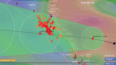
Last night and this morning (August 31), the Northern Delta, Phu Tho, and Southern Lao Cai had rain, moderate rain; from Thanh Hoa to Ha Tinh, there was moderate rain, heavy rain, and locally very heavy rain.
Rainfall from 7:00 p.m. on August 30 to 8:00 a.m. on August 31 was over 100mm in some places, such as: Thai Ninh station ( Hung Yen ) 151.4mm, Xuan Khanh station (Thanh Hoa) 164mm, Dong Van 1 station (Nghe An) 179.2mm,...
Flood warning on Ca River
The National Center for Hydro-Meteorological Forecasting said that in the next 24 hours, the flood on the Ca River will peak and gradually subside; the peak flood level at mid-upstream stations will be at alert level 1-alarm level 2, some places above alert level 2; at downstream stations it will fluctuate above alert level 1.
There is a high risk of flooding in low-lying areas along rivers, flash floods on rivers and streams, and landslides on steep slopes in Nghe An province (Real-time warning information on areas at risk of flash floods and landslides is provided online on the website of the Department of Hydrometeorology at: https://luquetsatlo.nchmf.gov.vn and in a separate bulletin warning of flash floods and landslides).
Warning level 1 flood disaster risk. River floods cause inundation of low-lying areas along the river, affecting activities such as water transport, aquaculture, agricultural production, people's lives and socio-economic activities.
Floods on the Ca River (Nghe An) are rising. At 7:00 a.m. on August 31, the water level on the Ca River at Con Cuong station was 29.72m, 0.72m above alert level 2; at Nam Dan station it was 5.50m, 0.10m above alert level 1.
Beware of tornadoes and strong winds in many coastal areas
The National Center for Hydro-Meteorological Forecasting informed that on the day and night of August 31, the Gulf of Tonkin, the sea area from Lam Dong to Ca Mau, Ca Mau to An Giang, the Gulf of Thailand, the North, Central and South East Sea (including Hoang Sa and Truong Sa special zones) will have scattered showers and thunderstorms, with the possibility of tornadoes, strong gusts of wind level 6-7 and waves 1-2m high.
In addition, in the northern sea area of the South China Sea (including the northern part of Truong Sa special zone), there are strong southwest winds of level 5, sometimes level 6, gusting to level 7-8, rough seas, waves 1.5-2.5m high.
All vessels operating in the above areas are at risk of being affected by tornadoes and strong gusts of wind. Currently, the central and southern East Sea (including Truong Sa special zone) has scattered showers and thunderstorms./.
According to Vietnamplus
Source: https://www.vietnamplus.vn/canh-bao-nguy-co-mua-tren-50mm-trong-3-gio-o-nhieu-khu-vuc-post1059064.vnp
Source: https://baolongan.vn/canh-bao-nguy-co-mua-tren-50mm-trong-3-gio-o-nhieu-khu-vuc-a201710.html
![[Photo] People eagerly wait all night for the parade on the morning of September 2](https://vphoto.vietnam.vn/thumb/1200x675/vietnam/resource/IMAGE/2025/9/1/0cf8423e8a4e454094f0bace35c9a392)
![[Photo] Celebration of the 65th Anniversary of the Establishment of Diplomatic Relations between Vietnam and Cuba](https://vphoto.vietnam.vn/thumb/1200x675/vietnam/resource/IMAGE/2025/9/1/0ed159f3f19344e497ab652956b15cca)
![[Photo] Chu Dau Ceramics – Proud of Vietnamese identity at Exhibition A80](https://vphoto.vietnam.vn/thumb/1200x675/vietnam/resource/IMAGE/2025/9/1/c62ab2fc69664657b3f03bea2c59c90e)
![[Photo] General Secretary receives heads of political party delegations from countries attending the 80th anniversary of our country's National Day](https://vphoto.vietnam.vn/thumb/1200x675/vietnam/resource/IMAGE/2025/9/1/ad0cb56026294afcae85480562c2e790)
![[Photo] Solemn reception to celebrate the 80th anniversary of the National Day of the Socialist Republic of Vietnam](https://vphoto.vietnam.vn/thumb/1200x675/vietnam/resource/IMAGE/2025/9/1/e86d78396477453cbfab255db1e2bdb1)
![[Photo] National Assembly Chairman Tran Thanh Man receives Cambodian Senate President Hun Sen](https://vphoto.vietnam.vn/thumb/1200x675/vietnam/resource/IMAGE/2025/9/1/7a90c9b1c1484321bbb0fadceef6559b)


![[Infographic] A week of strong fluctuations, gold prices continuously set historical peaks](https://vphoto.vietnam.vn/thumb/402x226/vietnam/resource/IMAGE/2025/9/1/1520fa24c9c94c39afee9a58ceb09de1)


Comment (0)