

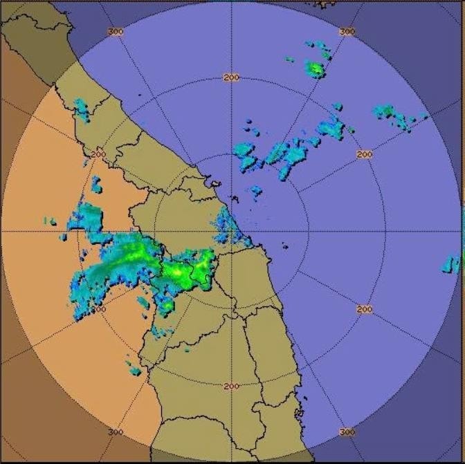
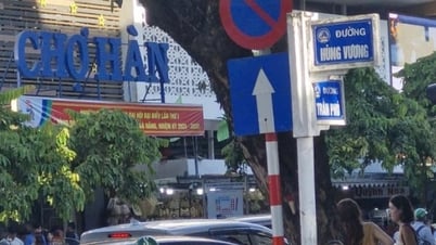
Through monitoring on Tam Ky Weather Radar images, satellite cloud images and lightning positioning, it is shown that convective clouds are forming and developing over the communes of Phuoc Chanh, Phuoc Thanh, Tra Linh, Tra Van, Nam Tra My, Tra Leng, Tra Giap, Tra My, Tra Doc, Tra Lien. Currently, thunderstorms are continuing to develop and expand to the East.
Currently, until the next 3 hours, these cloud areas will continue to develop, causing showers and thunderstorms for the above communes, then possibly spreading to Phuoc Nang, Kham Duc, Phuoc Hiep, Phuoc Tra, Tra Tap, Tra Tan, Lanh Ngoc, Thanh Binh communes, and then possibly developing and spreading to neighboring communes. It is necessary to be on guard against dangerous weather phenomena such as localized heavy rain, tornadoes, lightning, hail and strong gusts of wind during thunderstorms.
Currently (July 6), the sea area of Da Nang city and Hoang Sa archipelago has showers and thunderstorms in some places.
Forecast for today and tonight (July 6), the sea area of Da Nang city and the sea area of Hoang Sa archipelago will have scattered showers and thunderstorms. During thunderstorms, be on guard against tornadoes and strong gusts of wind level 6 - level 7.
All vessels and other activities in the above mentioned sea areas are at high risk of being affected by cyclones, strong winds and large waves.
Source: https://baodanang.vn/canh-bao-dong-loc-set-mua-da-va-mua-lon-cuc-bo-thanh-pho-da-nang-3265107.html
![[Photo] Many people eagerly await the preliminary review despite heavy rain](https://vphoto.vietnam.vn/thumb/1200x675/vietnam/resource/IMAGE/2025/8/27/4dc782c65c1244b196890448bafa9b69)
![[Photo] Brilliant red of the exhibition 95 years of the Party Flag lighting the way before the opening](https://vphoto.vietnam.vn/thumb/1200x675/vietnam/resource/IMAGE/2025/8/27/e19d957d17f649648ca14ce6cc4d8dd4)


![[Photo] Prime Minister Pham Minh Chinh chairs meeting of National Steering Committee on International Integration](https://vphoto.vietnam.vn/thumb/1200x675/vietnam/resource/IMAGE/2025/8/26/9d34a506f9fb42ac90a48179fc89abb3)


![[Photo] General Secretary To Lam attends Meeting with generations of National Assembly deputies](https://vphoto.vietnam.vn/thumb/402x226/vietnam/resource/IMAGE/2025/8/27/a79fc06e4aa744c9a4b7fa7dfef8a266)


Comment (0)