

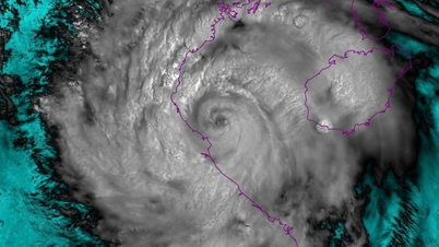
When storm No. 5 makes landfall in the South Thanh Hoa - North Ha Tinh area, it is forecasted that there will be strong winds of level 10-11; near the storm center, winds of level 12-14, gusting to level 15-16.
According to the National Center for Hydro-Meteorological Forecasting, at 7:00 a.m. on August 25, the center of storm No. 5 was at about 18.4 degrees North latitude; 107.3 degrees East longitude, about 170 km from Nghe An , 160 km from Ha Tinh and 160 km from northern Quang Tri. The strongest wind near the center of the storm reached level 14, gusting to level 17. The storm moved in a West-Northwest direction at a speed of about 20 km/hour.
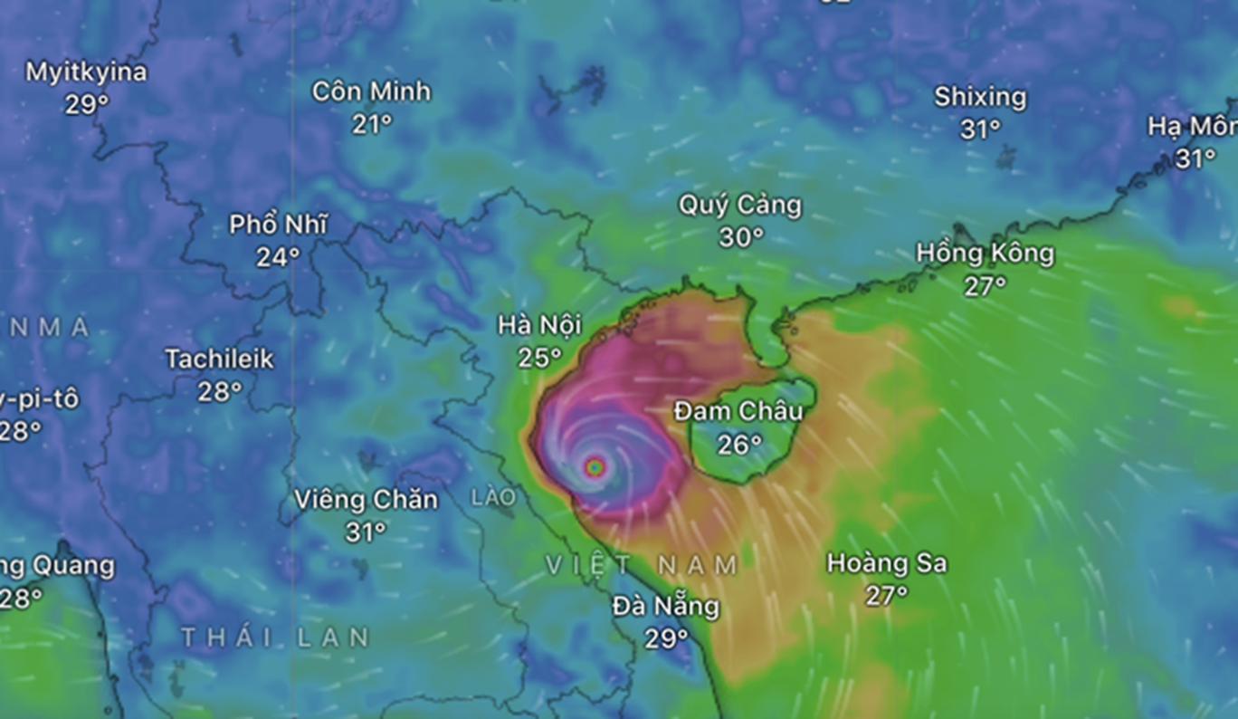 |
| Storm No. 5 approaches the Central region. Photo: Windy |
It is forecasted that on August 25, the storm will enter the Ha Tinh - Thanh Hoa sea area and maintain its intensity at level 14, gusting at level 15-16. When approaching the Ha Tinh - Nghe An coast, the storm's intensity is likely to decrease to late level 13, early level 14.
The North Thanh Hoa area has strong winds of level 8-9, gusting to level 10-11. The South Thanh Hoa - North Ha Tinh area has strong winds of level 10-11; the area near the storm center has strong winds of level 12-14, gusting to level 15-16, with a radius of strong winds above level 12 of about 50 km.
In southern Ha Tinh, Quang Tri and the coast from Quang Ninh to Ninh Binh, strong winds are at level 6-8, gusting to level 9-10. When the storm moves deep into the mainland of southern Thanh Hoa - Ha Tinh, 50-70 km from the coast, strong winds are at level 8-9, gusting to level 11-12; in the area bordering Laos, winds decrease to level 6-7, gusting to level 7-8.
Storm No. 5 is still very strong when it makes landfall.
On land in provinces from Thanh Hoa to Quang Tri, strong winds started from the morning of August 25, with the strongest winds from 12 noon to about 6 pm the same day.
Regarding rain, from the morning of August 25 to the end of August 26, the midlands and the Northern Delta, Lao Cai and from Thanh Hoa to Thua Thien Hue will have widespread heavy rain with common amounts of 100-150 mm, locally over 250 mm. Particularly, from Thanh Hoa to Northern Quang Tri, there will be very heavy rain, amounts of 200-400 mm, some places over 600 mm. Warning of the risk of extremely heavy rain over 200 mm in 3 hours.
Meteorological experts said that when storm No. 5 approaches the shore, increased friction along with the impact of the northwestern edge of the subtropical high pressure will gradually weaken the storm, its structure will lose symmetry and the storm axis will tilt to the North.
Forecasts from international agencies also show the danger level of storm No. 5. The Japan Meteorological Agency and Beijing (China) both said that the storm will have a level 13-14 intensity when it makes landfall, while Hong Kong (China) predicted that the storm will maintain a level 14 intensity.
According to Thuy Linh/NLDO
Source: https://baovinhlong.com.vn/thoi-su/202508/bao-so-5-manh-cap-12-14-giat-cap-16-do-bo-tu-nam-thanh-hoa-bac-ha-tinh-eb91aa9/
![[Photo] Prime Minister Pham Minh Chinh chairs meeting of National Steering Committee on International Integration](https://vphoto.vietnam.vn/thumb/1200x675/vietnam/resource/IMAGE/2025/8/26/9d34a506f9fb42ac90a48179fc89abb3)

![[Photo] Prime Minister Pham Minh Chinh receives CEO of Samsung Electronics](https://vphoto.vietnam.vn/thumb/1200x675/vietnam/resource/IMAGE/2025/8/26/373f5db99f704e6eb1321c787485c3c2)

![[Photo] Brilliant red of the exhibition 95 years of the Party Flag lighting the way before the opening](https://vphoto.vietnam.vn/thumb/1200x675/vietnam/resource/IMAGE/2025/8/27/e19d957d17f649648ca14ce6cc4d8dd4)


Comment (0)