


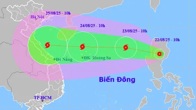
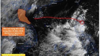
Initially, the Department of Hydrometeorology ( Ministry of Agriculture and Environment ) assessed that this cyclone system will move quickly towards the Gulf of Tonkin between August 24 and 25, so the weather at sea will turn bad from August 23 in the North and Central East Sea, and from August 24 in the Gulf of Tonkin.
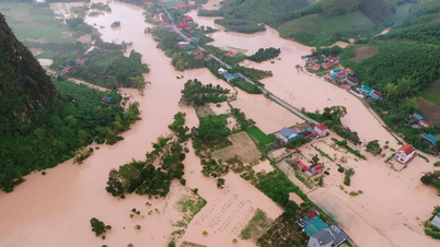
From August 25, the northern provinces and the area from Thanh Hoa to Hue may experience widespread moderate to heavy rain.
On the evening of August 21, after receiving a report on this low pressure, Deputy Minister of Agriculture and Environment Nguyen Hoang Hiep signed an official dispatch to coastal localities from Quang Ninh to An Giang, requesting that vessels be notified to proactively move, take shelter safely, ensure communication and prepare rescue vehicles and forces when necessary. Provinces and cities review and prepare response plans for heavy rain and flooding.
According to weather experts, current sea conditions are very favorable for the development of this cyclone. The surface temperature of the East Sea is higher than the average of many years and the deep warm water layer, creating a large source of energy, can cause the tropical depression to quickly strengthen.
Some international climate forecast models such as ECMWF (Europe) and GFS (USA) predict that this cyclone system has a high probability of developing into a storm in the coming days, with a trajectory mainly heading West - Northwest, directly affecting the Northern and North Central regions.
If this scenario occurs, the area from Ninh Binh to Ha Tinh may experience strong winds of level 12-13, along with heavy rain of 300-400mm from August 25 to 28.
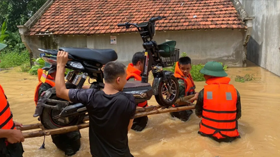
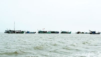
First of all, fishermen in the East Sea should proactively move their boats to the southern sea or ashore before August 24 to ensure safety. Reservoirs in the upstream of the North and North Central regions need to continue lowering their water levels to welcome floods from August 22 to 24 (before heavy rains). People in coastal and mountainous areas from Quang Ninh to Ha Tinh need to closely monitor this tropical depression (or storm).
Source: https://www.sggp.org.vn/ap-thap-dang-vao-bien-dong-co-the-thanh-bao-manh-post809510.html
![[Photo] President Luong Cuong attends special political-artistic television show "Golden Opportunity"](https://vphoto.vietnam.vn/thumb/1200x675/vietnam/resource/IMAGE/2025/8/22/44ca13c28fa7476796f9aa3618ff74c4)

![[Photo] Prime Minister Pham Minh Chinh chairs the conference to review the 2024-2025 school year and deploy tasks for the 2025-2026 school year.](https://vphoto.vietnam.vn/thumb/1200x675/vietnam/resource/IMAGE/2025/8/22/2ca5ed79ce6a46a1ac7706a42cefafae)


![[Photo] President Luong Cuong receives delegation of the Youth Committee of the Liberal Democratic Party of Japan](https://vphoto.vietnam.vn/thumb/1200x675/vietnam/resource/IMAGE/2025/8/22/2632d7f5cf4f4a8e90ce5f5e1989194a)


Comment (0)