
 |
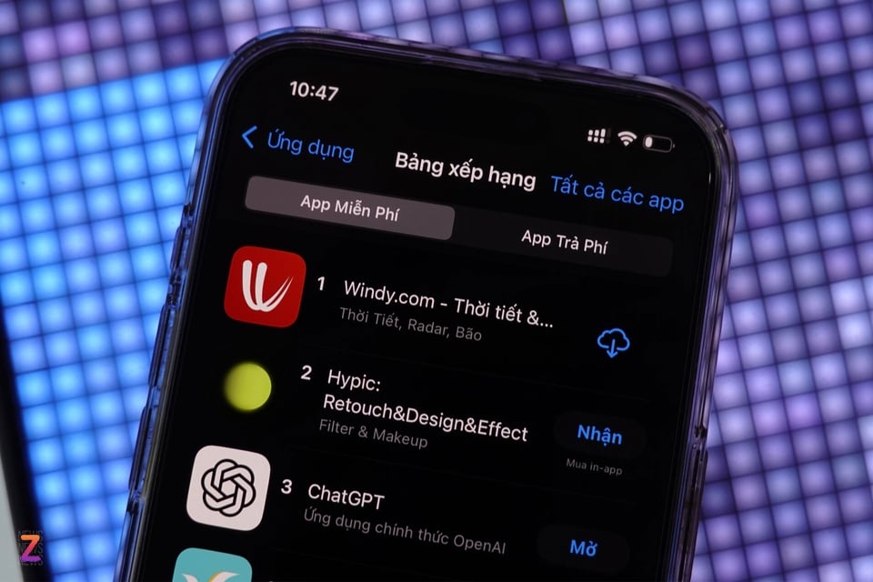
Windy app tops App Store charts in Vietnam. |
Windy became the most downloaded free app on the Vietnamese App Store (both iPhone and iPad) on July 21-22. This app also entered the top 10 most popular apps on the Google Play Store.
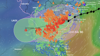
Currently, many people download Windy to track the path and predict the movement of Wipha, the storm that approached Vietnam's mainland on the morning of July 22.
According to data from research firm Sensor Tower , Windy has risen 389 places from July 5, ranking 58th in the list of popular free apps on the App Store in Vietnam on July 18, when the low pressure area in the East of the Philippines was upgraded to a storm by the Japan Meteorological Agency (JMA) and named Wipha.
By July 19, Windy had risen to fourth place. This was when Wipha’s intensity increased. As the storm made landfall in parts of China, the Philippines, and approached Vietnam, Windy became the most downloaded free app.
On Google Trends, searches for keywords such as “windy” and “windy app” also skyrocketed from July 19, reaching their peak in the early morning of July 22.
 |
Windy's popularity has skyrocketed since the storm information surfaced. Photo: Sensor Tower . |
Windy is an online mapping platform developed by a team of Czech programmers. The platform's data is aggregated from leading meteorological models such as ECMWF, GFS, ICON, JMA, and especially supports real-time satellite images.
Windy combines many powerful forecasting models (ECMWF, GFS…), updated regularly every 6-12 hours. Thereby, people can use the app for reference purposes.
When opening Windy, the app will determine the user's location with the default option of displaying wind speed. The app supports moving on the screen to display wind speed in the areas, holding lightly to display the exact longitude and latitude of the location.
Windy supports multiple views such as wind direction and strength, precipitation, temperature, clouds and air quality. Users can view future forecasts for each location's weather information for the following days. The application is based on OpenStreetMap's open source map.
The free version of Windy offers most of the important features, users can pay to get advanced forecasts. The application is well-reviewed for its simple interface, available in Vietnamese, but requires familiarity with the features to read the map.
In addition to the Windy app, users can directly track the storm's path through the Vietnam Natural Disaster Monitoring System (VNDMS). The system has 2 versions, web and VNDMS app, supporting both Android and iOS.
Source: https://znews.vn/ung-dung-theo-doi-bao-wipha-dung-dau-danh-sach-tai-tren-iphone-post1570661.html


Comment (0)