From the night of June 20 to this morning, June 21, the mountainous areas of the North experienced a widespread heavy rain, lasting for many hours with very strong intensity.
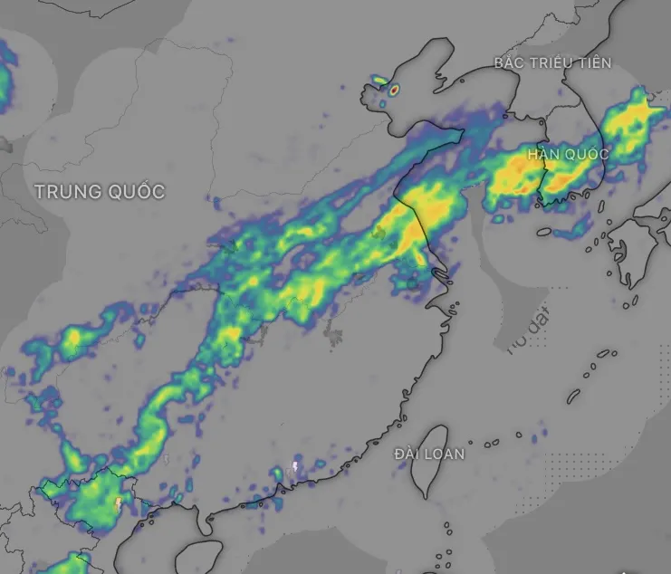
Weather radar data at 6 a.m. from automatic rain gauge applications showed a band of heavy rain (moderate to very heavy rain) extending from southern Japan to northern Vietnam. This thunderstorm cloud nest was formed by a tropical convergence zone combined with a low vortex at an altitude of 500-3,000m, causing strong convection and deep moisture convergence.
Specifically, a giant band of thunderstorms stretches from southern Japan, through the Korean peninsula, the East China Sea, through southern China (including areas such as Wuhan, Chongqing, Guangxi), down to northern Vietnam (including Ha Giang , Cao Bang, Hanoi, Thanh Hoa...). This is a tropical convergence zone with a Northwest - Southeast tilt axis, active and stretching over 2,000km, causing strong convective cloud formation with heavy to very heavy rain over a wide area.
Information about this cloud disk structure was also confirmed from meteorological satellite images of the Japan Meteorological Agency (JMA) and cross-referenced data from the Global Precipitation Measurement (GPM).
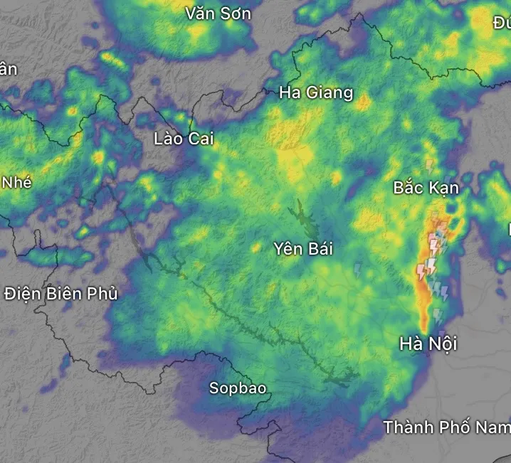
According to the Vrain automatic rain gauge system (deployed by the Vietnam National Center for Hydro-Meteorological Forecasting), as of 6:00 a.m. on June 21, many localities recorded rainfall exceeding 150mm, including: Thai Nguyen measured 253mm at Binh Son station; Tuyen Quang 209.4mm at Khuon Ha; Phu Tho 198.4mm at Bang Luan; Ha Giang 188mm at Ban Ngan; Son La 127.2mm at Km46 of National Highway 6; Bac Kan 97.2mm at Yen Han. Yen Bai, Lao Cai, Cao Bang, Hoa Binh and Hanoi all had heavy rain (over 60mm).
Meanwhile, the Central region is almost dry. Except for Thanh Hoa with heavy rain (82.2mm in Thanh Son), the provinces from Nghe An to Hue have no rain or insignificant rain. The South and Central Highlands have scattered rain with small amounts, commonly under 30mm.
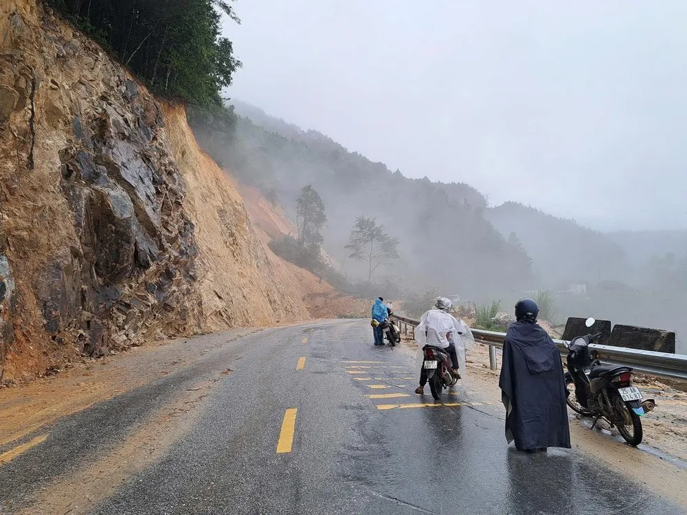
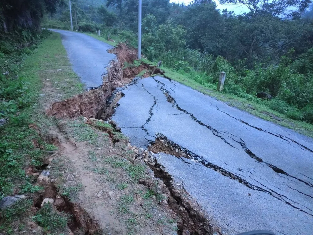
The National Center for Hydro-Meteorological Forecasting warns that this heavy rain is likely to continue today and tomorrow (June 22), concentrated in the mountainous and midland areas of the North. Dangerous weather phenomena such as flash floods, landslides in mountainous areas and flooding in low-lying urban areas will occur.
In the delta, the water level downstream of the Red - Thai Binh river system is changing slowly. From now until June 22, the upper reaches of the Thao River, Lo River and small rivers in the North are likely to experience a flood with an amplitude of 2-4m. Some places in the mountainous and midland areas of the North are likely to experience rain exceeding 300mm.
Since yesterday afternoon, June 20, the Department of Meteorology and Hydrology (Ministry of Agriculture and Environment) has reported on this rain. In this situation, Deputy Minister of Agriculture and Environment Nguyen Hoang Hiep has sent a document to the People's Committees of the provinces in the Northern mountainous region, requesting to respond to this rain.
Localities need to ensure traffic safety, guard and guide at spillways and areas with rapids; do not allow people and vehicles to pass if it is not safe. At the same time, check and reinforce works, reservoirs, and mineral exploitation; prepare rescue forces and means. The Department of Dyke Management and Disaster Prevention will summarize the situation and direct appropriate responses in the coming days.
Source: https://www.sggp.org.vn/tui-nuoc-khong-lo-treo-o-mien-bac-canh-bao-mua-to-nguy-co-lu-quet-post800331.html




















![[Maritime News] More than 80% of global container shipping capacity is in the hands of MSC and major shipping alliances](https://vphoto.vietnam.vn/thumb/402x226/vietnam/resource/IMAGE/2025/7/16/6b4d586c984b4cbf8c5680352b9eaeb0)







Comment (0)