The storm's circulation caused very heavy rain, strong gusts of wind on land, and river water rose rapidly beyond alert level 3, cutting off many national and provincial highways and causing more than 21 deep flooding points in mountainous villages.
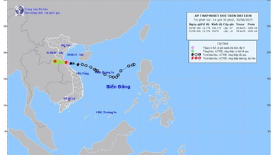
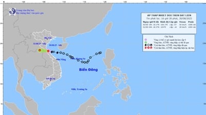
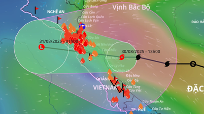
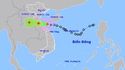
According to the National Center for Hydro-Meteorological Forecasting, at 10:00 a.m. on August 30, the storm center was at 17.9 degrees North latitude - 107.5 degrees East longitude, about 120km from the North of Quang Tri . The strongest wind near the storm center was level 8 (62-74 km/h), gusting to level 10-11.
On Con Co Island, strong winds of level 6, gusting to level 8, were recorded. At sea, waves were 3-5m high, and water levels rose 0.2-0.4m along the shore. It is forecasted that this evening, August 30, the storm will make landfall in Ha Tinh - Northern Quang Tri with winds of level 6, gusting to level 8, then gradually weaken as it enters Laos.
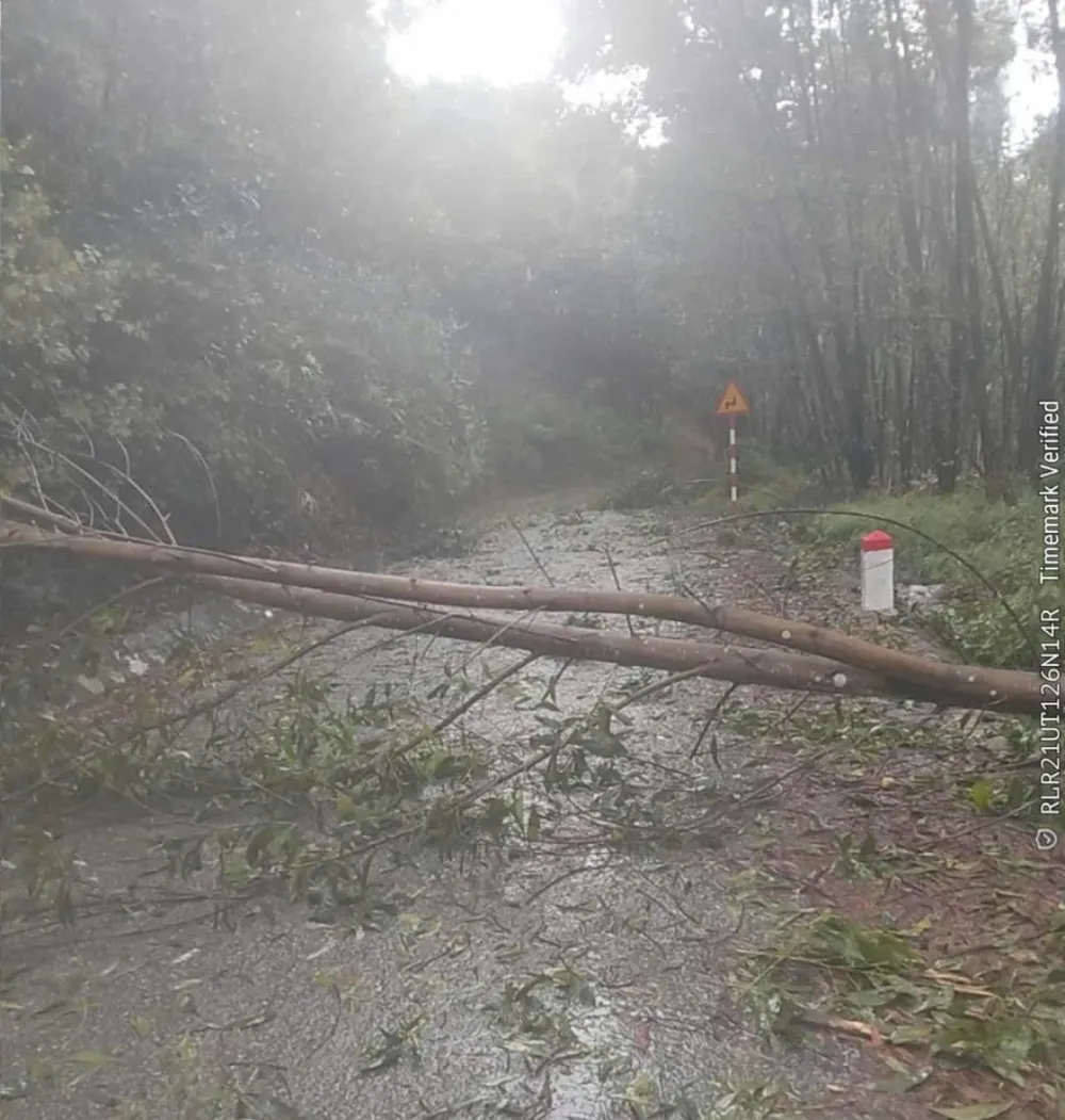
On the mainland of Quang Tri, many places recorded winds of level 6-7, gusting to level 8-9 such as Phu Trach, Ba Don, Hoan Lao, Dong Hoi. In Vinh Linh, Gio Linh, Cua Viet, Dong Ha, Quang Tri, Hai Lang areas, winds of level 5-6, gusting to level 7-8. There is a high risk of tornadoes and strong storms causing roofs to be blown off and trees to fall.
Due to the influence of the storm circulation, from the night of August 29 to noon of August 30, Quang Tri had very heavy rain. Measured rainfall: Huong Lap 258.6mm, Huong Viet 220.8mm, Hai Thai 213.4mm, Cam Chinh 212mm, Huong Linh 207.6mm, Linh Thuong 202.4mm. Plain and coastal areas also recorded widespread rain of 70-200mm.
At 11:00 a.m. on August 30, the water level of Hieu River at Dau Mau reached 23.56m, exceeding alarm level 3 by 0.06m; at Dong Ha it was 2.52m, 0.52m higher than alarm level 1. Hydrological stations on Thach Han River, Ben Hai River, and Kien Giang River were all above alarm level 1 and continued to rise rapidly.
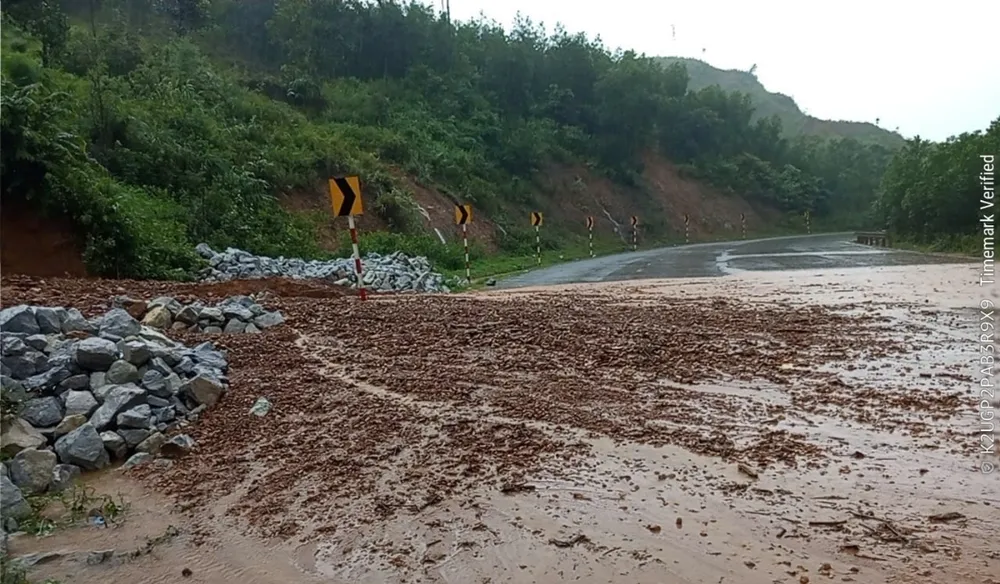
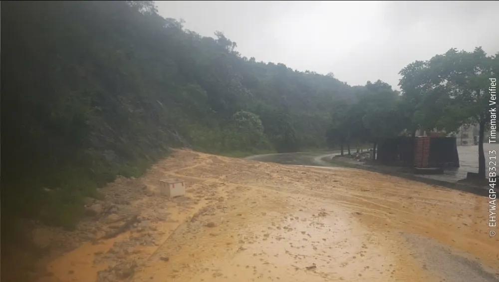
The flood has paralyzed many vital traffic routes: National Highway 9B has 2 points flooded 0.3-0.4m deep, DT571 spillway Km25+900 flooded up to 1.5m; DT588a Ba Long spillway flooded 0.3m. On Ho Chi Minh Highway West branch and Huong Phung - Lao Bao patrol road, landslides of tens of cubic meters of earth and rock occurred, completely blocking traffic.
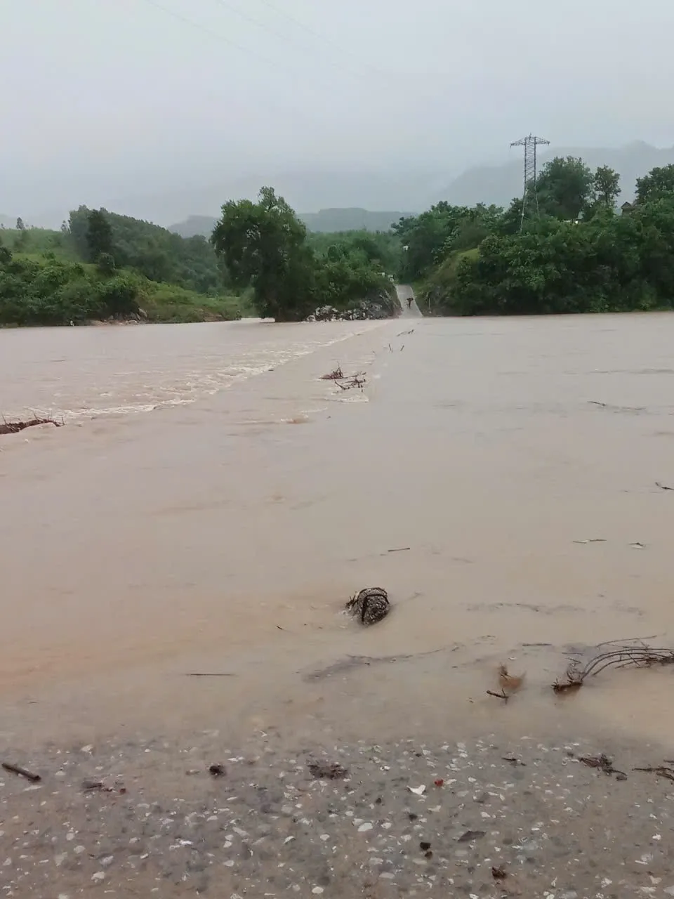
According to the Provincial Civil Defense Command, the province has recorded 21 flooded and isolated areas in mountainous and midland communes.
In Kim Phu commune: 3 flooded points in Ban On, Ban Yen Hop, Ban Mo O O O. Dakrong commune: Ly Ton spillway flooded 0.5m, Chan Ro spillway isolated.
Huong Lap Commune: Se Pu village, Cha Ly spillway submerged in water. Huong Hiep Commune: Khe Nghi and Tien Hien spillway flooded 0.7m, isolating Gia Gia village with 190 households (900 people).
Huong Phung Commune: many floods 1m deep, border patrol road congested.
Hieu Giang Commune: 5 flooded points including Ba Thung spillway, Ben Dau spillway, Thien Chanh spillway, Tan Quang spillway, Binh My village.
Ben Quan Commune: the roads to villages 4, 5, 8, 9 are completely isolated. In addition, the communes of Con Tien, Phong Nha, Tan Lap, Thuong Trach, Dan Hoa... all have bridges flooded 0.4-1m deep, causing many villages to be isolated, hundreds of households unable to move.
Faced with the complicated developments of the storm, the Quang Tri provincial government has issued an evacuation order for people in high-risk areas. In Huong Lap commune, 2 households/7 people in Cu Bai village have been evacuated from the landslide area. Military, police and border guards are on duty 24/7 at key locations, ready to respond in case of emergency.
Quang Tri currently has nearly 39,000 hectares of summer-autumn rice, of which 11,165 hectares are over 80% ripe, but storms have caused many areas to collapse and be flooded.
In addition, 27,800 hectares of crops and 7,127 hectares of aquaculture are at risk of serious damage if the floods continue. Irrigation reservoirs in the province are still safe, with capacity reaching 64.75% of the design. However, the authorities warn of the risk of flood discharge if the rains continue.
Faced with the above situation, Mr. Tran Phong, Chairman of the People's Committee of Quang Tri province, directed that there must be absolutely no subjectivity or negligence; units and localities must be resolute and synchronous, ensuring the safety of people's lives and property and the state, minimizing the damage caused by storm No. 6.
Source: https://www.sggp.org.vn/quang-tri-mua-lon-lu-vuot-bao-dong-3-co-21-diem-ngap-chia-cat-post810963.html





![[Photo] People eagerly lined up to receive special publications of Nhan Dan Newspaper](https://vphoto.vietnam.vn/thumb/1200x675/vietnam/resource/IMAGE/2025/8/30/53437c4c70834dacab351b96e943ec5c)






















































Comment (0)