

- Bac Lieu responds to the peak of "500 days and nights to complete 3,000km of expressway"
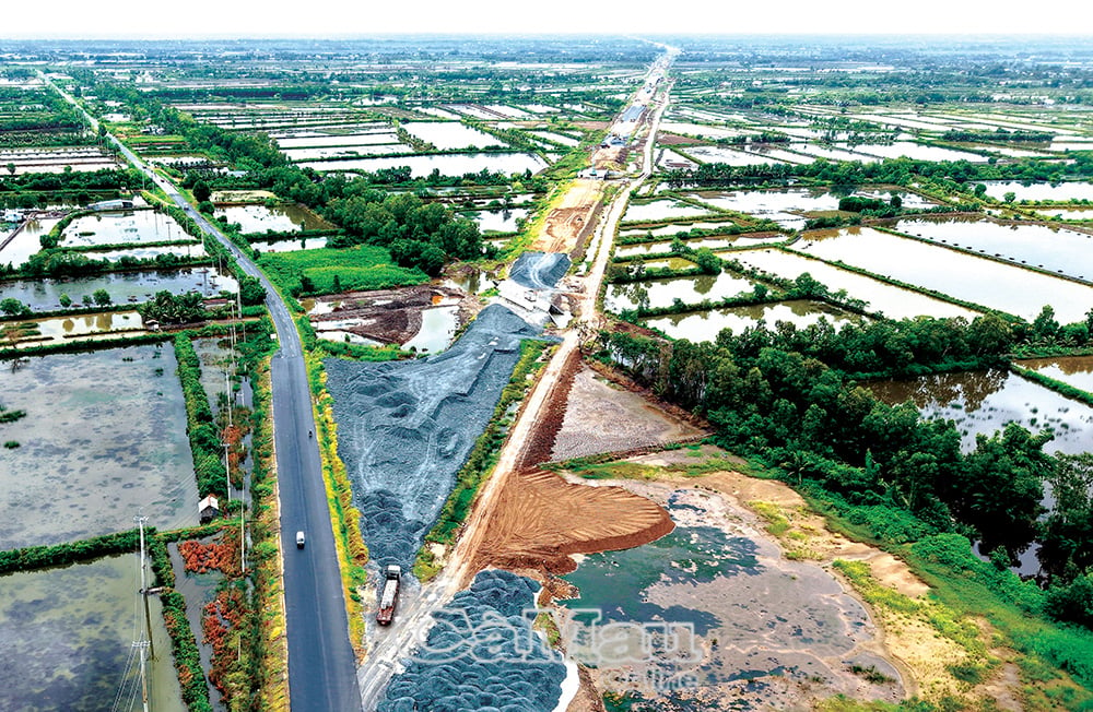
- Ca Mau - Dat Mui Expressway requires urgent progress
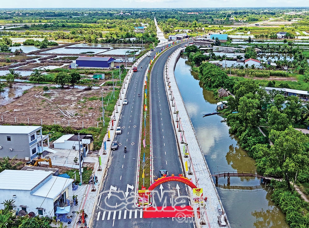
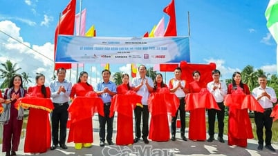
- Ca Mau simultaneously started and inaugurated works and projects to celebrate the August Revolution and National Day September 2nd.
A time of difficult traffic
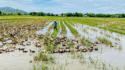
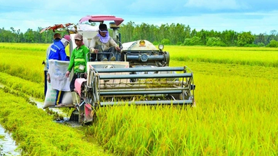
In the early 2000s, Ca Mau land was strongly transformed between two streams of salt and fresh water, with the story of shrimp and rice being topical. Investment capital was limited, small, and only focused on irrigation infrastructure; transportation still depended heavily on waterways. The province was far away, still poor, and had more obstacles.
At that time, in the old Ca Mau province, only National Highway 1 from the center of Ca Mau city to the above province was still acceptable, although it was quite bumpy due to its degradation and narrowness. Tran Hung Dao Street, the busiest street today, was then just a short, muddy road, connected by small roads made by the people themselves leading to rickety houses.
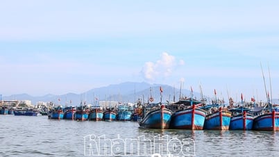
To get to the districts, most of them had to go by water, which was clearly divided into two regions, the South and the North of Ca Mau. From Wharf A in Ward 1 (now An Xuyen Ward) to the Tac Thu intersection, go straight to the U Minh brackish forest area with endless green cajuput trees; up to the Thoi Binh freshwater area with sugarcane and rice; down the Ong Doc River to the West Sea with lots of shrimp and fish in Tran Van Thoi District. At Wharf B (formerly in Ward 7, right at the intersection of the Ca Mau - Bac Lieu and Ganh Hao canals, Tan Thanh Ward today; then moved to Ward 8, now Ly Van Lam Ward), there were all kinds of watercraft bustling, from here following the Ganh Hao River to Dam Doi, to the East Sea; following the Bay Hap River to Cai Nuoc, down to Phu Tan; taking a shortcut across the East bank to Nam Can, or crossing the Cua Lon River to Ngoc Hien, Dat Mui far away on the alluvial plain.
The remoteness and isolation without roads and having to travel by boat are always remembered with memorable jokes. The story is that in 2004, Ngoc Hien was divided into two districts, Nam Can and Ngoc Hien. The new district headquarters, Ngoc Hien, was located in Kien Vang, which used to be the headquarters of a forestry company. Every day, there was a "public ferry" carrying the brothers to Ngoc Hien to work, departing from Nam Can at dawn; at 4:30 pm, the cadres had to be brought back to Nam Can, because of the long distance, so they had to hurry to cross the "La Lang Bay" before dusk. However, after a long journey, when they reached the Cua Lon River, it was already dusk, literally "coming from the forest" when on the other side of the river, Nam Can urban area had turned on the lights. Ngoc Hien at that time only had a road wider than 1 meter from Kien Vang to Rach Goc, and there were no street lights at night. Those who can't make it back on time for the ferry have no choice but to go to bed early when it gets dark, in the dormitories in the middle of the forest...
I remember when Ca Mau town was still there, there was only a small road to Tac Thu. To cross Ong Doc and Cai Tau, there was only a small iron bridge that was only for motorbikes, four-wheeled vehicles could only go one way. In the midst of economic difficulties, this bridge was considered the most massive and modern at that time in the countryside, associated with the great determination of Mr. Doan Thanh Vi, former Secretary of Minh Hai Provincial Party Committee. After the U Minh Ha forest fire disaster in 2002, the province opened a road along the Nong Truong canal to Coi 6, all the way to the coast at Hon Da Bac National Monument.
Landmark projects
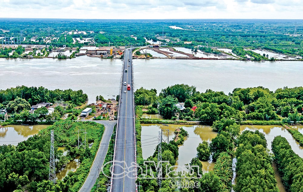
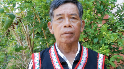
With the high political determination of the Party and Government leaders, in order to overcome difficulties for Ca Mau in particular, and the Nine Dragons in general, to reach out to the sea, each key traffic project has gradually been formed with all the responsibility and affection for the land of the revolutionary base that suffered much pain and destruction during the war. As Mr. Ngo Thinh Duc, when he was Deputy Minister of Transport, once said with all his heart that when the Ganh Hao 2 bridge on National Highway 1 connecting Ward 7 and Ward 8 is completed, then he will retire with peace of mind and ease of mind for this land that is heavily indebted to gratitude.
I still remember the days when, together with Mr. Ngo Thinh Duc and Mr. Bui Cong Buu, the Chairman of the Provincial People's Committee at that time, we had to overcome the bumpy road to attend the groundbreaking ceremony of the bidding packages on National Highway 1 to Nam Can, including the Dam Cung Bridge; or when Mr. Pham Thanh Tuoi was the Chairman of the Provincial People's Committee, I had the opportunity to accompany him along the flowing Cua Lon River, the group gathered at the edges of the forest, cut through the forest lines, dug up each layer of alluvial soil to find the location, set up markers to build the Nam Can Bridge on the Ho Chi Minh Trail to Dat Mui... so hard but full of pride and excitement. The sweat of the comrades of the working group mixed with the salty soil, reflecting the sweet aspiration, which was to erase the "oasis" Ngoc Hien, awaken the potential of the sacred land at the end of the Fatherland, connect a strip of mountains and rivers, satisfy the longing for Dat Mui of the people of the whole country.
Then, realizing that Dam Doi was still an "oasis" and needed a connecting bridge, the Prime Minister at that time, Mr. Nguyen Tan Dung, on the podium at an event in Khai Long, asked: "Should we build a floating bridge?". A question, but it was also an order. The transport sector urgently implemented the investment project to build Hoa Trung bridge (crossing Ganh Hao river, connecting with Ca Mau - Dam Doi route to connect from Ca Mau city to Dam Doi district), according to an unprecedented mechanism. And in a very short time, on January 16, 2016, Hoa Trung bridge was technically opened to traffic, at the same time as the Ho Chi Minh road from Nam Can to Dat Mui was opened to traffic. These are two projects of important significance in the socio-economic development, strengthening national defense and security of Ca Mau province in particular and the Mekong Delta in general. That time, returning to celebrate with Ca Mau was former General Secretary Le Kha Phieu.
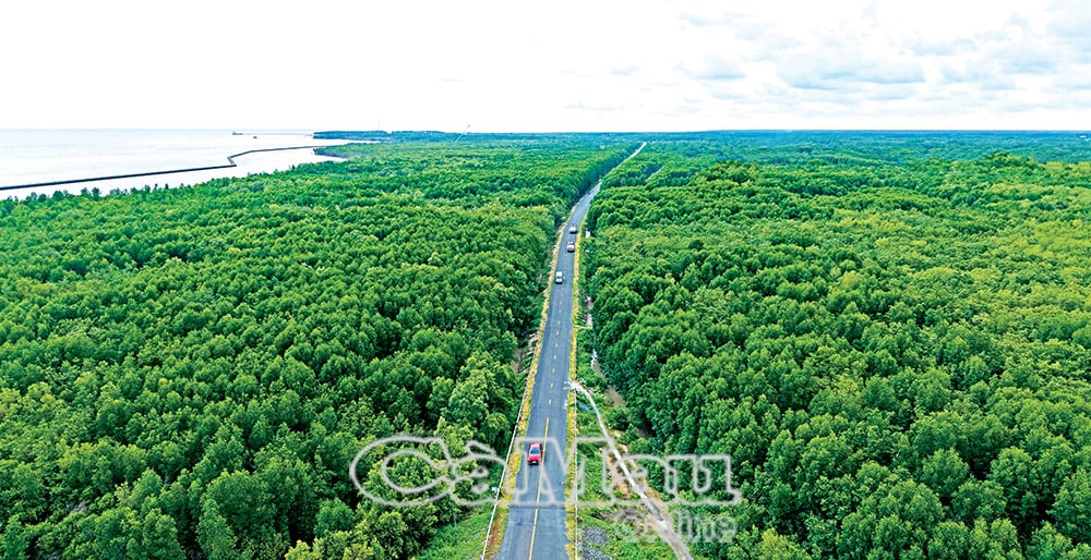
Mentioning the road named Ho Chi Minh to the end of the cape, it is even more emotional. Mentioning it to remember the early days, the people who went through the forest to clear the route had lost each other in the vast deep forest, the tangled rivers. The groups of boats and barges carrying blocks of sand and rocks from far away, sometimes had to be "transferred" to smaller vehicles, weaving through canals, so that the materials could reach the construction site; or often had to stop at "stop stations", because every day there were two regular high and low tides, at times of low tide, the whole river was just a stream. It was even more difficult when the current was strong in the coastal area, through the creeks and bays, it was extremely difficult and dangerous. Recalling the image of the early construction site in that remote, swampy land; looking at the road through the forest like a silk thread, a blood vessel today, I feel even more deeply the great power of unity, determination to open up...
More emotional was the day the road was technically opened to traffic, groups of simple people gathered behind the land, at the edge of the forest, waiting to see for the first time with their own eyes the car rolling to this land. Adults and children were happy, excited, the atmosphere was bustling like a festival. How could we not be excited when from now on there was a road, people who had been clinging to the forest for generations, rowing boats on square canals and ditches could now "reach the shore", no longer having to endure the insecurity every time they crossed deep rivers, or lost each other in the middle of the deep forests...
Expectations to reach the top of the South
Above all, the value and significance of the road named after Uncle Ho to Dat Mui is not only a construction project that realizes the lifelong dream of the people of the country, but also demonstrates the spirit of national solidarity, connecting the North and South, and the aspiration for the country to firmly reach out to the ocean.
Glorious past - beautiful present - bright future. One side leans against the forest, the other looks out to sea, the landmark embossed with the words "Ho Chi Minh Road - end point Ca Mau KM 2436" at Dat Mui is like an affirmation that this land will forever be more vast with alluvial grains.
With special affection for the sacred land of the nation, during his visit to Dat Mui in November 2024, General Secretary To Lam wholeheartedly wished to expand the southernmost "continent" of the Fatherland. And now, realizing the will and clear vision of the head of our Party, there is nothing more wonderful than the project of the expressway to Dat Mui, building a bridge to Hon Khoai Island and Hon Khoai dual-use port taking shape. These projects were started on August 19, at the same time as the groundbreaking and inauguration of a number of other key projects in the province as well as in many provinces and cities in the country to celebrate the 80th anniversary of the August Revolution and National Day on September 2 this year.
Airports, seaports, highways, and horizontal and vertical connecting routes have been, are being, and will be formed in the Ca Mau Cape area, bringing Ca Mau from being known as the end of the land to proudly becoming the southernmost region.
Ca Mau - still the tip of the Fatherland, but now no longer far away, but closer every day through connecting and spreading routes. During his working trip to Ca Mau, meeting with the people of Dat Mui to attend the National Great Unity Festival at the end of 2024, General Secretary To Lam shared his heart with the people about protecting forests and land. At the same time, he affirmed that with the spirit of solidarity and determination in all revolutionary movements, Ca Mau will certainly achieve great achievements.
Now, with expanded development space after the province's merger, Ca Mau has doubled its strength, multiplied its confidence, and is more steadfast in continuing the journey for greater aspirations in the era of national growth.
Tran Nguyen
Source: https://baocamau.vn/nhung-con-duong-mang-khat-vong-vuon-xa-a121779.html

![[Photo] Multi-colored cultural space at the Exhibition "80 years of the journey of Independence - Freedom - Happiness"](https://vphoto.vietnam.vn/thumb/1200x675/vietnam/resource/IMAGE/2025/8/26/fe69de34803e4ac1bf88ce49813d95d8)
![[Photo] Prime Minister Pham Minh Chinh receives CEO of Samsung Electronics](https://vphoto.vietnam.vn/thumb/1200x675/vietnam/resource/IMAGE/2025/8/26/373f5db99f704e6eb1321c787485c3c2)
![[Photo] Prime Minister Pham Minh Chinh chairs meeting of National Steering Committee on International Integration](https://vphoto.vietnam.vn/thumb/1200x675/vietnam/resource/IMAGE/2025/8/26/9d34a506f9fb42ac90a48179fc89abb3)


Comment (0)