
The project is chaired by Dr. Nguyen Le Tuan; the host agency is the Institute of Environmental, Marine and Island Sciences ( Ministry of Agriculture and Environment ), aiming to design a highly scientific marine environmental investigation and monitoring network, ensuring synchronization and continuous coverage across the entire continental shelf.
Reporting at the meeting, Dr. Nguyen Le Tuan said that Vietnam is implementing major strategies such as: Resolution No. 36-NQ/TW dated October 22, 2018 of the Central Executive Committee on the Strategy for Sustainable Development of Vietnam's Marine Economy to 2030, with a vision to 2045; Law on Marine and Island Resources and Environment (2015); National Marine Spatial Planning and sectoral/field planning related to the sea. These orientations all require a complete, accurate, and continuously updated marine environmental data monitoring network system, serving as a foundation for forecasting, monitoring, planning, and management.
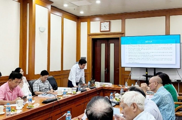
Dr. Nguyen Le Tuan, on behalf of the research team, presented a summary of the research content and results of the task.
The project has successfully completed the set objectives and achieved remarkable results, such as: Establishing a network of basic investigation and monitoring of the marine environment in Vietnam, with the task of measuring oceanographic characteristics such as marine meteorology, marine physics (marine hydrography), seawater environment and designed to be implemented through marine survey teams using specialized ships; researching and designing a network of measurement, observation and monitoring of the marine environment for the period 2020-2030 with 6 typical cross-sections for 6 marine areas (North, North Central, Central Central, South Central, Southeast and Southwest).
With a flexible deployment method using a fleet of specialized survey vessels, the project's designed network has the ability to expand the monitoring space to offshore areas, sensitive areas or areas with complex terrain conditions. When integrated with the fixed base station system, data from the project's network will contribute to: (i) Thickening and enhancing the spatial-temporal coverage of the national marine monitoring data system. Supplementing real-time and flexible measurement data, serving the calibration and verification of numerical models, especially during periods of extreme events (storms, environmental incidents); (ii) Creating a solid scientific basis for verification, comparison, and optimization of fixed station locations in the future; (iii) Supporting the design of an integrated inter-regional - inter-sectoral monitoring program, ensuring investment efficiency, avoiding duplication, and improving the ability to forecast and comprehensively monitor the marine environment.
In addition, the topic has proposed modern technologies and methods suitable for Vietnam's conditions, including: Automatic monitoring technology, IoT sensors, unmanned devices, remote sensing, real-time data integration models, sampling and analysis methods in laboratories according to international standards, thereby proposing a list of equipment, organizational systems, methods of data collection and processing for comprehensive management.
In addition, the results of building a modern, synchronous monitoring network help provide accurate data for planning sustainable exploitation of marine resources. The monitoring network allows early detection of pollution and degradation of marine ecosystems, thereby promptly providing solutions to protect the environment; helps monitor climate change, rising sea levels and other long-term impacts on the marine environment.
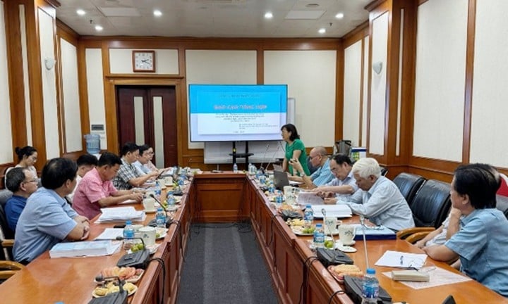
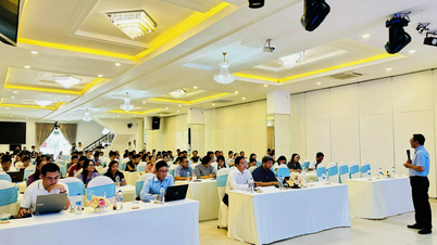
National Acceptance Evaluation Council.
The members of the Acceptance Council highly appreciated the contributions of the project manager and the host agency and agreed to accept the project. At the same time, they requested the research team to absorb the content and make appropriate edits, complete the dossier and submit it to the Ministry of Science and Technology for a decision to recognize the results of the task./.
Source: https://mst.gov.vn/nghien-cuu-co-so-khoa-hoc-xay-dung-mang-luoi-dieu-tra-co-ban-va-giam-sat-moi-truong-bien-giai-doan-2020-2030-tam-nhin-2045-19725080621192976.htm


![[Photo] Nghe An: Provincial Road 543D seriously eroded due to floods](https://vphoto.vietnam.vn/thumb/1200x675/vietnam/resource/IMAGE/2025/8/5/5759d3837c26428799f6d929fa274493)


![[Photo] Discover the "wonder" under the sea of Gia Lai](https://vphoto.vietnam.vn/thumb/1200x675/vietnam/resource/IMAGE/2025/8/6/befd4a58bb1245419e86ebe353525f97)


Comment (0)