

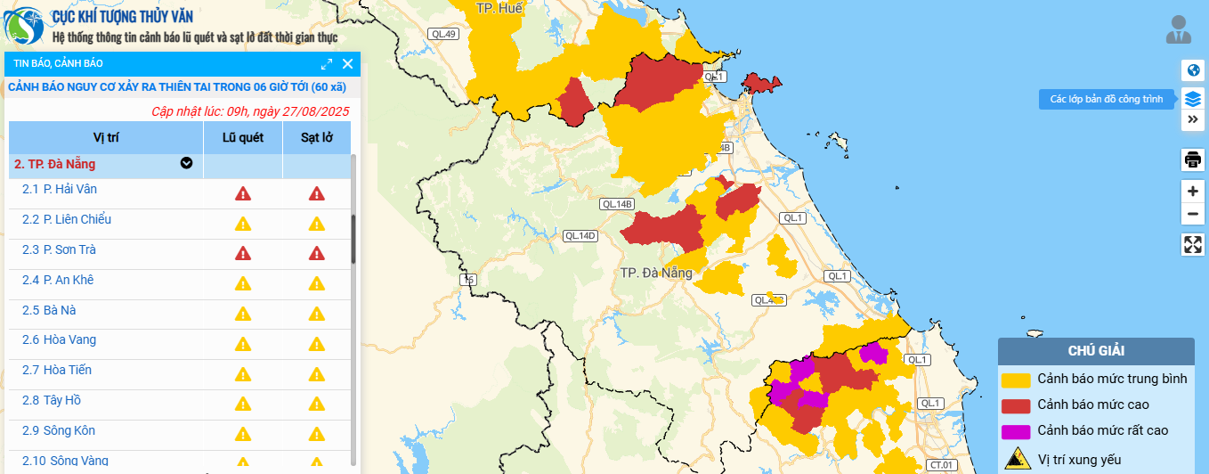
Total rainfall in communes and wards in coastal plains and southern mountainous areas is generally 20-50mm, in some places over 80mm; in communes and wards in western and northwestern mountainous areas is generally 10-30mm, in some places over 60mm.
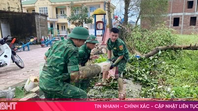
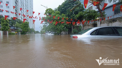
Thunderstorms are concentrated in the afternoon and evening. During thunderstorms, beware of tornadoes, lightning and strong gusts of wind. Localized heavy rains may cause flooding in low-lying areas and urban areas, and flash floods and landslides in mountainous areas.
In addition, due to the influence of low pressure circulation, the northern and central East Sea (including the Hoang Sa special zone) has gradually stronger winds and worse weather.
From August 30 to September 2, Da Nang city is affected by the tropical convergence zone and there is a possibility of a tropical cyclone forming in the East Sea, so there will be scattered showers and thunderstorms in the area, locally moderate to heavy rain; during thunderstorms, beware of tornadoes, lightning and strong gusts of wind; sunny days are intermittent.
To proactively respond to natural disasters, the Da Nang City Civil Defense Command has just issued a document requesting the City Military Command, the City Border Guard Command, the Department of Agriculture and Environment, People's Committees of coastal communes and wards, the Da Nang Coastal Information Station, the Department of Sea, Islands and Fisheries, and related units to monitor and promptly notify owners of vehicles and boats operating at sea of information on low pressure areas for proactive prevention.
The City Border Guard Command proactively manages ships going out to sea.
Armed forces units, departments, branches, localities and related units closely monitor the developments of low pressure areas and daily weather bulletins warning of thunderstorms, tornadoes, lightning, etc. to proactively handle possible situations.
Source: https://baodanang.vn/chu-dong-ung-pho-mua-to-cuc-bo-tren-dat-lien-gio-manh-tren-bien-3300424.html


![[Photo] Many people eagerly await the preliminary review despite heavy rain](https://vphoto.vietnam.vn/thumb/1200x675/vietnam/resource/IMAGE/2025/8/27/4dc782c65c1244b196890448bafa9b69)
![[Photo] Prime Minister Pham Minh Chinh chairs meeting of National Steering Committee on International Integration](https://vphoto.vietnam.vn/thumb/1200x675/vietnam/resource/IMAGE/2025/8/26/9d34a506f9fb42ac90a48179fc89abb3)
![[Photo] Brilliant red of the exhibition 95 years of the Party Flag lighting the way before the opening](https://vphoto.vietnam.vn/thumb/1200x675/vietnam/resource/IMAGE/2025/8/27/e19d957d17f649648ca14ce6cc4d8dd4)


![[Photo] General Secretary To Lam attends Meeting with generations of National Assembly deputies](https://vphoto.vietnam.vn/thumb/402x226/vietnam/resource/IMAGE/2025/8/27/a79fc06e4aa744c9a4b7fa7dfef8a266)


Comment (0)