According to data from the VRain automatic rain gauge system, by 5:00 p.m. on June 7, thunderstorms had occurred widely in the North to North Central regions.
Of the 25 provinces and cities in the North, 23 localities recorded rain, many places with heavy to very heavy rain.

The heaviest rainfall was in Ha Giang with 305.8mm (measuring station at Tan Lap 1) - classified as very heavy rain.
In Quoc Oai district (Hanoi), heavy rain of 85.8mm was also recorded.
Other localities with heavy rainfall include Cao Bang (62.6mm), Hoa Binh (61.2mm), Thai Nguyen (53mm).
Areas such as Lai Chau, Dien Bien, Ninh Binh, Yen Bai, Lao Cai... have rainfall of 30-45mm.
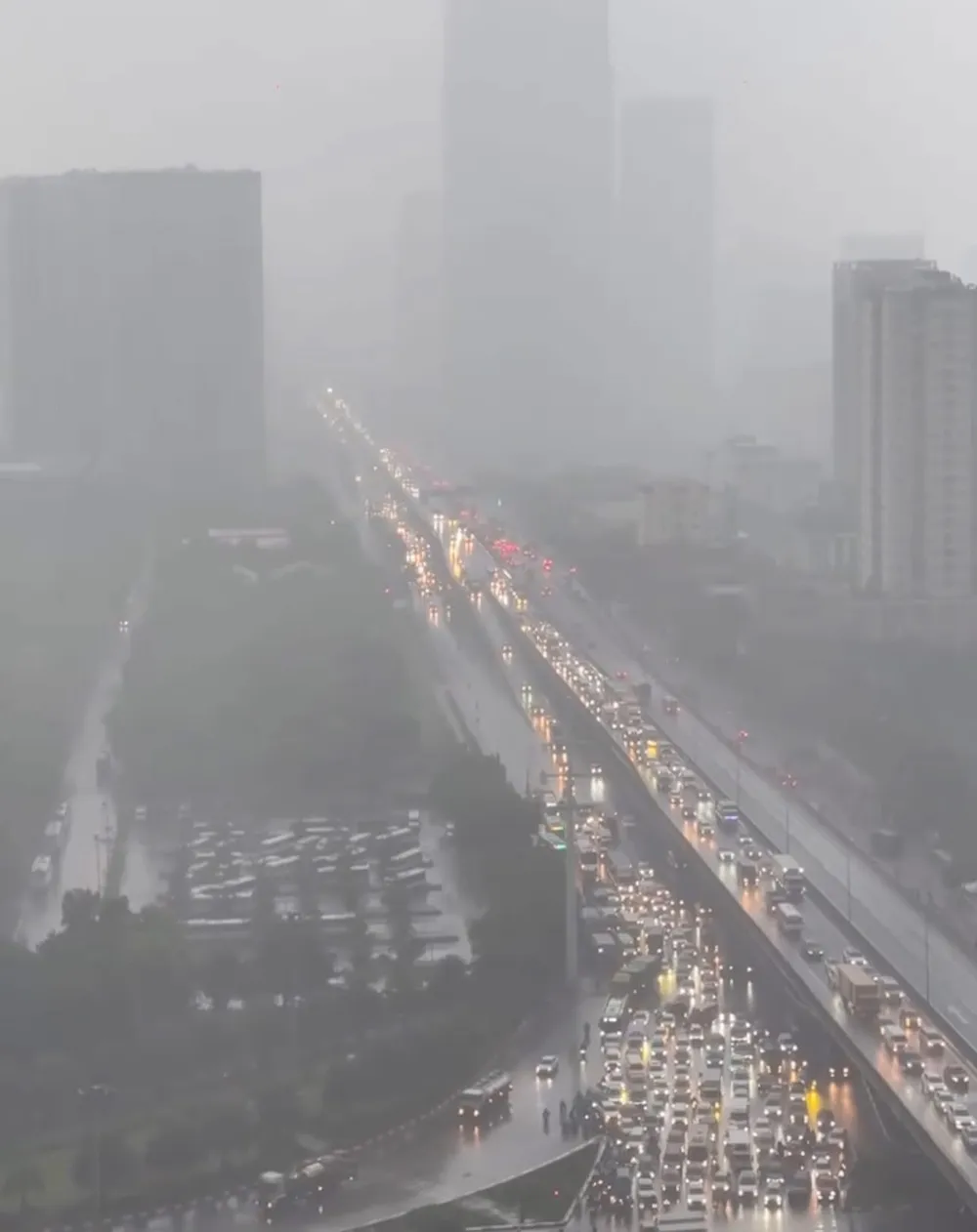
Heavy and moderate rain is mainly concentrated in the Northwest region, part of the Northeast region and some provinces in the delta such as Hanoi and Ninh Binh.
According to satellite images, from early afternoon on June 7, a dense cloud area formed due to convective clouds and thunderstorms from Northern Laos, moving through Son La and Hoa Binh provinces and then spreading to the midlands and deltas of the North, including Hanoi.
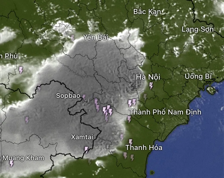
From about 2:00 p.m. to 5:00 p.m., convective clouds develop strongly, forming areas of thunderstorms spreading from the Northwestern mountains towards Hanoi and the plains.
The meteorological agency determined that this weather pattern was caused by the impact of a low pressure trough with a Northwest - Southeast axis, combined with high-altitude wind convergence at an altitude of about 1,500-5,000m. High daytime temperatures and high humidity create conditions for strong air to rise, promoting the formation and development of convective clouds.

This is a typical summer phenomenon in the North, often causing showers and thunderstorms in the late afternoon.
Source: https://www.sggp.org.vn/chieu-7-6-mot-con-dong-nhiet-phu-xuong-nhieu-noi-o-mien-bac-post798560.html




![[OCOP REVIEW] Tu Duyen Syrup - The essence of herbs from the mountains and forests of Nhu Thanh](https://vphoto.vietnam.vn/thumb/402x226/vietnam/resource/IMAGE/2025/6/5/58ca32fce4ec44039e444fbfae7e75ec)


Comment (0)