

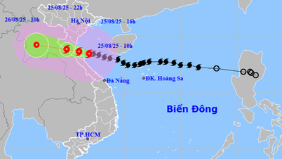
Tonight (August 23), Dr. Mai Van Khiem, Director of the National Center for Hydro-Meteorological Forecasting ( Ministry of Agriculture and Environment ) informed the press about storm number 5.
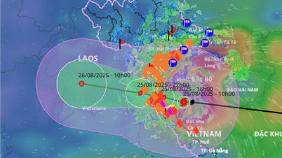
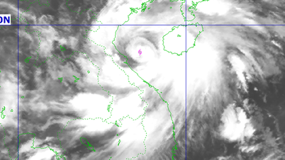
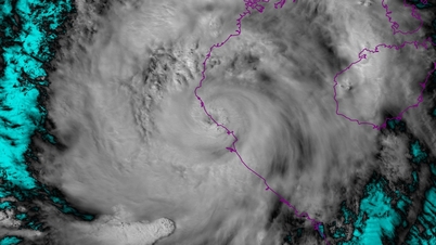
According to Mr. Khiem, this afternoon, storm No. 5 has strengthened to level 10, gusting to level 12 - 2 levels higher than this morning. This is a storm with a very wide circulation, moving quickly and is forecast to continue to strengthen rapidly in the next 24 hours, when passing through very warm seas up to 30 degrees Celsius, combined with strong southwest monsoon activity.
According to the forecast of the National Center for Hydro-Meteorological Forecasting and international centers, storm No. 5 may reach level 12-13, gusting 15-16 in the Gulf of Tonkin and the sea from Quang Tri to Hue; some models even predict the storm will be stronger.
Mr. Khiem assessed that the danger level of storm No. 5 is forecast to be no less than storm Yagi in 2024 in terms of strong winds, and at least equal to, or possibly even stronger than, storm No. 10 - Doksuri in 2017, which had a similar path and area of influence.

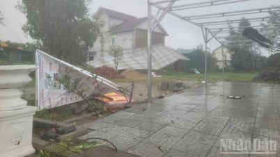
"In particular, the danger of this storm is not only due to strong winds but also due to the combined impact of many natural disasters: very strong winds, extremely heavy rain, the risk of widespread flooding, flash floods and landslides. Thus, storm No. 5 poses a comprehensive threat from the sea, the plains to the mountainous areas," said Mr. Khiem.
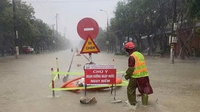
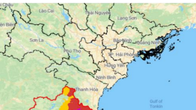
In response to this situation, the National Center for Hydro-Meteorological Forecasting has raised the disaster risk warning level to level 4, a very high level, for coastal areas from Thanh Hoa to Hue and inland provinces from Thanh Hoa to Quang Tri. This level is likely to cause great damage to people and property. "Therefore, we recommend that people and local authorities pay close attention to response work and absolutely do not allow boats to go out to sea at this time," the Director of the National Center for Hydro-Meteorological Forecasting warned.
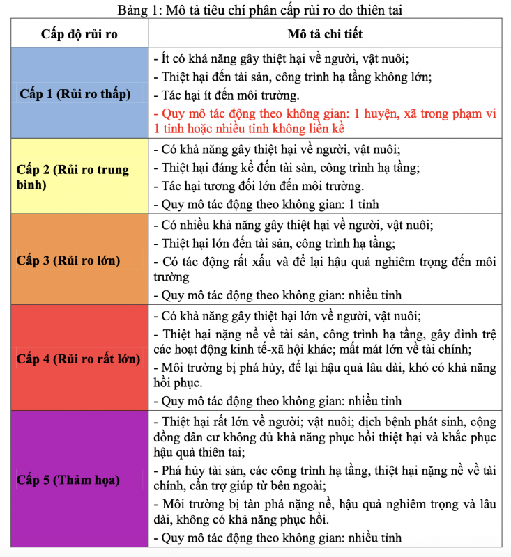
Classification of disaster risk levels due to tropical depressions and storms.
In addition, it is forecasted that around the night of August 24, there will be a very heavy rain in the North Central and Northeastern regions, with rainfall in the storm's center area possibly reaching 600mm. This rainfall will not only be concentrated in coastal areas but also cover the western region, with a high risk of flash floods and landslides. Notably, this risk will not only occur during the storm but also affect before, during and after the storm dissipates.
Source: https://cand.com.vn/Xa-hoi/bao-so-5-duoc-du-bao-manh-ngang-bao-yagi-i779077/

![[Photo] General Secretary To Lam attends the 80th anniversary of Vietnam's diplomacy](https://vphoto.vietnam.vn/thumb/1200x675/vietnam/resource/IMAGE/2025/8/25/3dc715efdbf74937b6fe8072bac5cb30)


Comment (0)