

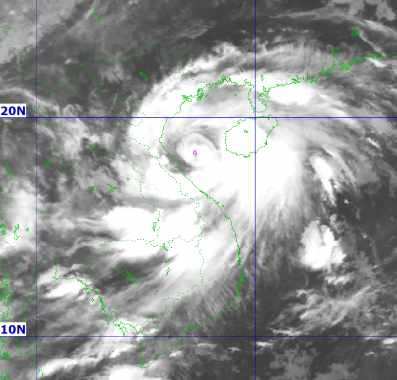
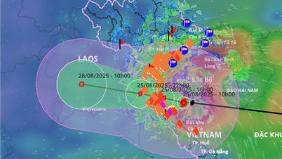
This morning (August 25), storm No. 5 moved West Northwest at 20km/h, 170km from Nghe An, 160km from Ha Tinh, 160km from Bac Quang Tri (old Quang Binh ), level 14 intensity, gust level 17.
According to the National Center for Hydro-Meteorological Forecasting, from now until the afternoon when the storm moves into the Ha Tinh - Thanh Hoa sea area, the storm will maintain its intensity at level 14, gusting to level 15-16. When approaching the coast of Ha Tinh - Nghe An, the intensity may decrease to late level 13 or early level 14.
On land, in the North of Thanh Hoa, there will be strong winds of level 8-9, gusting to level 10-11; in the South of Thanh Hoa - North of Ha Tinh, there will be strong winds of level 10-11, near the storm center, level 12-14, gusting to level 15-16 (Radius of strong winds above level 12 around the storm center is about 50km); in the South of Ha Tinh, Quang Tri, coastal areas of provinces from Quang Ninh to Ninh Binh, there will be strong winds of level 6-8, gusting to level 9-10.
Deep inland in the South Thanh Hoa - Ha Tinh area, about 50-70km from the coast, strong winds level 8-9, gusts level 11-12; further inland, the part bordering Laos, strong winds level 6-7, gusts level 7-8.
The National Center for Hydro-Meteorological Forecasting said that strong winds on land in the provinces from Thanh Hoa to Quang Tri will begin to appear from the morning of August 25. The strongest winds will be from 12:00 a.m. to about 6:00 p.m.
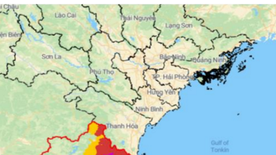
From the morning of August 25 to the end of August 26, in the midlands and deltas of the North, Lao Cai area and from Thanh Hoa to Hue city, there will be widespread heavy rain with common rainfall of 100-150mm, locally over 250mm; in particular, the area from Thanh Hoa to Northern Quang Tri will have heavy to very heavy rain with common rainfall of 200-400mm, locally over 600mm. Warning of the risk of heavy rain (>200mm/3 hours).
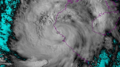
According to hydrometeorological experts, based on the forecast of the intensity of storm No. 5, it will still be strong when the storm approaches the mainland and the factors affecting the intensity of the storm, it shows that storm No. 5 moves over the central sea with a water surface temperature of up to 30°C; at the same time, it is supplemented with energy from the southwest monsoon from the Bay of Bengal and the east wind of the subtropical high pressure tongue, so the possibility of the storm maintaining its strong intensity is very high.
The vertical wind shear of this storm is small at 2.5 m/s in the southern part of the Gulf of Tonkin, which is favorable for the storm to maintain its intensity when approaching the shore. The circulation of storm No. 5 is less affected by friction with the terrain of Hainan Island, so its structure is not broken. Forecasts from weather models calculated by Vietnam and internationally all predict that the storm will continue to maintain its strong intensity when approaching the shore.
When moving close to the shore, friction increases, the influence of the northwestern part of the subtropical high pressure tongue (the shape that determines the path of storm No. 5) will make the storm less symmetrical, the axis tilts more to the north, so it will reduce its intensity.
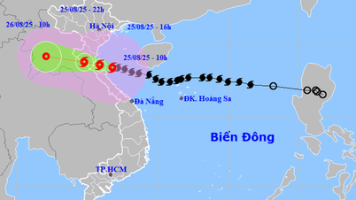
International forecasting stations are quite consistent in their forecasts of the direction and level of storm No. 5. The meteorological agencies of Japan, Beijing (China) and Hong Kong (China) all predict that the storm will have a landfall intensity of level 13-14.
Source: https://cand.com.vn/doi-song/tu-12h-18h-chieu-nay-bao-so-5-hoanh-hanh-manh-nhat-tai-cac-tinh-tu-thanh-hoa-den-quang-tri-i779191/
![[Photo] General Secretary To Lam attends the 80th anniversary of Vietnam's diplomacy](https://vphoto.vietnam.vn/thumb/1200x675/vietnam/resource/IMAGE/2025/8/25/3dc715efdbf74937b6fe8072bac5cb30)


Comment (0)