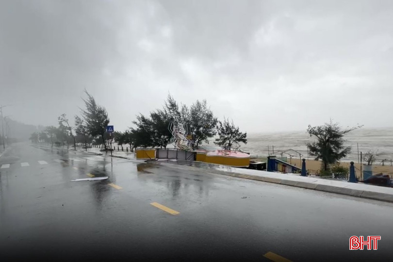
According to Mr. Tran Duc Ba - Director of Ha Tinh Hydrometeorological Station, in the past 6 hours (from 0:00 on August 25 to 6:00 on August 25), Ha Tinh has had moderate rain, heavy rain, and very heavy rain in some places such as: Ban Nuoc: 160.2 mm (Cam Lac); Mac Khe Lake: 137.2 mm (Huong Khe); Song Rac Lake: 136.6 mm (Huong Xuan); Thuong Song Tri Lake: 131.4 mm (Vung Ang); Ky Anh: 120.4 mm, Kim Son Lake: 119.6 mm (Ky Hoa); Ky Bac: 124.6 mm (Ky Xuan); Ky Giang: 115 mm (Ky Anh); Ky Lam: 171.2 mm (Ky Lac); Ky Son: 133.6 mm (Ky Thuong) ...

Heavy rains are likely to cause flooding of dykes, coastal roads, and river mouths due to rising water and storm waves; flooding of low-lying areas along rivers and streams; localized flooding in residential areas and urban areas. Especially in the communes of Ky Khang, Ky Anh, Ky Xuan, Song Tri ward, Hai Ninh ward, Vung Ang ward, Cam Nhuong commune, Cam Yen, Nghi Xuan, Tien Dien, Loc Ha, Thanh Sen ward, Tran Phu ward.
Flooding is likely to last until the end of August 26; maximum flood depth: 0.5 - 1.8m.
Heavy rain causes flooding on roads, affecting traffic and travel of people. People and units are requested to monitor and take preventive measures.
According to the latest forecast of the National Center for Hydro-Meteorological Forecasting: At 4:00 a.m. on August 25, the center of the storm was located at about 18.3 degrees North latitude; 107.7 degrees East longitude, about 220 km from Nghe An , about 200 km East Southeast of Ha Tinh, and about 180 km East Northeast of Quang Tri.
The strongest wind near the storm center is level 14 (150-166 km/h), gusting to level 17; moving in the West Northwest direction at a speed of about 20 km/h. The sea area of Ha Tinh has winds gradually increasing to level 7 - 9, then increasing to level 10 - 11, the area near the storm center is level 12 - 14, gusting to level 17; waves are 5.0 - 7.0m high, near the center 8.0 - 10.0m, the sea is very rough.
From early morning on August 25, on land, winds will gradually increase to level 8-11, gusting to level 12-14. Particularly in the northern part of Ha Tinh, winds will increase to level 12-14, gusting to level 15-16. From the morning of August 25 to August 26, Ha Tinh province will have heavy to very heavy rain and scattered thunderstorms. Rainfall will generally be from 200-400mm, locally over 600mm (heavy rain will be concentrated from early morning on August 25 to evening on August 25). Warning of the risk of heavy rain (>200mm/3 hours).
Source: https://baohatinh.vn/bao-so-5-du-bao-gay-ngap-lut-nhieu-noi-tai-ha-tinh-post294318.html


![[Photo] Images of the State-level preliminary rehearsal of the military parade at Ba Dinh Square](https://vphoto.vietnam.vn/thumb/1200x675/vietnam/resource/IMAGE/2025/8/27/807e4479c81f408ca16b916ba381b667)


![[Photo] Parade blocks pass through Hang Khay-Trang Tien during the preliminary rehearsal](https://vphoto.vietnam.vn/thumb/1200x675/vietnam/resource/IMAGE/2025/8/27/456962fff72d40269327ac1d01426969)


Comment (0)