

The tropical depression is moving rapidly into the East Sea and will become storm number 5 (Kajiki) today, and will make landfall in our country in just 2 days. This is a very strong storm and will cause heavy rain and wind.
 |
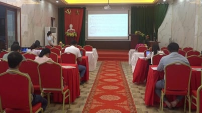
| Deputy Minister of Agriculture and Environment Nguyen Hoang Hiep held a meeting to direct response to the tropical depression strengthening into storm No. 5 - Photo: CT |
Storm No. 5 is very dangerous
The low pressure area over the eastern part of Luzon Island (Philippines) has strengthened into a tropical depression.
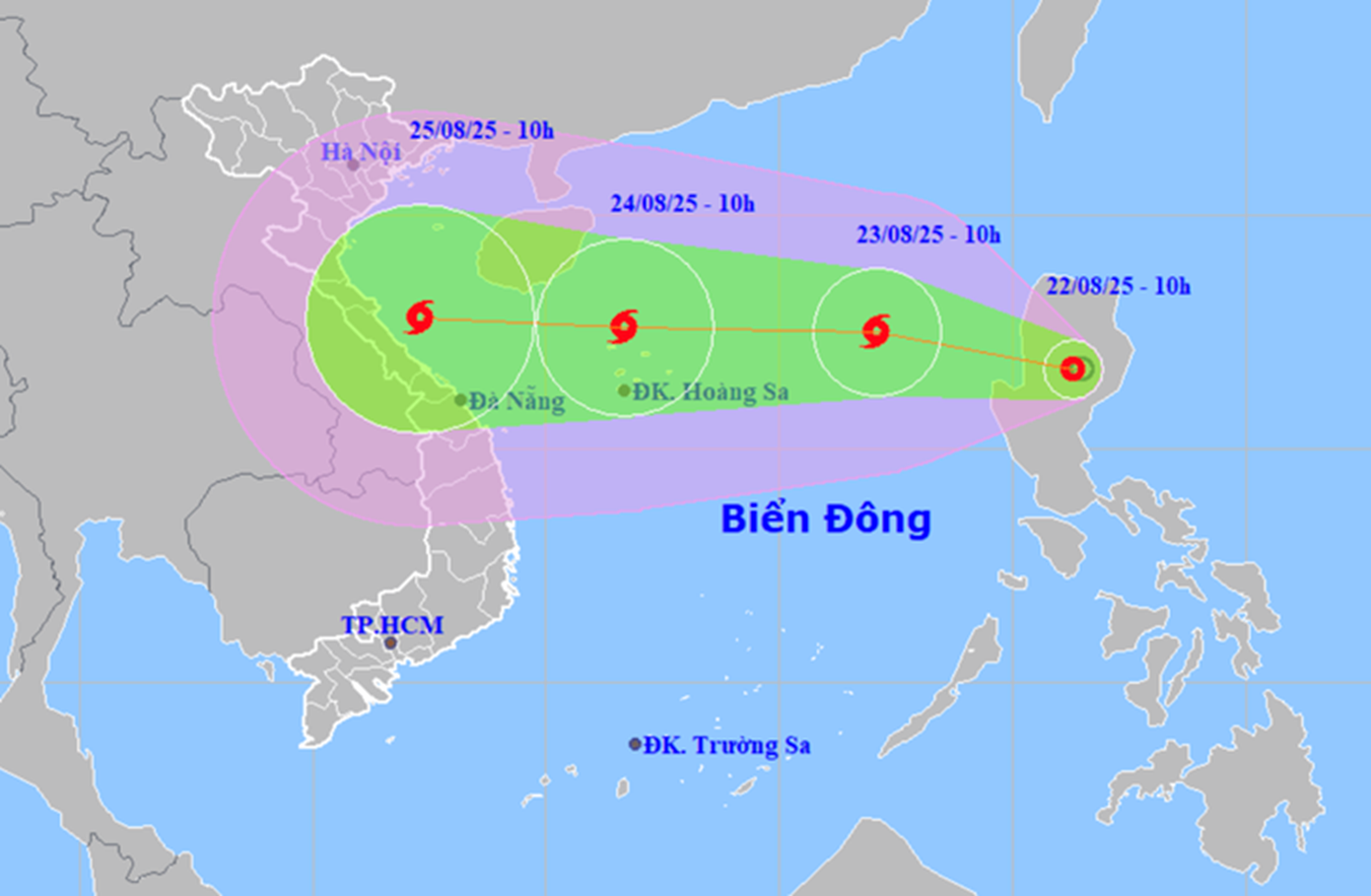
Tonight, a tropical depression will move into the East Sea, likely to strengthen into a storm. This is the 11th storm in the northwest Pacific and the 5th storm in the East Sea (international name is Kajiki).
The meteorological agency said that when the storm moves into the East Sea, it will move quickly, at a speed of about 20km/h. By around August 24, when the storm reaches the Hoang Sa special zone, its intensity may reach level 10-11, with gusts of level 13-14.
Further, the authorities assessed that "there are very few conditions that can weaken the storm, and it can even strengthen when it moves into the Gulf of Tonkin". The reason is that the temperature and humidity conditions are very favorable for a storm to be nurtured.
It is forecasted that the storm will move inland on August 25.
Concerned about rain and wind
On the morning of August 22, the Ministry of Agriculture and Environment held a meeting to respond to the tropical depression that is strengthening into storm No. 5.
At the meeting, Deputy Minister of Agriculture and Environment Nguyen Hoang Hiep emphasized that the most worrying point is that storm Kajiki is likely to form quickly. "When entering the East Sea, the storm is forecast to move very quickly, so response time needs to be shortened. In particular, it is necessary to coordinate with the Ministry of Industry and Trade to review all hydropower reservoirs," Deputy Minister Nguyen Hoang Hiep directed.
Mr. Hiep also emphasized that landslides must be taken into account. Residential areas in mountainous areas must be proactively relocated. People's lives must definitely not be affected by landslides.
In addition, to respond to storms to ensure safety for ships, it is necessary to try to forecast as accurately as possible to notify localities where the storm passes.
Mr. Hiep noted that the storm will make landfall at the weekend, when many people travel. In addition, activities to celebrate National Day are also taking place, so we must proactively respond as soon as possible.
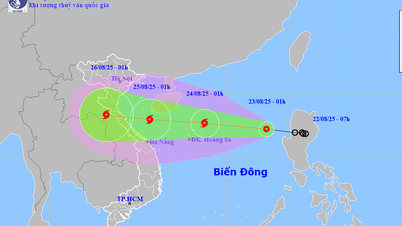
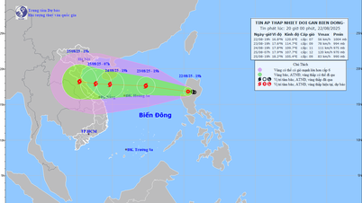
 |
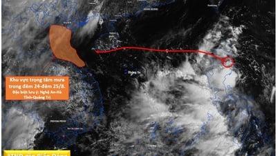
| Forecast of the path of the tropical depression about to become storm No. 5 - Photo: National Center for Hydro-Meteorological Forecasting |
Mr. Mai Van Khiem - Director of the National Center for Hydro-Meteorological Forecasting - said that with the current impact scenario, the storm's impact circulation is very wide, affecting the entire coastal areas of the North and North Central regions.
"The coastal area from Nghe An to Quang Tri will be the main area affected by the storm's circulation, with the possibility of strong coastal winds of level 10 - 11, gusting to level 13 - 14. In addition, from the night of August 24 to the end of August 27, the area from Thanh Hoa to Hue will experience heavy to very heavy rain, with rainfall ranging from 150 - 300mm, in some places over 600mm," Mr. Khiem assessed.
The rain and wind lasted from before to after the storm made landfall. Therefore, the rain and wind caused by the storm were considered dangerous and caused great impacts on people's lives and property.
What impact does storm number 5 have?
Due to the influence of the storm circulation, in the northern and central areas of the East Sea (including Hoang Sa special zone), from tomorrow (August 23), there will be strong winds of level 6-7, then increasing to level 8-9. From August 24, strong winds will increase to level 10-11, gusting to level 13-14, waves from 4-7m high, very rough seas with thunderstorms, whirlwinds and heavy rain.
The sea area from Thanh Hoa to Da Nang from August 25 will have strong storm winds of level 8, near the storm center of level 11-12, gusting to level 15.
With the current impact scenario, the storm's circulation is very wide, affecting the coastal areas of the North and North Central regions. The coastal areas from Nghe An to Quang Tri will be the main area affected by the storm's circulation, with the possibility of strong coastal winds of level 10-11, gusting to level 13-14.
From the night of August 24 to the end of August 27, in the area from Thanh Hoa to Hue City, there will be a period of heavy to very heavy rain, with rainfall ranging from 150-300mm, in some places over 600mm.
A flood occurred on rivers from Thanh Hoa to Quang Tri. There is a risk of flash floods, landslides and inundation in low-lying areas, riverbanks, and urban areas in the provinces in the above region.
Localities need to proactively deploy flood prevention plans, check residents in dangerous areas, and ensure the safety of reservoirs and flood prevention works.
According to CHI TUE - LE PHAN/ tuoitre.vn
Source: https://baovinhlong.com.vn/thoi-su/202508/bao-so-5-co-the-cang-di-cang-manh-giat-cap-14-mua-600mm-b312f9b/

![[Photo] President Luong Cuong receives delegation of the Youth Committee of the Liberal Democratic Party of Japan](https://vphoto.vietnam.vn/thumb/1200x675/vietnam/resource/IMAGE/2025/8/22/2632d7f5cf4f4a8e90ce5f5e1989194a)
![[Photo] President Luong Cuong attends special political-artistic television show "Golden Opportunity"](https://vphoto.vietnam.vn/thumb/1200x675/vietnam/resource/IMAGE/2025/8/22/44ca13c28fa7476796f9aa3618ff74c4)

![[Photo] Prime Minister Pham Minh Chinh chairs the conference to review the 2024-2025 school year and deploy tasks for the 2025-2026 school year.](https://vphoto.vietnam.vn/thumb/1200x675/vietnam/resource/IMAGE/2025/8/22/2ca5ed79ce6a46a1ac7706a42cefafae)


Comment (0)