

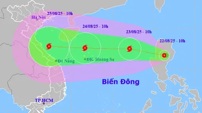
In the next 24 hours, storm No. 6 (Tra Mi) is likely to reach maximum intensity of level 12, gusting to level 15. In the Hoang Sa archipelago, the storm is affected by cold air and a new storm, so its direction of movement is very "strange".
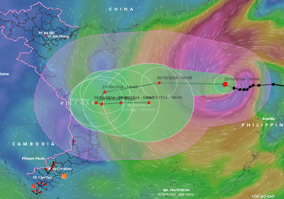
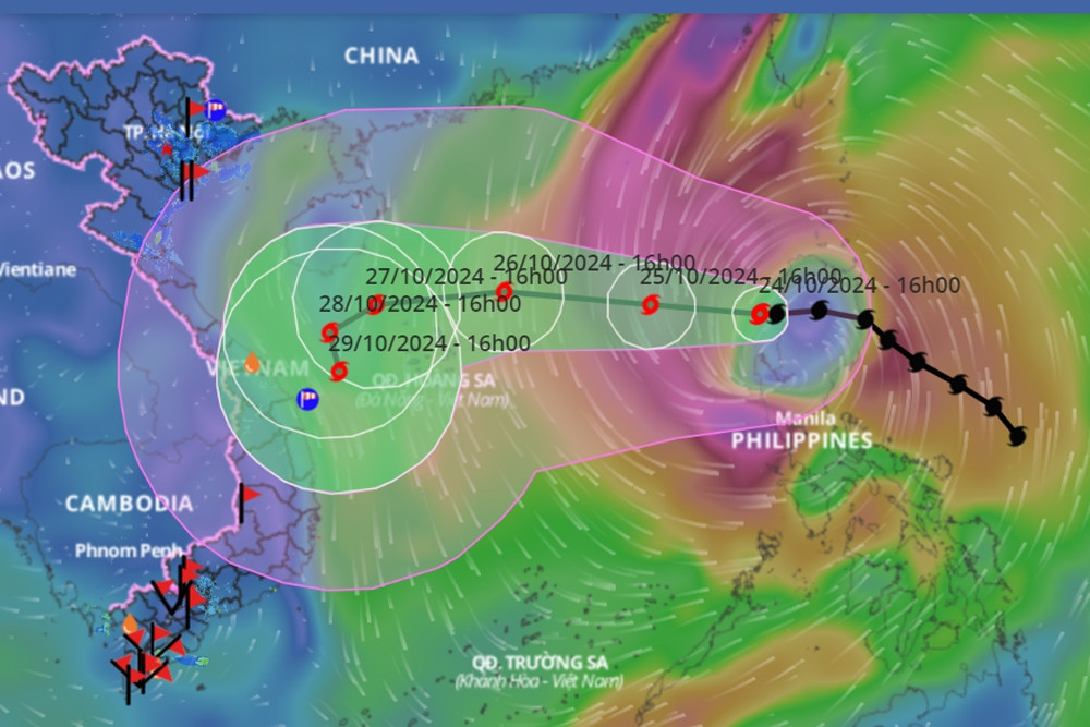
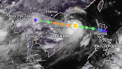
According to the National Center for Hydro-Meteorological Forecasting, at 10:00 a.m. this morning (October 25), the eye of the storm was located in the eastern sea of the North East Sea. The strongest wind near the eye of the storm was level 10 (89-102 km/h), gusting to level 12. Moving in the West Northwest direction, at a speed of about 15 km/h.
Forecast, by 10am on October 26, the storm center is located in the North East Sea; about 160km northeast of Hoang Sa archipelago. The strongest wind near the storm center is level 11-12, gusting to level 15. The storm moves west at a speed of 20km/h.
At 10:00 a.m. on October 27, the eye of the storm was located in the western part of the Hoang Sa archipelago, about 200 km northeast of Quang Tri - Quang Ngai . The strongest wind near the eye of the storm was level 11, gusting to level 14. The storm moved west-southwest at a speed of 15 km/hour.
At 10:00 a.m. on October 28, the eye of the storm was located in the sea off the Central Central Coast. The strongest wind near the eye of the storm was level 10, gusting to level 12. The storm moved southwest, then southeast, at a speed of about 5-10 km/hour.
From the next 72 to 120 hours, the storm will move mainly to the East at 5-10km per hour, and its intensity will continue to weaken.
On the same morning, at the meeting to respond to storm No. 6 (Tra Mi) organized by the Department of Dyke Management and Natural Disaster Prevention ( Ministry of Agriculture and Rural Development ), Mr. Nguyen Van Huong, Head of Weather Forecasting Department, National Center for Hydro-Meteorological Forecasting, also explained the very complicated direction of the storm's movement.
Accordingly, in the next 24 hours, storm Tra Mi will move westward and is likely to reach a maximum intensity of level 12, gusting to level 15. When reaching the northern area of Hoang Sa archipelago, the storm will tend to weaken due to the impact of cold air, so the intensity is likely to decrease to level 10-11.
Mr. Huong said that after passing through the Hoang Sa archipelago (crossing the 110th degree East meridian), there is a possibility that the storm will turn towards the sea because in the east of the Philippines there is a tropical depression that is likely to strengthen into a storm.
The interaction of the twin storms caused storm No. 6 to move outward and weaken. However, the storm's strong wind circulation is relatively large, and the convective cloud area is also shifted to the West, so the North and Central East Sea will be mainly affected by strong winds.
With the storm's movement as above, around tomorrow afternoon (October 26), in the Central Coast, there may be strong winds of level 6-7. After the storm approaches, the winds will increase to level 8-9. Ly Son island area will also have similar strong winds.
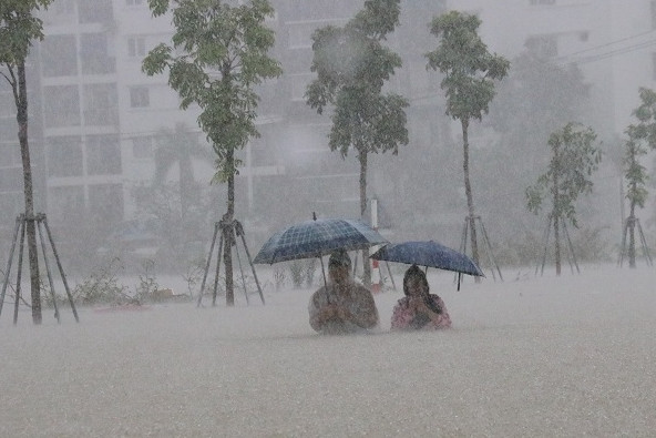
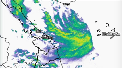
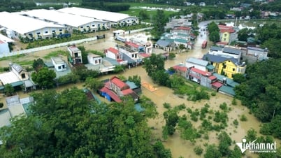
Notably, with cloud circulation shifting to the West, it is possible that tomorrow evening and night until October 29, storm No. 6 will cause heavy rain in the Central region (from Ha Tinh to Binh Dinh, Phu Yen), with heavy rain concentrated in Quang Tri to Quang Nam , Kon Tum and Gia Lai; rainfall in this area can reach 200-300mm, not excluding the possibility of areas with heavy rain.
In addition, due to the influence of storm No. 6, the North East Sea area has strong winds of level 8-9, near the storm's eye level 10-12 (89-133km/h), gusts of level 15, waves 5-7m high, near the storm's eye 7-9m; rough seas.
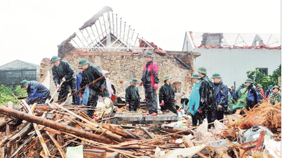
Ships operating in the above-mentioned dangerous areas (especially in the Hoang Sa island district) are likely to be affected by storms, whirlwinds, strong winds, and big waves.
According to experts, storm Tra Mi is considered to have a complicated path. Before moving into the East Sea, the storm changed direction 4 times. Therefore, people need to regularly update forecasts to monitor.
Storm No. 6 is likely to approach the Central coast, with heavy rain in 5 provinces.
Storm No. 6 likely to encounter cold air 'nemesis', unusual direction of movement

Hanoi weather for the next 3 days: Cold air remains, day and night temperatures differ
Source: https://vietnamnet.vn/vi-sao-bao-so-6-co-huong-di-ki-di-2335387.html


![[Photo] Prime Minister Pham Minh Chinh receives CEO of Samsung Electronics](https://vphoto.vietnam.vn/thumb/1200x675/vietnam/resource/IMAGE/2025/8/26/373f5db99f704e6eb1321c787485c3c2)
![[Photo] Prime Minister Pham Minh Chinh chairs meeting of National Steering Committee on International Integration](https://vphoto.vietnam.vn/thumb/1200x675/vietnam/resource/IMAGE/2025/8/26/9d34a506f9fb42ac90a48179fc89abb3)
![[Photo] Brilliant red of the exhibition 95 years of the Party Flag lighting the way before the opening](https://vphoto.vietnam.vn/thumb/1200x675/vietnam/resource/IMAGE/2025/8/27/e19d957d17f649648ca14ce6cc4d8dd4)


Comment (0)