
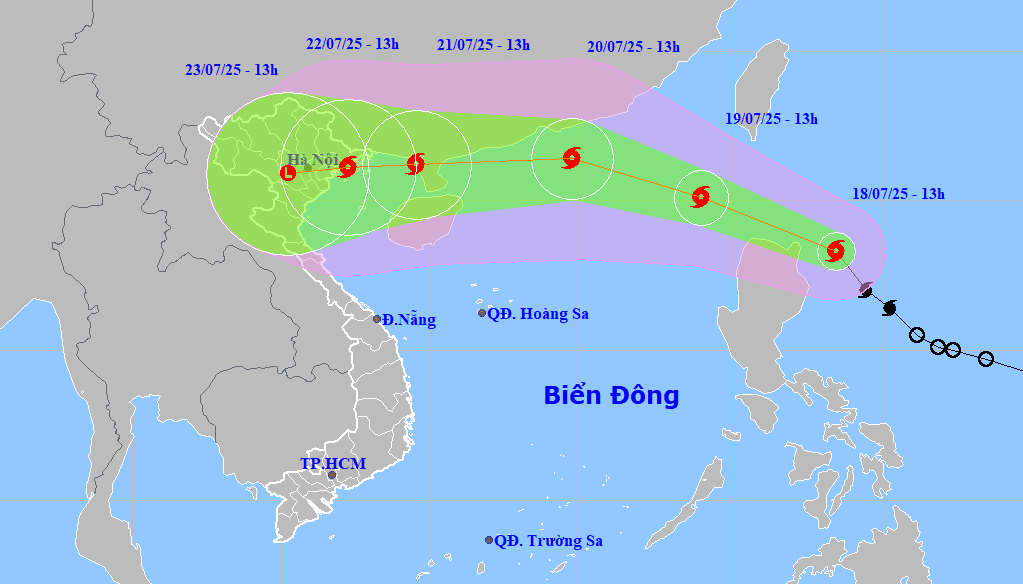
According to the assessment of the leader of the National Center for Hydro-Meteorological Forecasting at the meeting, storm Wipha will strengthen when moving into the East Sea (from the morning of July 19).
By July 21, when the storm center is east of Leizhou Peninsula (China), the strongest wind will be level 12, gusting to level 15.
With its fast moving speed, on the night of July 21, the storm will begin to affect the Northern mainland with the strongest wind at level 9-10.
In addition, there is a possibility of widespread heavy rain in the North and North Central regions from July 21 to 24.
Depending on the location of the storm's landing, rainfall in different places may vary, but is commonly from 200-300mm, with some places reaching 500mm.
Additionally, another storm will interact with storm number 3, which could cause prolonged heavy rain.
The movement direction of Typhoon Wipha this year is similar to Typhoon No. 3 ( Yagi ) in 2024, but the movement direction is more northerly and the intensity of strong winds and heavy rain is lower. However, localities need to proactively respond to strong storms and heavy rain.
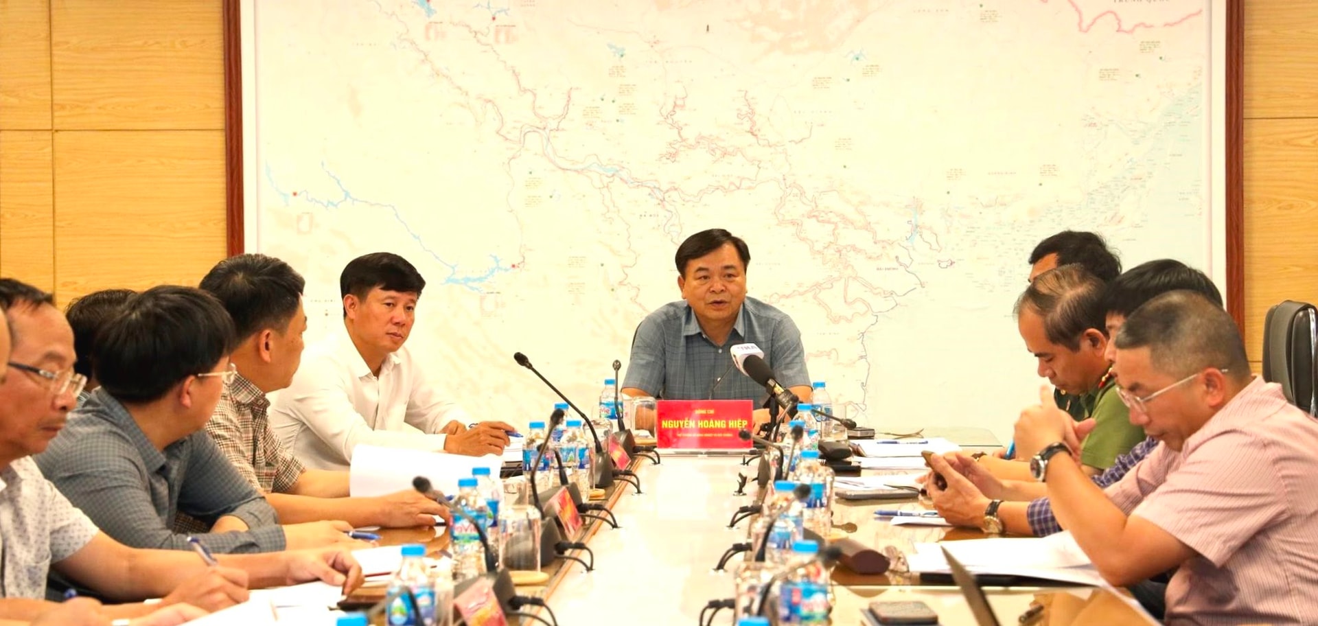
Concluding the meeting, Deputy Minister of Agriculture and Environment Nguyen Hoang Hiep noted that ministries, branches and localities should focus on guiding ships still operating at sea to move out of dangerous areas.
At the same time, pay attention to ensuring safety for people and tourists in tourist areas and aquaculture areas on islands and bays...
The Deputy Minister also noted that the sea dike and river estuary dike system from Quang Ninh to Thanh Hoa currently has 20 weak points and 7 projects under construction.
Therefore, units and localities need to quickly complete repairs and fix damage incidents; inspect and review dike works and dike protection plans; prepare human resources, materials, means and equipment to proactively respond according to the "4 on-site" motto when incidents occur.
Many reservoirs in the North are quite full of water, so reservoir management and operation units need to continue to proactively lower the water level to a safe threshold; proactively operate reservoirs according to procedures, avoiding emergency situations like the Thac Ba hydropower reservoir after storm Yagi in 2024.
Localities must immediately deploy measures to prevent landslides and floods; proactively deploy measures to respond to natural disasters caused by storm Wipha with the motto of early and remote response; pay attention to ensuring safety for people and minimizing damage caused by the storm.
Storm Wipha will continue to have complex developments, changing in direction and intensity, so people and ministries, branches, units and localities need to closely monitor the storm's developments from forecast bulletins of the National Center for Hydro-Meteorological Forecasting to deploy appropriate and effective response work.
Source: https://baodanang.vn/trung-uong-chi-dao-chu-dong-ung-pho-bao-wipha-tu-som-tu-xa-3297200.html


![[Infographic] In 2025, 47 products will achieve national OCOP](https://vphoto.vietnam.vn/thumb/402x226/vietnam/resource/IMAGE/2025/7/16/5d672398b0744db3ab920e05db8e5b7d)


Comment (0)