
 |
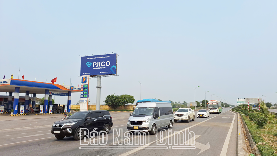
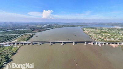
| Thien Truong Avenue (National Highway 21B) passing through Nam Dinh city is a vital traffic axis contributing to promoting the comprehensive socio -economic development of the province. |
The boundary of planning zone IX.A includes the entire natural area of My Thang, My Ha, My Thuan communes and part of Hung Loc ward and My Loc commune; the North and West border Binh Luc district (Ha Nam), the East borders My Phuc commune and Loc Hoa ward, the South borders Thien Truong Avenue with a planning area of about 2,444.09 hectares. The projected population by 2040 is about 49,965 people. The nature of the planning area is a knowledge-based urban area, a green, smart urban area; a centerfor education and training, commercial services, sports, and the Northwest gateway of Nam Dinh city.
The overall planning of subdivision IX.A is divided into 3 main sub-areas for management. Of which, sub-area 1 is the central urban area with an area of about 678.96 hectares, with an expected population of about 23,114 people by 2040. The development orientation will form a new modern central area, with a complex of high-rise mixed-use commercial service buildings along the northern route of National Highway 21B (Thien Truong Avenue) and the new central axis area identified in the adjustment of the General Planning of Nam Dinh City to 2040, with a vision to 2050. This is a new urban area with a smart public utility system, applying modern and advanced technology.
Sub-area 2 is a western residential area associated with the regional education and training center with an area of about 612.74 hectares, with an estimated population of about 12,970 people by 2040. As a western residential area associated with the regional education and training center, sub-area 2 is oriented to develop a western gateway residential area of the city associated with the regional education and training system... The area adjacent to National Highway 21B (Thien Truong Avenue) is a complex of commercial, mixed-use and residential service facilities.
Sub-area 3 is a rural residential area associated with high-quality agricultural production activities with an area of about 1,152.43 hectares, with an estimated population of about 13,881 people by 2040. Development orientation: Protecting the existing residential space structure, harmonizing with new residential development areas, adding public service works, green trees associated with Chau Giang River and the city's Ring Road II to ensure living conditions for urban residents.
The principles of organizing space, architecture, and landscape comply with the orientations of the adjusted General Planning of Nam Dinh City to 2040, with a vision to 2050; the Planning of Nam Dinh Province for the period 2021-2030, with a vision to 2050 approved by the Prime Minister and the National Technical Regulations on Construction Planning. The overall framework for organizing space for the entire area is determined based on the traffic framework system along with the land use orientation determined in the adjusted General Planning of Nam Dinh City to 2040, with a vision to 2050 as the basis for forming 3 planning sub-areas. The belt route II and the new central axis road towards Tran Temple are oriented to be the two green landscape axes of the area, with a clearance of 100m.
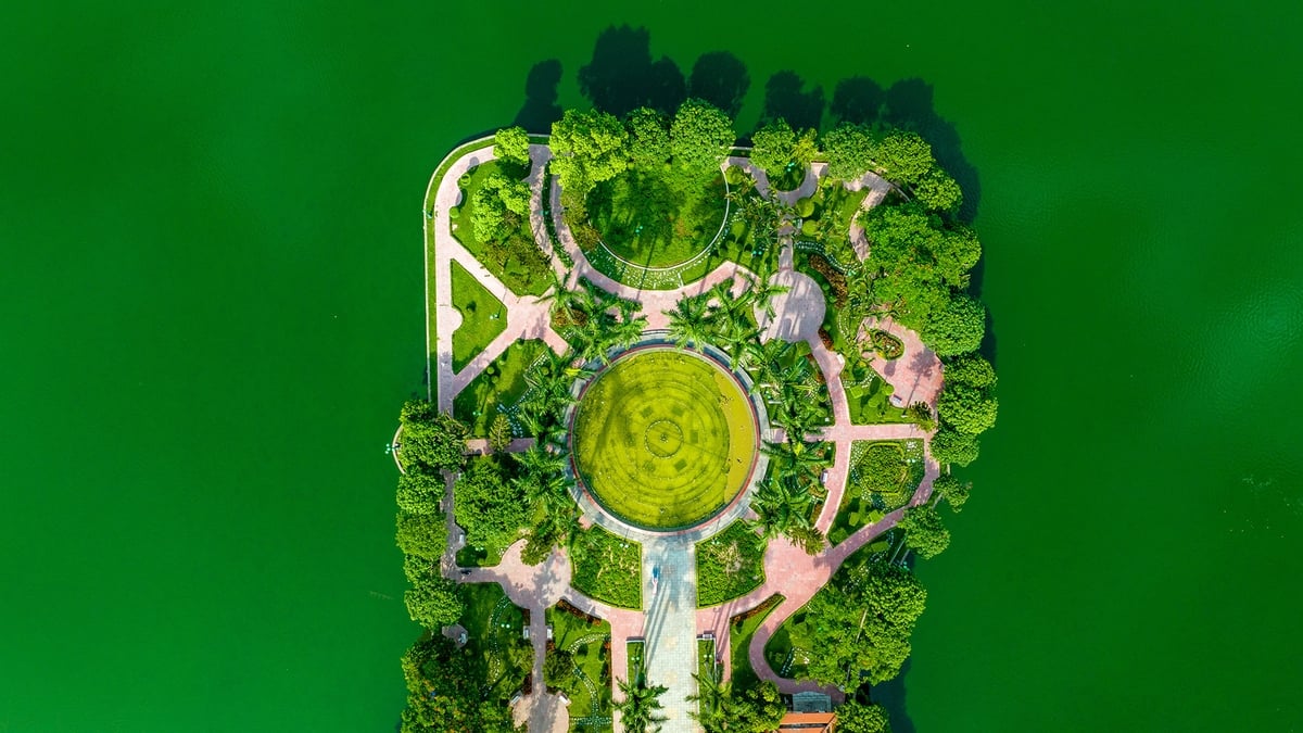
For the space north of Thien Truong Avenue, the land is mainly arranged for urban service areas as determined in the adjustment of the General Planning of Nam Dinh City to 2040, with a vision to 2050, with multi-purpose, high-rise mixed-use service buildings creating a highlight for the western gateway area of the city. For the space for building regional training schools, the traffic network is planned in a checkerboard pattern connecting conveniently with the main traffic axis using smart, environmentally friendly technology, fully arranging service works, key infrastructure, and landscape trees in the area. For the urban public green park area, the space will be organized for the central square area, green water surface, walking paths and service works. For the urban sports green area, the construction of sports facilities, football fields, etc. will be specified in the detailed planning project.
Sub-zone IX.A is planned with a synchronous and modern technical infrastructure system. In which, the external traffic system includes both road and railway traffic. In which, the external road traffic network includes: Phu Ly - Nam Dinh expressway (CT.11) through the research area with a cross-section of 67m wide with service roads on both sides, the traffic routes in the subdivision are designed to intersect only with the service roads of the expressway; Ring Road II with the role of reducing traffic volume through the center of Nam Dinh city, the route is planned with a scale of about 6-8 lanes (minimum road cross-section of about 38m), the clearance area is about 100m; Provincial Road 486C will be upgraded to meet the minimum standard of level IV plain, with a minimum scale of 2 lanes. Railway traffic will build a high-speed railway running through the research area, arranging land fund for safety corridor to protect the railway. The urban traffic system includes urban main roads with 3 main axes; of which 2 main axes in the North - South direction connect from Thien Truong Avenue (planning the route with a cross-section width of 36-40m) and 1 main axis in the East - West direction connect from Ring Road II to Ring Road I (minimum road cross-section width of about 52m). Plan 2 inter-regional routes with a cross-section width of 27-30m; plan main regional roads with a cross-section width of 30m; plan regional roads as dispersed traffic axes with a cross-section width of 13-21m. For existing residential roads, respect the existing road structure, renovate and expand when conditions permit, main routes suitable to current conditions. The cross-sections of the routes will be specified during the investment project implementation phase, ensuring compliance with the traffic planning solution in the detailed planning project and meeting development requirements in the long term. Traffic infrastructure works include bus stations, parking lots, road overpasses, bridges over rivers, etc. Plan a new bus station at the intersection of Thien Truong Avenue and Ring Road II with an area of about 4 hectares. Plan 10 parking lots in areas near public works, services, and parks to ensure urban parking needs with a total area of about 8 hectares. Plan 1 road overpass on Thien Truong Avenue across the different-level intersection with Ring Road II...
According to the planning approved by the Provincial People's Committee, in the coming time, the list of priority investment projects is: Construction of Phu Ly - Nam Dinh Expressway (CT.11); landscape axis road connecting Nam Dinh - Hoa Lu passing through the planning area (including the new central axis identified in the Adjustment of the General Planning of Nam Dinh City to 2040, vision to 2050; Ring Road II; main urban axis road in the East - West direction); construction, renovation and embellishment of commune-level central areas and completion of ongoing projects; construction of at least 1 new high school; investment in construction of main infrastructure framework, upgrading and renovating existing main roads according to Sub-zone Planning IX.A; construction, renovation and upgrading of the capacity of My Loc water plant, wastewater treatment station according to the planning; upgrading the capacity of My Loc 110kV station and Hien Khanh 110kV station according to the approved provincial planning. To manage and implement the planning, the Provincial People's Committee requests the Department of Construction to be responsible for coordinating with the Nam Dinh City People's Committee to organize the public announcement of the approved planning project according to regulations; coordinate with relevant departments and branches according to their functions and tasks to be responsible for guiding the management of the implementation according to the planning and relevant legal regulations. The Departments of Finance, Agriculture and Environment and relevant agencies and units according to their functions and tasks are responsible for updating the planning by sector to manage and organize the implementation of the planning according to regulations.
Article and photos: Thanh Trung
Source: https://baonamdinh.vn/kinh-te/202506/quy-hoach-phan-khu-ixa-theo-dinh-huong-phat-trien-do-thi-xanh-thong-minh-f69389f/


![[Maritime News] Wan Hai Lines invests $150 million to buy 48,000 containers](https://vphoto.vietnam.vn/thumb/402x226/vietnam/resource/IMAGE/2025/6/20/c945a62aff624b4bb5c25e67e9bcc1cb)


![[Infographic] Party Committee of the Ministry of Culture, Sports and Tourism: Marks of the 2020 - 2025 term](https://vphoto.vietnam.vn/thumb/402x226/vietnam/resource/IMAGE/2025/6/22/058c9f95a9a54fcab13153cddc34435e)


Comment (0)