
 |
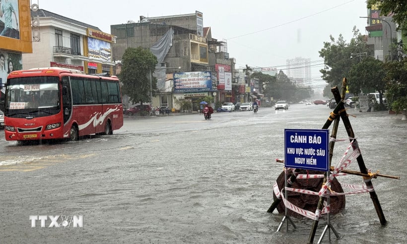
| The main road Nguyen Trai, Hac Thanh ward, Thanh Hoa province is flooded, warning signs must be erected for vehicles participating in traffic. (Photo: Viet Hoang/VNA) |
Commenting on the storm's developments, at noon on July 22, Deputy Director of the National Center for Hydro-Meteorological Forecasting Hoang Van Dai said that it is forecasted that in the afternoon of July 22, the storm will continue to move southwest and gradually weaken into a tropical depression and then a low pressure area.
However, Mr. Hoang Van Dai noted that the storm circulation continues to cause heavy rain in Nghe An and Thanh Hoa areas with common rainfall of 50-100 mm, and the southern Son La and southern Phu Tho areas have rain from 30-70 mm.
"With the above forecast, there is a high risk of flash floods, landslides, and localized flooding in the afternoon and night of July 22, especially in the western areas of Thanh Hoa and Nghe An," Mr. Dai stated.
In addition, according to Mr. Hoang Van Dai, Nghe An and Thanh Hoa are experiencing heavy rain, rivers and streams are starting to form flood flows and will increase sharply. Therefore, during this time, people need to limit their movements, if necessary, limit travel in areas along rivers, streams, and culverts because floods can rise quickly, leading to not being able to respond in time./.
Source: https://huengaynay.vn/chinh-tri-xa-hoi/de-phong-hoan-luu-bao-bao-so-3-gay-mua-lon-lu-quet-sat-lo-dat-155924.html


Comment (0)