

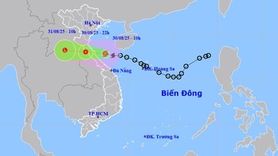
The storm center is approaching the shore, the sea is very rough
From noon on August 30, coastal areas from Nghe An to Quang Tri began to have winds gradually increasing to level 6, gusting to level 8. Particularly, coastal areas from Ha Tinh to Northern Quang Tri had winds of level 6-7, near the storm center level 8, gusting to level 10.
The meteorological agency warned that the strongest winds are concentrated between 3pm and 7pm, with the risk of breaking tree branches, blowing off roofs and causing major damage to homes.
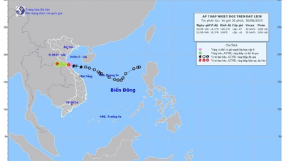
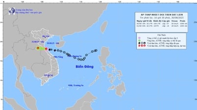
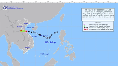
At 10am this morning, the storm center was in the Ha Tinh - Quang Tri sea area, about 120km east of the north of Quang Tri. The strongest wind near the storm center was at level 8 (62-74 km/h), gusting to level 10-11. The sea was very rough, especially dangerous for boats, rafts and aquaculture facilities.
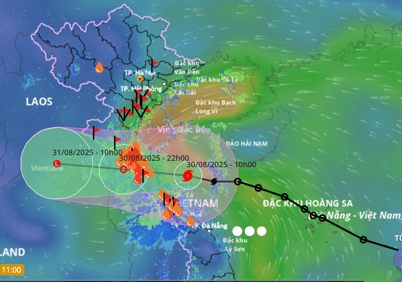
Storm makes landfall in the evening, weakens into a tropical depression
It is forecasted that this evening, the eye of the storm will enter the area from South Ha Tinh to North Quang Tri with winds of level 7, near the eye of the storm level 8, gusting to level 9-10. The storm will move quickly in a west-northwest direction at a speed of about 20km/hour.
At 10 p.m., the storm weakened into a tropical depression over the Vietnam-Laos border area, then moved deep into Central Laos and gradually dissipated.
The impact of storm No. 6 caused many stations to record strong winds: Bach Long Vi ( Hai Phong ) wind level 7, gust level 9; Co To (Quang Ninh) wind level 6, sometimes level 7, gust level 8; Con Co (Quang Tri) wind level 6, gust level 8.
The area from Nghe An to Da Nang has had heavy rain, with rainfall exceeding 170mm in many places, with a risk of flash floods and landslides in mountainous areas.
Source: https://baonghean.vn/bao-so-6-ap-sat-dat-lien-19h-toi-nay-do-bo-ha-tinh-quang-tri-10305558.html


![[Photo] People eagerly lined up to receive special publications of Nhan Dan Newspaper](https://vphoto.vietnam.vn/thumb/1200x675/vietnam/resource/IMAGE/2025/8/30/53437c4c70834dacab351b96e943ec5c)


Comment (0)