

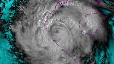
On the morning of August 26, the National Center for Hydro-Meteorological Forecasting issued the final information about storm No. 5 after the storm weakened into a tropical depression and moved deep into Central Laos.

According to the meteorological agency, at 7:00 a.m., the center of the tropical depression was at about 18.9 degrees North latitude - 103.9 degrees East longitude with the strongest wind at level 6, gusting to level 8, continuing to move west-northwest at a speed of about 20km/h. It is forecasted that in the next 12 hours, this low pressure area will continue to weaken and gradually dissipate. The news released at 8:00 a.m. on August 26 is the last information about storm number 5.
Heavy rain due to post-storm circulation
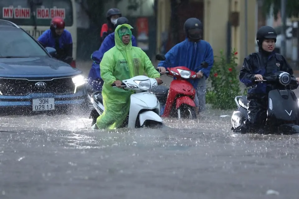
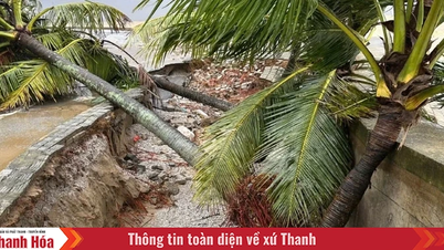
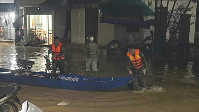
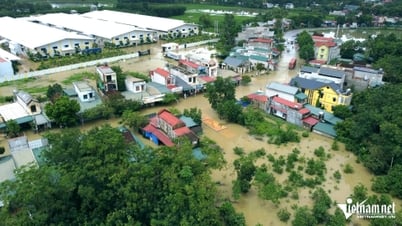
Although the storm has weakened, heavy rains are still occurring in the Northern Delta and midland areas, Son La, Lao Cai , Thanh Hoa and Nghe An. Strong winds and high waves continue in the Gulf of Tonkin, and people and boats need to closely monitor forecasts of heavy rain and dangerous weather at sea.
Currently, the National Center for Hydro-Meteorological Forecasting continues to warn of the risk of heavy to very heavy rain in many provinces from the North Central region to the North, along with a high risk of floods, flash floods and landslides in mountainous areas.

Over the past 24 hours, the midlands and northern deltas, Son La, Lao Cai and provinces from Thanh Hoa to northern Quang Tri have had continuous moderate to heavy rain. Particularly, Phu Tho, Hanoi and many places in Thanh Hoa and Nghe An have had very heavy rain lasting for many hours.


It is forecasted that from this morning to tomorrow morning, August 27, the midlands and deltas of the North, Son La, Lao Cai and Thanh Hoa will continue to have moderate to heavy rain, with rainfall ranging from 60-120mm, with some places exceeding 250mm. The area from Nghe An to Ha Tinh will still have moderate to heavy rain, but less than the North with forecasted rainfall of about 20-50mm, with some places exceeding 100mm.
During the day and tonight, August 26, many other places in the North will also have 20-40mm of rain, locally over 100mm. The Central Highlands and the South will also have showers and thunderstorms, with rainfall of 10-30mm, with some places experiencing heavy rain of over 80mm, concentrated in the afternoon and evening. During thunderstorms, there is a high risk of tornadoes, lightning, hail and strong gusts of wind.

According to forecasts, from the night of August 26, heavy rain in the Thanh Hoa to Ha Tinh region will gradually decrease. From the afternoon of August 27, heavy rain in the North will also begin to decrease, however, people in high-risk areas still need to closely monitor forecasts and natural disaster warnings to proactively prevent.
Source: https://www.sggp.org.vn/bao-so-5-tan-nhung-keo-tui-nuoc-khong-lo-vao-bac-bo-va-bac-trung-bo-post810178.html
![[Photo] Brilliant red of the exhibition 95 years of the Party Flag lighting the way before the opening](https://vphoto.vietnam.vn/thumb/1200x675/vietnam/resource/IMAGE/2025/8/27/e19d957d17f649648ca14ce6cc4d8dd4)

![[Photo] Prime Minister Pham Minh Chinh receives CEO of Samsung Electronics](https://vphoto.vietnam.vn/thumb/1200x675/vietnam/resource/IMAGE/2025/8/26/373f5db99f704e6eb1321c787485c3c2)

![[Photo] Prime Minister Pham Minh Chinh chairs meeting of National Steering Committee on International Integration](https://vphoto.vietnam.vn/thumb/1200x675/vietnam/resource/IMAGE/2025/8/26/9d34a506f9fb42ac90a48179fc89abb3)


Comment (0)