

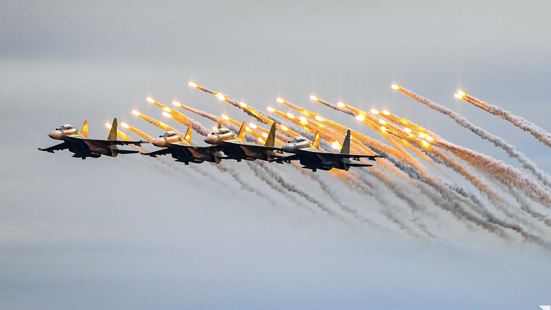
The National Center for Hydro-Meteorological Forecasting said that at 4:00 p.m. on September 1, the center of storm Saola (storm No. 3) was located in the northern sea area of the North East Sea, about 140 km southeast of Hong Kong (China). The strongest wind near the center of the storm was level 14-15 (150-183 km/h), gusting to level 17, moving west at a speed of 10-15 km/h.
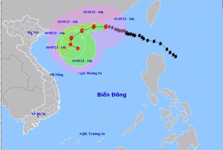
Forecast path of storm number 3.
Forecast at 4pm on September 2, the storm is moving westward in the southwestern sea of Guangdong province (China) and then turning west-southwestward, at 10-15 km per hour. The strongest wind near the storm center is level 12, gusting to level 14.
At around 4pm on September 3, the storm was moving southwest at a speed of 5-10 km/h in the eastern sea of Leizhou Peninsula (China). The strongest wind near the storm center was level 8-9, gusting to level 11.
At 4:00 p.m. on September 4, storm No. 3 was moving southward in the eastern part of Hainan Island (China), at a speed of about 5 km per hour. The strongest wind near the storm center was level 7, gusting to level 9.
Impact of storm No. 3, on the night of September 1 and day of September 2, the northern sea area of the North East Sea has strong winds of level 10-13, near the storm center level 14-15, gusts above level 17, rough seas, waves 2-4 m high, near the storm center 6-8 m.
Between the East Sea and the northern sea area of the South East Sea (including the northern sea area of Truong Sa archipelago), the sea area from Ninh Thuan to Ba Ria - Vung Tau has strong winds of level 6, sometimes level 7, gusting to level 8-9, rough seas, waves 2-4 m high.
The sea area from Ben Tre - Ca Mau, from Ca Mau - Kien Giang and the Gulf of Thailand has strong winds of level 5, sometimes level 6, gusting to level 7, rough seas, waves 1.5 - 2.5 m high.
In addition, on the night of September 1 and 2, the northern sea area of the North East Sea will have storms. The sea area from Quang Ngai to Binh Dinh, Binh Thuan to Ca Mau and the southern sea area of the North East Sea (including the waters of the Hoang Sa archipelago), between the East Sea and the northern sea area of the South East Sea (including the waters of the Truong Sa archipelago) will have showers and strong thunderstorms. During the thunderstorms, there is a possibility of tornadoes and strong gusts of wind.
The CNA Meteorological Agency reported that on the night of September 2 and September 3, the northern sea area of the North East Sea will have strong winds of level 8-9, near the storm center will have strong winds of level 10, gusting over level 13, and very rough seas. The southern sea area of the central East Sea, the northern sea area of the South East Sea (including the waters of the Truong Sa archipelago) and the sea area from Ninh Thuan to Ba Ria-Vung Tau will have strong southwest winds of level 6, sometimes level 7, gusting to level 8-9, and rough seas. Wave heights in these sea areas will range from 2 to 4 m.
The sea area from Ben Tre to Ca Mau, from Ca Mau - Kien Giang and the Gulf of Thailand has southwest wind level 5, sometimes level 6, gusting to level 7, rough sea, waves from 1.5 - 2.5 m high.
Nguyen Hue
Source
![[Photo] Chu Dau Ceramics – Proud of Vietnamese identity at Exhibition A80](https://vphoto.vietnam.vn/thumb/1200x675/vietnam/resource/IMAGE/2025/9/1/c62ab2fc69664657b3f03bea2c59c90e)
![[Photo] Solemn reception to celebrate the 80th anniversary of the National Day of the Socialist Republic of Vietnam](https://vphoto.vietnam.vn/thumb/1200x675/vietnam/resource/IMAGE/2025/9/1/e86d78396477453cbfab255db1e2bdb1)
![[Photo] General Secretary receives heads of political party delegations from countries attending the 80th anniversary of our country's National Day](https://vphoto.vietnam.vn/thumb/1200x675/vietnam/resource/IMAGE/2025/9/1/ad0cb56026294afcae85480562c2e790)
![[Photo] Celebration of the 65th Anniversary of the Establishment of Diplomatic Relations between Vietnam and Cuba](https://vphoto.vietnam.vn/thumb/1200x675/vietnam/resource/IMAGE/2025/9/1/0ed159f3f19344e497ab652956b15cca)
![[Photo] National Assembly Chairman Tran Thanh Man receives Cambodian Senate President Hun Sen](https://vphoto.vietnam.vn/thumb/1200x675/vietnam/resource/IMAGE/2025/9/1/7a90c9b1c1484321bbb0fadceef6559b)
![[Photo] People eagerly wait all night for the parade on the morning of September 2](https://vphoto.vietnam.vn/thumb/1200x675/vietnam/resource/IMAGE/2025/9/1/0cf8423e8a4e454094f0bace35c9a392)


Comment (0)