
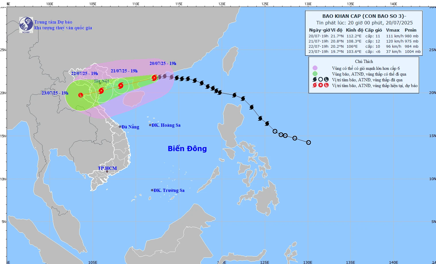
Forecast of the path of storm No. 3 according to the bulletin issued at 8:00 p.m. on July 20, 2025 by the National Center for Hydro-Meteorological Forecasting.
At 7:00 p.m. today, the storm center was at about 21.7 degrees North latitude; 112.2 degrees East longitude, in the northwest sea of the North East Sea, about 480km east of Quang Ninh - Hai Phong . The strongest wind is level 11 (103-117km/h), gusting to level 14. The storm is moving west at a speed of about 20km/h.
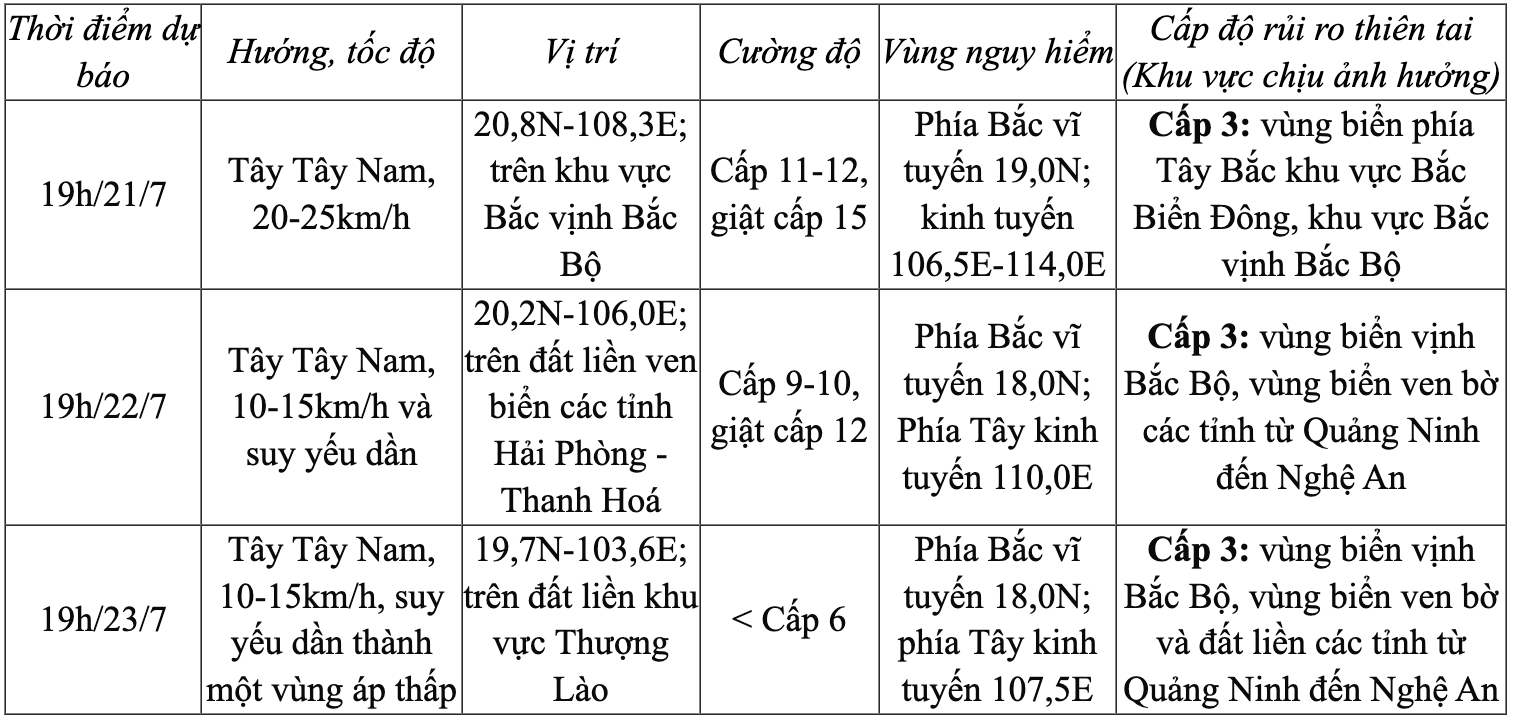
Storm forecast (next 24 to 72 hours):
Storm causes strong winds and rough seas
At sea:
Northwest sea area of the North East Sea: Wind level 8-9, near the storm center level 10-11, gust level 14; waves 5-7m high, rough seas.
Northern Gulf of Tonkin: Wind gradually increases to level 6-7, then increases to level 8-9, near the storm center level 10-12, gusting to level 15; waves 2-5m high, rough seas.
Southern Gulf of Tonkin: Wind level 6-7, near the storm center level 8-9, gust level 11; waves 2-4m high, very rough seas.
On land: From the evening and night of July 21, coastal areas from Quang Ninh to Nghe An will have strong winds of level 7-9, near the storm center, level 10-11, gusting to level 14. Inland areas will have strong winds of level 6-7, gusting to level 8-9.
Recommendation: Do not allow boats to operate in the affected area. Warning of prolonged heavy rain, risk of flash floods, landslides in mountainous areas and flooding in low-lying areas. Special attention should be paid to areas with total rainfall exceeding 200-300mm/period. |
NDS
Source: https://baothanhhoa.vn/bao-so-3-giam-cap-cach-quang-ninh-hai-phong-khoang-480km-255462.htm


![[Photo] National Assembly Chairman Tran Thanh Man visits Vietnamese Heroic Mother Ta Thi Tran](https://vphoto.vietnam.vn/thumb/1200x675/vietnam/resource/IMAGE/2025/7/20/765c0bd057dd44ad83ab89fe0255b783)


Comment (0)