
I still remember when I was in high school studying geography, when we were practicing drawing a map of Vietnam, the teacher reminded us to draw all the small dots to represent the islands and island points of our country.
Eternal pride
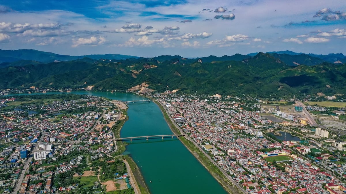
The first stroke of my pen when drawing the map of the country was Sa Vi Cape - the northeasternmost point, in Mong Cai City, Quang Ninh Province. It was not until 15 years later that I had the opportunity to visit and fully feel the sacredness of standing at the headland of the Fatherland.
I came to Sa Vi in the historic days of April, when millions of hearts turned to the 50th Anniversary of the Liberation of the South and the reunification of the country. The milestone recorded the information: From Tra Co to Ca Mau Cape 3,260 km. Right next to this milestone is a relief with the poem "From Tra Co, the pine forest to Ca Mau the mangrove forest" ("So happy today" - To Huu) which is visited by many tourists to check-in and take souvenir photos.
The verse is like a gentle yet proud stroke, outlining the shape of a country. A proud feeling amidst the vastness of the land and sky, To Huu continued in the poem "So Happy Today": "My Fatherland has never been so beautiful!"
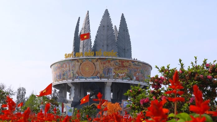
Sa Vi Cape - the northeasternmost point of the country
Sa Vi Cape (also known as Got Cape) is located in Mong Cai City. Locals explain that "sa" means sand, "vi" means tail, Sa Vi is also called the tail of sand. It is called Sa Vi because every time the tide goes down, a long, winding sandbank appears here, likened to the shape of a dragon's tail. Like it has for generations, the sandbank still stands tall and firm, as an affirmation of the country's inviolable sovereignty .
Not far away is the Sa Vi border propaganda information cluster. The highlight of the project is the central area with the image of a poplar tree. This tree has stood firm against wind and rain for generations to protect Tra Co, so it is considered a representative of the durability and longevity of the land and people here.
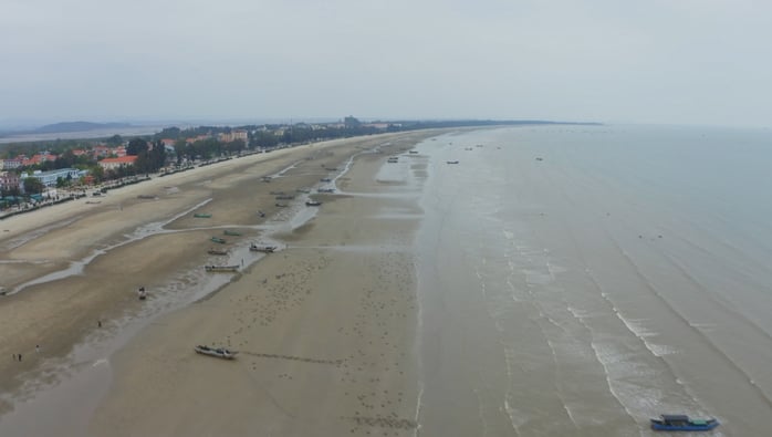
That morning, the golden sunlight gently spread over the poplar trees, along with the gentle sound of the waves of Tra Co beach, mixed with the rustling wind. I stood on top of the Sa Vi border information cluster, looking far away at the 1378 milestone in the middle of the Bac Luan River - the last milestone marking the end of the border between Vietnam and China. A small milestone, even hard to see in the vast expanse of water, but I understood that to build that milestone and preserve it until now has never been easy.
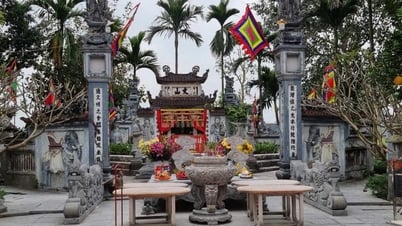
In Tra Co, there is also a famous communal house associated with the history of the formation of this land with nearly 600 years of age. Through many ups and downs of history, Tra Co communal house still stands tall, symbolizing Vietnamese culture in the border area.
Meeting Mr. Nguyen Quang Canh, a member of the Tra Co Communal House Management Board, I had the opportunity to hear many interesting stories about the village communal house that is familiar to many generations of people here. According to Mr. Canh, the communal house dates back to the reign of King Le Thanh Tong, and was built by fishermen from Do Son who came here to reclaim the land. That is why the people still circulate the saying "Tra Co Village, Do Son Ancestor" to remind their descendants that their ancestors were from Do Son. Mr. Canh also showed me the horizontal plaques with the words "Dia cuu thien truong", meaning that this land will last forever with heaven and earth. Or the horizontal plaque with the words "Dan duc quy hau" meaning that the people here will enjoy eternal prosperity.
Sa Vi Cape with its long, winding sandbar, is likened to the shape of a dragon's tail.
Majestic nature
Leaving Tra Co, I continued my journey to Vinh Thuc Island - an island about 20 km south of Mong Cai city center. From Mui Ngoc, it only takes about 15 minutes by canoe to reach the island that still retains its wild beauty and visit Vinh Thuc lighthouse.
Vinh Thuc Lighthouse stands tall on the top of Dau Tan Mountain, built in 1962 in the ancient French architectural style. Vinh Thuc Lighthouse is known as the first lighthouse among more than 90 lighthouses spread across the S-shaped strip of land. The structure is likened to the "eye of the East Sea", lighting up day and night to guide and signal ships passing through the area.
Standing on the top of the lighthouse, with binoculars, I could admire the majestic beauty of nature with Sa Vi Cape in the distance. With a very high position from the base to the top of the lighthouse tower is 18 m, the height of the lighthouse tower from the sea level to the top of the tower is 86 m, so from far away at sea, all ships can be guided by Vinh Thuc lighthouse.
Talking to the lighthouse keeper, we learned that the "specialties" here are the sun and wind: in the summer, the sun burns the skin, in the winter, the wind blows coldly. This staff member said: "From April onwards, there is a shortage of water, after washing vegetables, we have to store water to water the plants. The station has just been equipped with a water tank but it is still not enough for daily use." Despite the difficulties, the staff here still persevere in their work, keeping the lighthouse always bright, contributing to maintaining the sacred sovereignty of the Fatherland.
For me, the journey to the homeland's frontier, to Tra Co, Vinh Thuc, is not only to visit beautiful places, to explore, check-in, admire new and interesting things, it is also a journey to turn towards the homeland, to see in that frontier, the islands and seas, the beloved shape of the country.
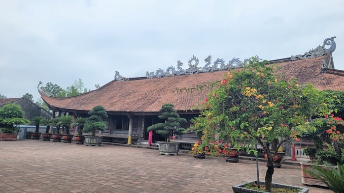
Tra Co Communal House was established by fishermen from Do Son who came to reclaim the land.

Source: https://nld.com.vn/bai-du-thi-cuoc-thi-viet-chu-quyen-quoc-gia-bat-kha-xam-pham-dang-hinh-dat-nuoc-19625061420282136.htm


Comment (0)