

Do recent archaeological discoveries at Den citadel contribute to identifying, decoding and restoring the ancient citadel system of Hoa Lu as many people wish?
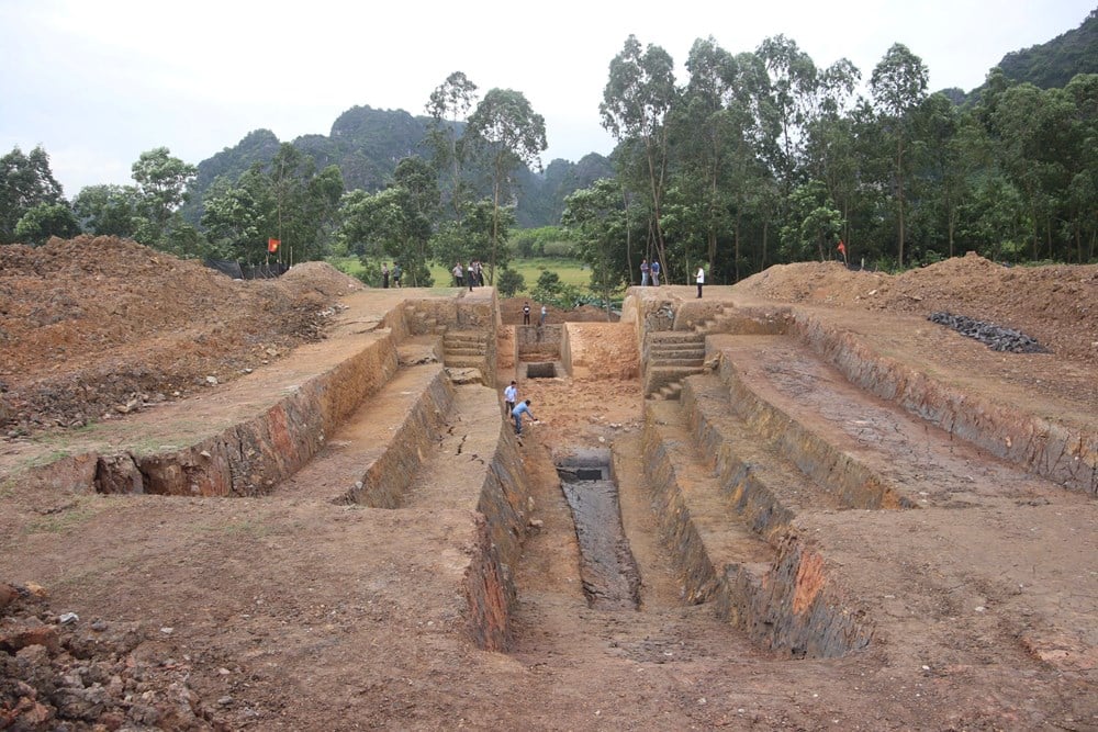
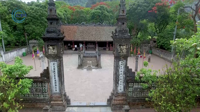
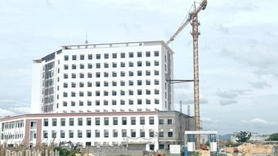
Panoramic view of the excavation area of the Den citadel, the northern defense line of Hoa Lu capital
Nearly 60 years ago, the first archaeological digs to find the ancient citadel of Hoa Lu deep underground were carried out, and up to now, there have been many excavations, but still cannot "redraw" the old appearance of our ancestors. Why is that?
After the Dong Son culture and Red River civilization, the history of Vietnamese culture and civilization entered the second great era, the Dai Co Viet - Dai Viet - Vietnam era, with three cultural periods of different lengths. Hoa Lu was the first capital of the centralized feudal state, the capital of Dai Co Viet during the Dinh (968-980) and Tien Le (980-1009) dynasties with important historical marks such as unifying the country, defeating the Song - pacifying the Cham and starting the process of moving the capital to Thang Long.
The ancient capital is located in Truong Yen commune, Hoa Lu city ( Ninh Binh ), a land with a unique terrain surrounded by many limestone mountains. According to historical records, over many dynasties, about 10 sections of earthen ramparts were built connecting the mountains, creating a special natural and artificial defense system with a total area of over 300 hectares.
However, historical records and relics are still quite limited, making it difficult to fully visualize the structure of this ancient citadel. Many tourists visiting the ancient capital of Hoa Lu find it difficult to imagine what the ancient citadel of more than a thousand years ago was like, only knowing that the temples and palaces would be located neatly in the valley, surrounded by towering limestone mountains. Could it be that, after many historical changes and the encroachment of climate, natural disasters and even humans, the ancient citadel system has been shattered into pieces underground, unable to be restored?
The history of research in this area began quite early. In 1969, the staff of the National Museum of History first surveyed and “fire-extinguished” the system of ramparts of the ancient capital Hoa Lu, including preliminary records of an earthen rampart connecting the mountains of Chi Phong village. However, at that time, only general records were made and there was no large-scale field excavation.
It was not until 2018 that the Institute of Archaeology and the Department of Culture, Sports and Tourism of Ninh Binh province organized an exploration of only 8m². Notably, archaeologists here discovered a special structure of the citadel foundation: a layer of horizontally arranged tree branches and leaves, covered with mud and clay on top, a construction technique highly adapted to weak strata and riverine swamps. However, due to the small area, it is not possible to fully determine the role and scale of the citadel section in the overall defense system.
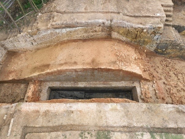
Cross section of Den citadel wall - earthen layer shaped like a fish, broken bricks covering the slope
The land turns to tell stories of a thousand years ago
In early March 2025, according to Decision No. 554/QD-BVHTTDL of the Ministry of Culture, Sports and Tourism, the Institute of Archaeology officially conducted two excavations at Den Citadel, an important section of the ancient citadel system of Hoa Lu ancient capital, with the coordination of the Department of Culture, Sports and Tourism of Ninh Binh. Den Citadel is located in Chi Phong village, Truong Yen commune, Hoa Lu city. The citadel is built of earth connecting the mountains to surround the northern part of the Inner Citadel of Hoa Lu capital.
According to local people, the nearly 700m long section of Den citadel has just been removed from the flood-prevention dike system by the competent authority, literally “giving back the name to me”, a section of the ancient citadel built of earth. The citadel consists of two sections: The main section is about 500m long, connecting Sau Cai mountain (or Ham Xa, Co Dai) to Canh Han mountain. This is the longest section of the ancient citadel in the Hoa Lu citadel system.
The 150m long auxiliary section, connecting Canh Han Mountain to Hang To Mountain (or Nghen Mountain), is located on the same route as the main section. Two large excavation pits, with a total area of over 600m², were opened at key locations. The initial results surprised many researchers. The Den Citadel Wall turned out to be more than just “an old earth bank”, which was previously used as a dike section around the Hoang Long River and was only replaced when the outer concrete dike was built in early 2025.
Thanh Den is essentially a defensive structure built with complex techniques: The wall foundation is up to 2m thick, consisting of many layers of mud mixed with vegetation, mainly leaves and tree trunks. This construction method helps reinforce weak ground, avoiding subsidence and landslides. Above is a core of fine gray-white clay, compacted into the shape of a loach, more than 6m wide. The two sides are covered with flexible reddish-brown soil, covered with a layer of broken bricks to reinforce and drain water.
The total width of the wall surface is more than 16m, the height is nearly 6m from the field, creating a solid rampart. Not stopping there, archaeologists also discovered traces of a defensive moat outside, now filled with modern waste soil. Through initial identification, this area is a flooded depression, about 1.2m lower than the embankment at the foot of the wall. In the moat, there are still traces of wooden stakes, which may have been used to prevent crossing the moat or to tie anchors to warships.
Talking to Van Hoa , Dr. Nguyen Ngoc Quy (Institute of Archaeology), the person in charge of the excavation, said: “The presence of the moat creates a closed defense system, including ramparts and moats. The wall is not high, but imagine: Outside is a swamp several hundred meters lower than the citadel, it is not easy for the enemy to cross.”
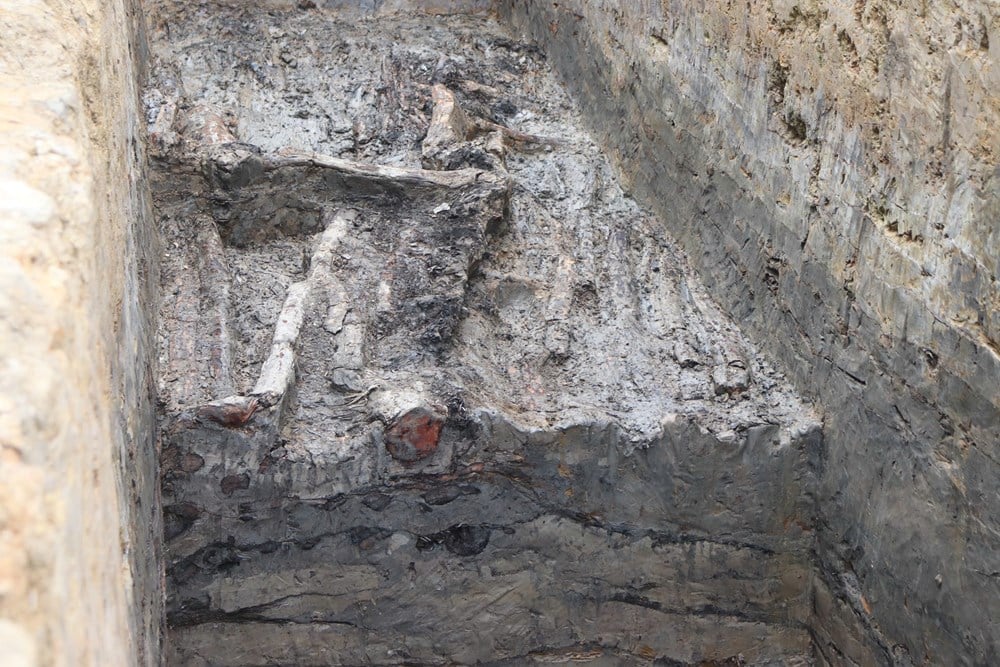
Details of horizontal leaf layers in the foundation structure
Recovering value from a forgotten relic
The discovery at Den citadel continues the series of archaeological evidences of the construction techniques of the Dinh - Tien Le citadel, which have been confirmed through excavations at the Eastern citadel (1969), the Northeastern citadel (2024) and part of the Southern citadel. All show similar techniques: Using organic foundations combined with mud, brick or stone foundations, multi-layered walls, taking advantage of natural terrain and rivers to strengthen defense.
Thanh Den is special in that: This is the only section of the citadel located close to the Hoang Long River, playing the role of "intersection" between the military wall and the irrigation works. In the overall ancient citadel of Hoa Lu, it is a missing piece, both to determine the boundary of the capital and to show the smooth combination of defense and flood control of the ancients.
The excavation of a Den citadel not only helps to “name” a forgotten relic, but also raises a bigger question: Have we correctly perceived the value and structure of Hoa Lu ancient citadel? For many years, most of the research and explanations of Hoa Lu relics revolved around the Inner Citadel area, the temples of King Dinh and King Le, or more visible sections of the citadel such as the Eastern Citadel. Because the Den citadel was built over with earth to create a flood-prevention dike, there were no visual traces left, so it was removed from the relic tour map.
However, with the discovery from the 2025 excavation, Den citadel can completely become a research and outdoor sightseeing site, where visitors can not only "see" but also "understand" the thousand-year-old citadel-building technique. This is also the basis for digitizing and reconstructing the 10th-century citadel model in the current Hoa Lu Ancient Capital relic conservation system.
The story of Den city is a vivid proof that, without proper attention, many precious relics can be buried, not by nature but by the unplanned modernization process. During the excavation journey, archaeologists have encountered many difficulties because of the thick layer of modern waste, mud, and subsidence. There are areas that seem impossible to save without the support of 3D scanning technology and the determination of experts to restore.
What has just emerged from the deep soil of Truong Yen commune is not just a wall. It is a memory, an industry, a living piece of a capital that once stood tall to protect the country. Thanh Den was once forgotten, but now, from the ground, it is returning as a reminder that every inch of the ancient capital has a voice, as long as we are patient enough to listen.
(To be continued)
Source: https://baovanhoa.vn/van-hoa/bat-ngo-voi-cau-truc-dap-dung-thanh-den-143207.html

![[Photo] Many people eagerly await the preliminary review despite heavy rain](https://vphoto.vietnam.vn/thumb/1200x675/vietnam/resource/IMAGE/2025/8/27/4dc782c65c1244b196890448bafa9b69)

![[Photo] Prime Minister Pham Minh Chinh chairs meeting of National Steering Committee on International Integration](https://vphoto.vietnam.vn/thumb/1200x675/vietnam/resource/IMAGE/2025/8/26/9d34a506f9fb42ac90a48179fc89abb3)

![[Photo] Brilliant red of the exhibition 95 years of the Party Flag lighting the way before the opening](https://vphoto.vietnam.vn/thumb/1200x675/vietnam/resource/IMAGE/2025/8/27/e19d957d17f649648ca14ce6cc4d8dd4)


![[Photo] General Secretary To Lam attends Meeting with generations of National Assembly deputies](https://vphoto.vietnam.vn/thumb/402x226/vietnam/resource/IMAGE/2025/8/27/a79fc06e4aa744c9a4b7fa7dfef8a266)


Comment (0)