
 |
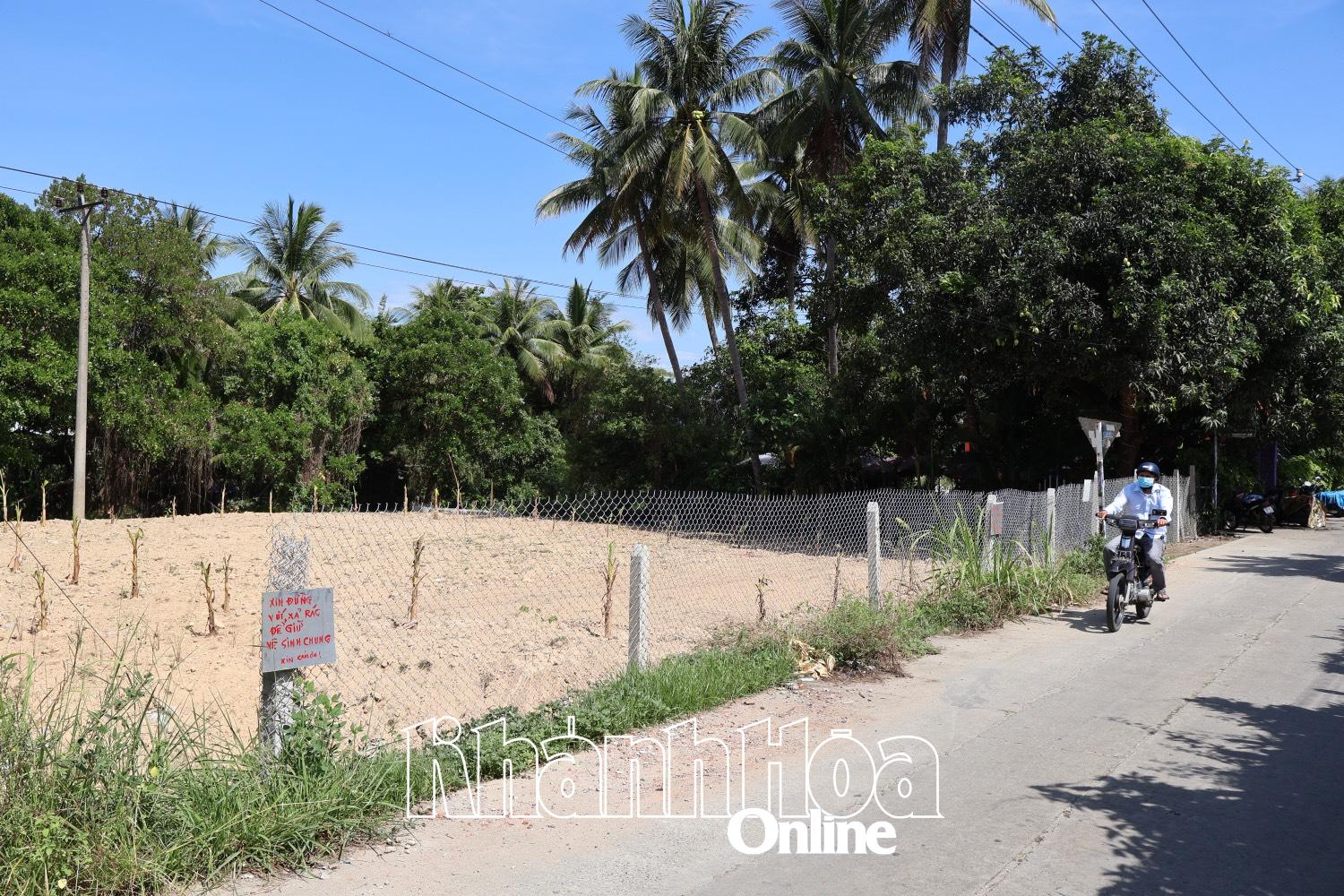
| Illegal land leveling area in Vo Canh village. |
Through inspection, the Economic , Infrastructure and Urban Affairs Department of the ward determined that the leveled land location belongs to plot No. 167, map sheet No. 01 (Vo Canh village), area 2,270m2 , current status is agricultural land, current land user is Ms. PTTL. At the time of inspection, the land user had leveled an area of about 600m2 , 1m higher than the original land status. The west side of the leveled land area adjacent to the water ditch was filled with soil, and a concrete embankment with a hollow cylinder structure and a diameter of 90cm was built. Trees were planted on the leveled land; the part adjacent to Luong Dinh Cua street had a concrete pillar fence and a B40 mesh fence with a height of 1.5m and a length of 20m. The leveling and raising of the 600m2 area was within the boundary of the land use right certificate granted to Ms. PTTL; it did not encroach on the water ditch and adjacent land plots.
During the meeting with Ms. PTTL on July 16, Ms. L. admitted to deforming the terrain of agricultural land. Ms. L. said that the land she was using was low-lying and flooded, so it could not be used for farming. She had repeatedly submitted requests to renovate and raise the ground to avoid flooding, but the competent authority had not yet agreed. The Economic, Infrastructure and Urban Department of Tay Nha Trang Ward requested Ms. L. to voluntarily remedy and restore the original state of the land within 3 days from the working date. After the above time, if Ms. L. does not voluntarily remedy, the local government will handle it according to current legal regulations.
THAI THINH
Source: https://baokhanhhoa.vn/xa-hoi/moi-truong-do-thi/202507/xu-ly-truong-hop-san-lap-mat-bang-trai-phep-o-phuong-tay-nha-trang-7982f27/


![[Infographic] In 2025, 47 products will achieve national OCOP](https://vphoto.vietnam.vn/thumb/402x226/vietnam/resource/IMAGE/2025/7/16/5d672398b0744db3ab920e05db8e5b7d)


Comment (0)