

Current storm location and intensity
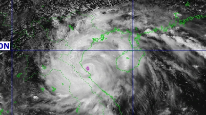
According to the news, at 10:00 p.m. on August 24, the center of storm No. 5 was at approximately 18.0 degrees North latitude; 108.7 degrees East longitude. The center of the storm was approximately 330km East Southeast of Nghe An .
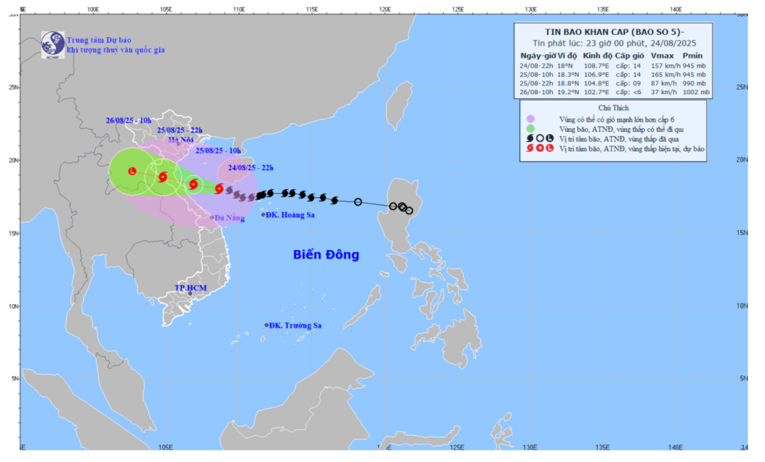
The strongest wind near the storm center is level 14 (equivalent to 150-166km/h), gusting to level 17. The storm is moving west at a speed of 15-20km/h and is likely to strengthen further.
Storm path forecast
Forecast in the next 12 hours, the storm will mainly move in the West Northwest direction at a speed of about 20km/h.
By 10am tomorrow morning (August 25), the storm's eye will be in the southern Gulf of Tonkin, only about 140km from Nghe An. At this time, the storm's wind speed will remain at level 14, gusting to level 17.
By around 10pm tomorrow night (August 25), the storm will move deep into the Vietnam - Laos border area, its intensity will decrease to level 9-10, gusting to level 14.
Detailed warning of extremely dangerous effects
1. Extremely strong winds on land:
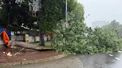
From early morning on August 25, on the mainland of Nghe An province, winds will gradually increase to level 12-14, gusting to level 15-16. According to the scale, this is an extremely destructive wind level, which can cause disaster if not prevented.
2. Extremely dangerous waves:
The sea area of Nghe An province (including Hon Ngu island) will have winds gradually increasing to level 7-9, then increasing to level 10-11. The area near the storm's eye will have strong winds of level 13-14, gusting to level 17. Waves will be 5.0-7.0m high, near the storm's eye waves will be 8.0-10.0m high, the sea will be very rough.
3. Rising water and risk of coastal flooding:
Coastal areas of Nghe An are likely to experience storm surges of 0.5-1.8m high. There is a high risk of flooding in low-lying coastal areas and river mouths due to surges and large waves, especially in the afternoon and evening of August 25.
4. Widespread heavy rain:
From tonight (August 24) to the end of August 26, the entire Nghe An province is likely to experience heavy to very heavy rain. Rainfall is generally between 200-400mm, locally over 600mm. The meteorological agency also warns of the risk of very heavy rain (over 150-200mm in just 3 hours).
Disaster risk level is very high
The meteorological agency determined the disaster risk level due to storm No. 5 to be Level 4 (very high risk) for coastal waters and mainland areas of provinces from Thanh Hoa to northern Quang Tri .
Weather conditions at sea and on coastal land during the storm's landfall are warned to be extremely dangerous, unsafe for any vehicle or structure.
Nghe An Newspaper and PTTH will continue to update in the next news.
Source: https://baonghean.vn/tin-bao-khan-cap-luc-23h00-bao-kajiki-cap-14-giat-cap-17-sieu-bao-tien-thang-vao-dat-lien-nghe-an-co-the-hung-gio-giat-cap-16-10305137.html

![[Photo] Exhibition “80 years of journey of Independence-Freedom-Happiness”: An inspirational meeting place for the young generation](https://vphoto.vietnam.vn/thumb/1200x675/vietnam/resource/IMAGE/2025/8/26/2aaef59beb604923b0f848f5c6311dbd)


![[Photo] General Secretary To Lam attends the 80th anniversary of Vietnam's diplomacy](https://vphoto.vietnam.vn/thumb/1200x675/vietnam/resource/IMAGE/2025/8/25/3dc715efdbf74937b6fe8072bac5cb30)


Comment (0)