
On the morning of June 12, with 461/465 delegates present in agreement, the National Assembly passed a historic resolution on the arrangement of provincial-level administrative units in 2025, reducing from 63 to 34 new provinces and cities.
The Resolution takes effect from the date of its passage by the National Assembly.
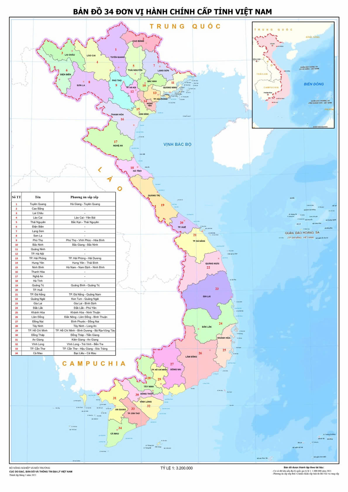
The appearance and shape of Vietnam are also redrawn.
Previously, the shape of the country stretched from Lung Cu ( Ha Giang province - the northernmost point) to Ca Mau Cape (Ca Mau province - the southernmost point).
Now, when Ha Giang province and Tuyen Quang province are merged into a new province called Tuyen Quang province, the length of the country will stretch from the starting point of Tuyen Quang to Ca Mau .
Along the 3,260km coastline, there were previously 28 coastal provinces and cities; after the merger, it was reduced to 21 localities. However, the proportion of coastal localities after the arrangement increased to 62% (21/34), compared to 44% (28/63) before.
In particular, all localities formerly belonging to the Central Highlands region after the merger have sea.
Tuoi Tre Online posted a map of 34 new provinces and cities:
Source: https://tuoitre.vn/ngam-dien-mao-34-tinh-thanh-tu-dia-dau-tuyen-quang-den-mui-ca-mau-20250612092611986.htm


![[Infographic] In 2025, 47 products will achieve national OCOP](https://vphoto.vietnam.vn/thumb/402x226/vietnam/resource/IMAGE/2025/7/16/5d672398b0744db3ab920e05db8e5b7d)


Comment (0)