
12:24 July 22, 2025
Big waves, rough seas in Ninh Binh when storm sweeps through
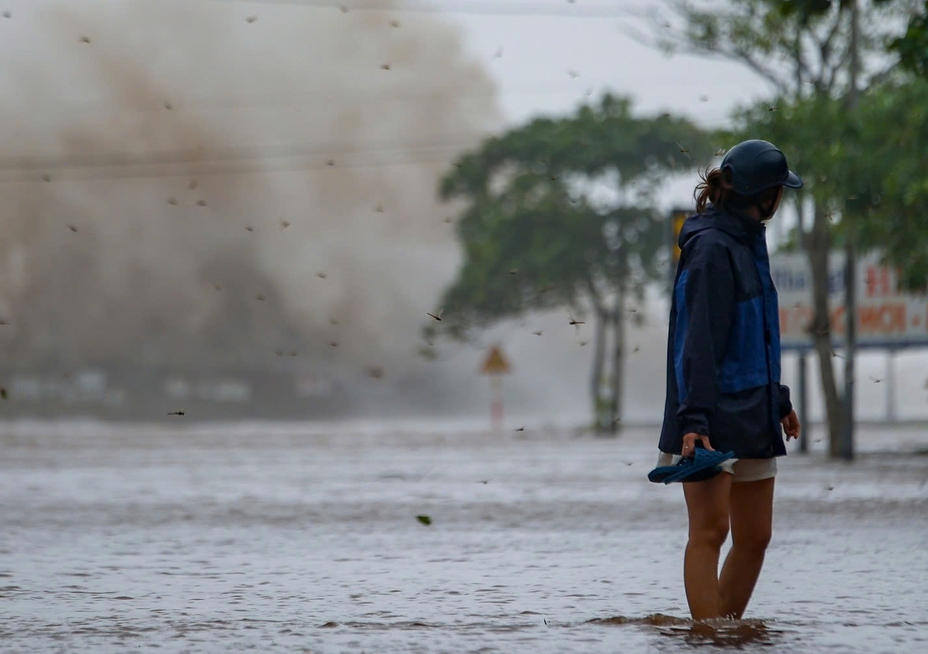
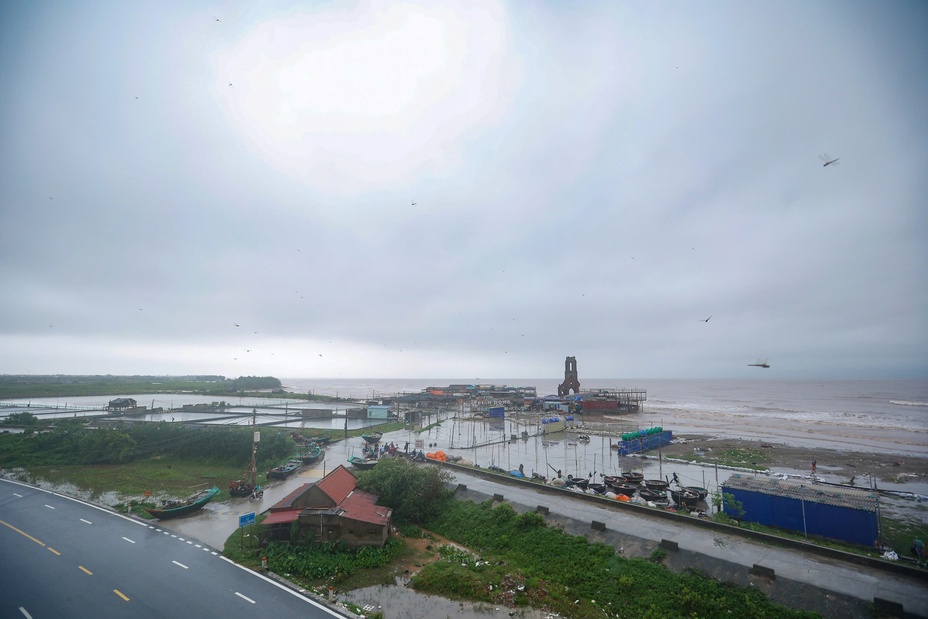
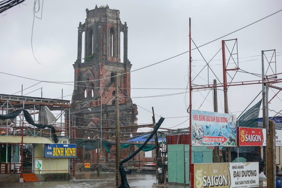
At 12 noon, the coastal area of Giao Ninh commune (Quat Lam town, old Nam Dinh province) suddenly had rain and strong winds again. Water flooded the road leading to the coast, in some places it was over 1 meter deep.
Many people rushed to find shelter. Ms. Phuong Thuy (Giao Ninh commune) said it had been a long time since she had seen the sea as rough as today. "I ran out to check the belongings at the shop before the strong wind came. I must go home now or the wind will be too strong," Ms. Thuy said.
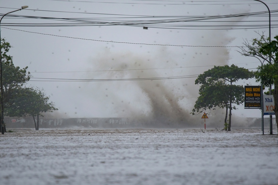
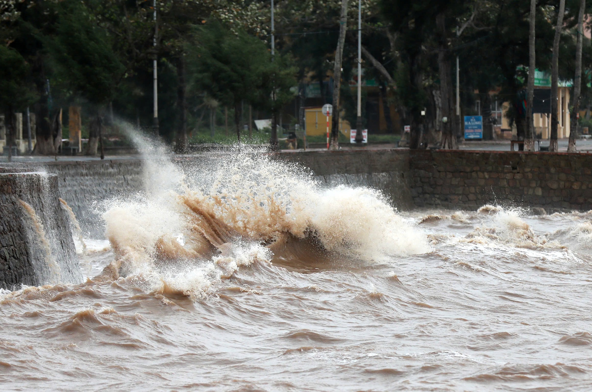
High waves in Giao Ninh commune
PHOTO: TUAN MINH
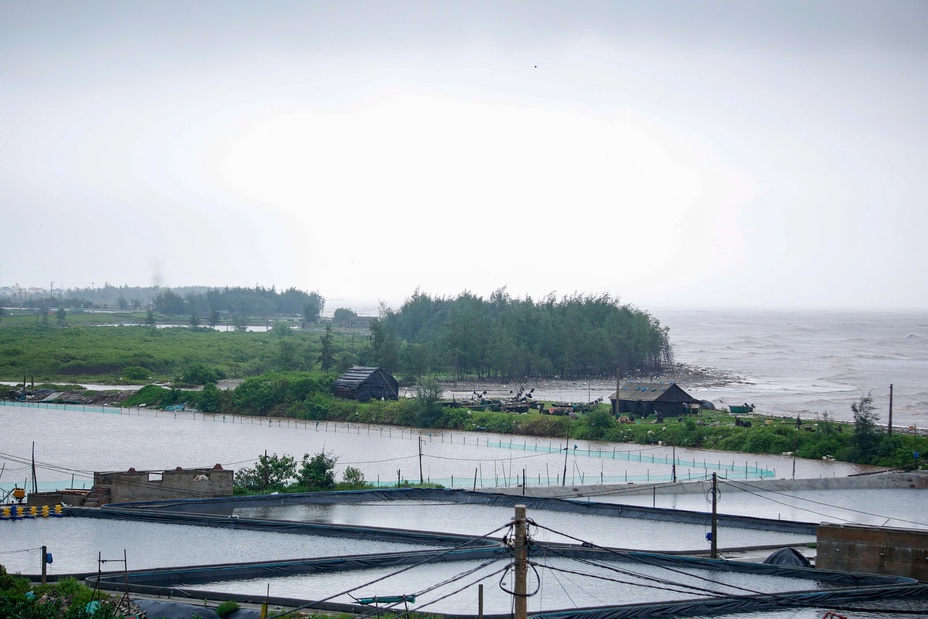
People said that seas as rough as today rarely happen.
PHOTO: TUAN MINH
11:15 July 22, 2025
Storm moves deep inland, coastal areas remain extremely dangerous
The National Center for Hydro-Meteorological Forecasting said that at noon on July 22, the storm's eye had moved deep into the mainland of Hung Yen - Ninh Binh provinces. The strongest wind near the storm's eye was level 8, equivalent to 62 - 74 km/h, gusting to level 10. The storm is moving west-southwest at a speed of 10 - 15 km/h.
Coastal areas from Quang Ninh to Nghe An have strong winds of level 6 - 7, near the storm center level 8, gusting to level 10. Inland areas of the provinces and cities: Hai Phong, Hung Yen, Bac Ninh, Hanoi, Ninh Binh and Thanh Hoa have gusts of level 6 - 8. Level 8 winds can break tree branches, blow off roofs and cause damage to houses.
Dong Chau coast (Hung Yen) strong wind, big waves
PHOTO: NGUYEN ANH
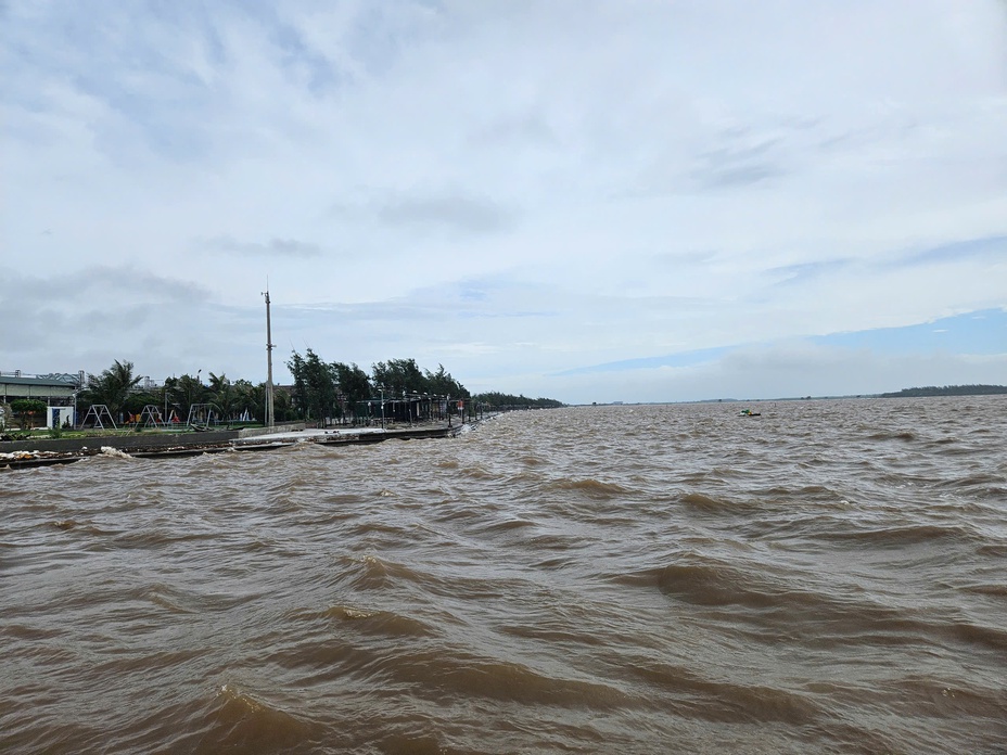
Due to the impact of the storm, the National Center for Hydro-Meteorological Forecasting has warned of storm surges and coastal flooding. Specifically, the Hung Yen - Quang Ninh coast has storm surges of 0.5 - 1 m; at Ba Lat (Hung Yen) 2.4 - 2.6 m; at Hon Dau (Hai Phong) 3.6 - 4.1 m; at Cua Ong (Quang Ninh) 4.4 - 4.8 m and at Tra Co (Quang Ninh) 3.6 - 4.0 m.
This afternoon and evening, the weather at sea and in coastal areas is extremely dangerous, unsafe for any vehicles or structures operating in the danger zone such as: cruise ships, passenger ships, transport ships, cages, rafts, aquaculture areas, dykes, embankments, coastal routes. Vehicles are at high risk of capsizing, destruction, and flooding due to strong winds, storms, whirlwinds, large waves, and rising sea levels.
11:05 July 22, 2025
Ninh Binh coastal road flooded
The road to the sea in Hai Thinh commune is 1 meter deep. Last night, Mr. Nguyen Van Long (resident of residential group 11) and his family quickly used a screen to prevent water from entering the house.

The coastal road of Hai Thinh commune is flooded due to the impact of storm No. 3.
PHOTO: TUAN MINH
"The water has now receded by half. Luckily it didn't rain more, or my house would have been flooded," said Mr. Long.

Mr. Long and his family use measures to prevent water from flooding into the house.
PHOTO: TUAN MINH

People still have difficulty moving through flooded areas.
PHOTO: TUAN MINHd
10:18 July 22, 2025
Landslides appear in Thanh Hoa
Almost all areas in Thanh Hoa province have heavy to very heavy rain, especially coastal areas. Some areas including traffic routes and residential areas are deeply flooded. In mountainous areas, small landslides have appeared, such as in Dong Luong commune.
Many traffic routes in Thanh Hoa were deeply flooded this morning.
PHOTO: PHUC NGU

Some small landslides have appeared in mountainous areas of Thanh Hoa province.
PHOTO: PHUC NGU
In Ninh Binh province, rain continued, light wind. Some traffic routes were flooded, many trees fell.
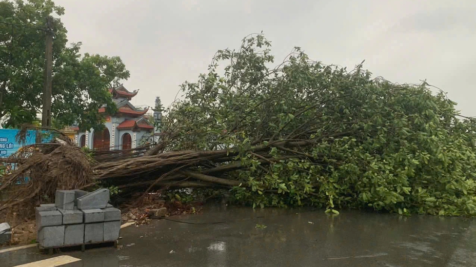
In Ninh Binh province, rain continues, many trees fall down.
PHOTO: PHUC NGU
10:16 July 22, 2025
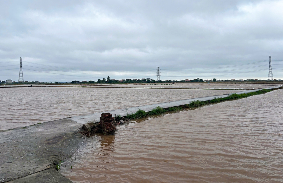
Rice fields in Nghia Hung, Ninh Binh (formerly Nam Dinh) are flooded.
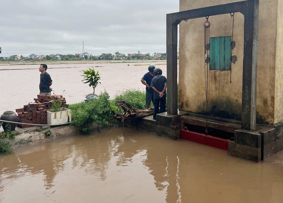
According to Thanh Nien , by around 10am this morning, many rice fields of people in Nghia Hung commune, Ninh Binh province were flooded. Local people said that heavy rain from last night until this morning had not stopped, causing the river water to rise, while the water in the fields had not been able to drain, leading to flooding. Authorities have installed pumps to prepare to drain water to save the rice fields.
"We have only been planting for over a week now, the rice is still small so if it rains more than usual it will be flooded," said a local resident.
According to statistics from the specialized rain gauge system Vrain, in Nghia Hung commune, 170 mm of rainfall was recorded.
Nghia Hung commune fields are flooded
PHOTO: PHAM QUAN
The water level in the river is equal to the water level in the fields.
PHOTO: PHAM QUAN
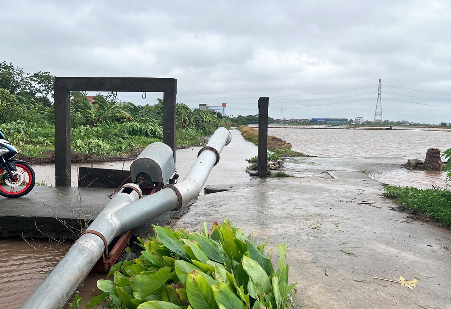
Pumps are mobilized to prepare for flood prevention pumping.
PHOTO: PHAM QUAN
10:05 July 22, 2025
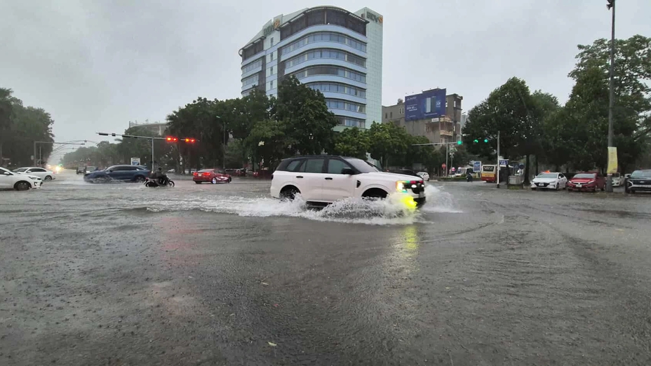
Hanoi has temporarily stopped raining, the wind is blowing gently

The rain stopped in Hanoi at 10am on July 22.
PHOTO: NGUYEN TRUONG
By 10am, the rain had stopped in the Hanoi area, there was only light wind and the sky was sunny. However, the National Center for Hydro-Meteorological Forecasting still issued warnings of thunderstorms, tornadoes, lightning, and localized heavy rain in the inner city of Hanoi.
Accordingly, in the next 4 hours, wards in Hanoi's inner city such as Viet Hung, Bo De, Hong Ha, Ba Dinh, Khuong Dinh... are forecasted to have rain, showers and possibly thunderstorms. The thunderstorm area may then expand to other wards in the city center.
09:58 July 22, 2025
Ninh Binh: People gather to watch the storm make landfall
At 9:54 a.m., the coastal sky of Hai Tien commune (Ninh Binh) was calm, no more rain, and some areas of clear sky. Some people gathered on the dike to monitor the storm's landing.
The coastal sky of Hai Tien commune is calm
PHOTO: TUAN MINH
The waves in this area are not as high as in the early morning.
PHOTO: TUAN MINH

People gathered on the dike to monitor the storm situation.
PHOTO: TUAN MINH

Working delegation of Ninh Binh province and the Department of Dyke Management and Natural Disaster Prevention inspected the Dinh Mui sea dyke in Hai Xuan commune.
PHOTO: PV
09:52 July 22, 2025
Storm No. 3 is hitting Hung Yen and Ninh Binh
Mr. Mai Van Khiem, Director of the National Center for Hydro-Meteorological Forecasting, said that at 10:00 a.m., the center of storm No. 3 had entered the mainland along the coast from Hung Yen to Ninh Binh. The intensity was level 8 - 9, gusting to level 11.
Forecast this afternoon and tonight, the storm continues to move west-southwest and gradually weakens. The storm circulation continues to cause heavy to very heavy rain in Thanh Hoa and Nghe An areas today and tonight with common rainfall of 100 - 200 mm, locally over 300 mm.
Because the storm clouds are mainly concentrated in the southwestern circulation of the storm, the provinces and cities in the northern circulation of storm No. 3, including Hanoi, and the northeastern provinces and cities, will see less rainfall compared to last afternoon and night.
The storm makes landfall with winds of level 8 - 9, which is very dangerous for road activities and can cause trees to fall. When going further inland, areas and communes in the south of Hanoi, Bac Ninh, Hung Yen, and Thanh Hoa have strong winds of level 6 - 7, so extreme caution is needed.
09:29 July 22, 2025
The eye of storm number 3 is located on the sea of Hung Yen - Ninh Binh.
According to the National Center for Hydro-Meteorological Forecasting, at 9:00 a.m., storm number 3 was located right on the coastal waters of Hung Yen - Ninh Binh.
In about 1 hour, the storm center will enter the mainland area of Hung Yen - Ninh Binh and the storm intensity when entering will still be strong at level 8 - 9, gusting at level 11 - 12.
Inland areas of the provinces and cities of Hai Phong, Hung Yen, Bac Ninh, Hanoi, Ninh Binh and Thanh Hoa have strong winds of level 5 - 6, gusting to level 7.
According to Thanh Nien reporter in Do Son Ward (Hai Phong City), it was not raining but the sea waves were more violent with high waves exceeding the embankment.
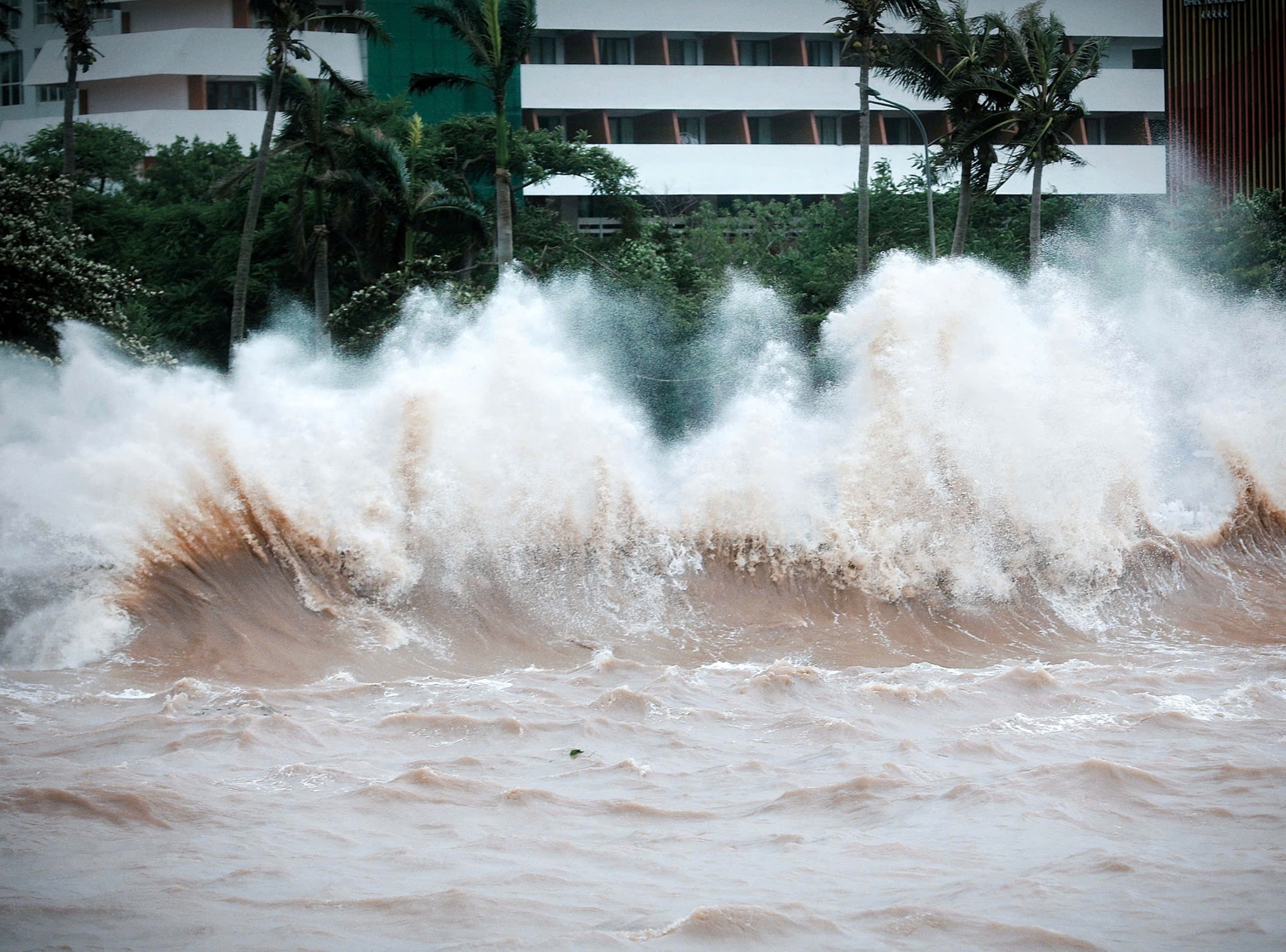
Do Son sea waves are more fierce before storm number 3 makes landfall
PHOTO: NGOC DUONG
Waves cover the embankment on the coast of Do Son
PHOTO: NGOC DUONG
09:15 July 22, 2025
Heavy rain on Ninh Binh coast, waves continue to get stronger
Storm No. 3 is approaching the mainland, in Hai Tien commune (Ninh Binh) there continues to be heavy rain, big waves at sea. Coastal areas are closed, there are few people passing by, only a few people are reinforcing and checking properties along the coast.

The waves in Hai Tien commune are quite large.
PHOTO: TUAN MINH
Beachside restaurants are closed.
PHOTO: TUAN MINH

People go to coastal areas to check their property
PHOTO: TUAN MINH
09:12 July 22, 2025
Storm level 9 winds are very dangerous in coastal areas
Mr. Mai Van Khiem, Director of the National Center for Hydro-Meteorological Forecasting, said that with strong storm winds of level 9, gusting to level 11 - 12, the wind level is still extremely dangerous for coastal wards and communes in the southern areas of Hai Phong, Hung Yen (old Thai Binh), and Ninh Binh (old).

Experts from the National Center for Hydro-Meteorological Forecasting are closely monitoring storm No. 3.
PHOTO: PHAN HAU
According to Mr. Khiem, the storm cloud structure has concentrated in the south of the storm circulation. When the storm center reaches the mainland, all the main clouds in the south will cause heavy rain concentrated in Thanh Hoa, Nghe An and part of Ha Tinh.
Today, storm No. 3 continues to cause rain in the Northern Delta, Thanh Hoa, Nghe An, rainfall of 100 - 300 mm. In particular, the mountainous area west of Nghe An, Thanh Hoa is a sensitive area, with a very high risk of landslides and flash floods.
09:09 July 22, 2025
Dong Chau beach starts to have big waves, no rain
Currently, the coastal area of Dong Chau commune (Hung Yen) is experiencing strong winds, big waves, and no rain. The coastal restaurant area is closed. Restaurant owners have tied down, removed some of the corrugated iron roofs, and reinforced their houses to prevent storms.

Police cars broadcast notices reminding people of Dong Chau commune to take precautions against storms.
PHOTO: NGUYEN ANH
Mr. Phan Van Phien, a resident of Dong Chau commune, said that last night it rained heavily, with winds of about level 9 or 10. "I read in the newspaper that the storm would make landfall at 9-10 o'clock, and I'm very worried. I wonder if this storm will be as strong as the Yagi storm in 2024 when it makes landfall," said Mr. Phien.
Dong Chau sea has started to have big waves
PHOTO: NGUYEN ANH
Since midnight yesterday, July 21, the entire commune has had its electricity cut off to ensure safety. Here, local authorities have continuously used loudspeakers to remind people to proactively prepare for storms…
09:09 July 22, 2025
Thanh Hoa heavy rain
In Hac Thanh Ward, the center of Thanh Hoa province, on the morning of July 22, many roads were flooded.
Le Loi Avenue intersection area (Hac Thanh Ward, Thanh Hoa)
PHOTO: PHUC NGU

Although there was no strong wind, the impact of prolonged heavy rain caused trees in Hac Thanh Ward to fall and block traffic.
PHOTO: PHUC
09:04 July 22, 2025
Nearly 200 flights canceled, diverted to avoid storm
According to the report of the Ministry of Construction, an estimated 129 flights had to change routes to avoid the storm; 57 flights had to wait on July 19; 11 flights to Noi Bai International Airport and 2 flights to Tho Xuan Airport had to go to the alternate airport.
In addition, on July 21, Van Don airport (Quang Ninh) canceled 3 flights; Cat Bi airport (Hai Phong) canceled 33 flights.

Checking storm prevention work at Noi Bai airport on the night of July 21
The Civil Aviation Authority of Vietnam has requested to temporarily stop receiving and operating aircraft at Van Don and Cat Bi airports from 11pm on July 21 to 12pm on July 22.
At Tho Xuan Airport (Thanh Hoa), on July 22, Vietnam Airlines announced that flights VN1276 and VN1277; VN7264 and VN7265 between Ho Chi Minh City and Tho Xuan will be operated early, taking off at Tho Xuan before 11:00. Flights VN1278 and VN1279; VN7268 and VN7269; VN7276 and VN7277 on the same day will be canceled.
At Noi Bai airport, the airline is continuing to closely monitor the weather to decide on appropriate operations. In addition, many domestic and international flights on July 22 may be affected by the development of storm Wipha.
To cope with storm Wipha, many aircraft at Noi Bai have been carefully secured and moved to sheltered positions.
08:54 July 22, 2025
Ninh Binh coast begins to have big waves

People check and reinforce sandbags to prevent water from flooding into the store yard.
PHOTO: TUAN MINH
At 8:30 a.m. on July 22, in the coastal area of Hai Tien commune (Ninh Binh), the weather continued to have heavy rain, the wind began to increase, reaching about 50 km/h. The sea began to have big waves. The restaurant area along the coast of Hai Tien commune was closed, no one was passing by.
It is reported that some signs have collapsed due to strong winds. To ensure safety, people are asked to stay off the streets unless necessary.
Early in the morning, before the storm arrived, some people checked and reinforced their properties near the coast. Mr. Pham Van Nghia (owner of a coastal restaurant) said that yesterday he mobilized his staff and family members to reinforce more than 300 sandbags to prevent rising water and damage to property.
"It has been raining since yesterday so the whole yard is flooded. This morning I had to open the road to let the water drain, and reinforced the sandbags to make it higher. I expect the water will reach the yard of the store this afternoon," said Mr. Nghia.
08:46 July 22, 2025
Houses in Thanh Hoa flooded due to heavy rain
Due to the impact of storm No. 3, communes located in the northern coastal area of Thanh Hoa province are experiencing heavy to very heavy rain.

People in Thanh Loc village wade through water to move their belongings to higher ground.
PHOTO: PHAM DUC
Prolonged heavy rain caused dozens of houses in Thanh Loc village (Van Loc commune, Thanh Hoa province) to be flooded.
A local resident said that Thanh Loc village has a high population density, is located close to the sea but has only a few drainage culverts to the sea, so every time there is prolonged heavy rain, many households' houses are flooded.
"This time, due to the impact of storm No. 3, heavy rain lasted from the night of July 21 until this morning, causing many roads in the village to be deeply flooded. The drainage system is poor, so rainwater flooded my family's house and many surrounding households. We had to wake up early to move our belongings to higher ground, it was very difficult," this resident complained.
HD
auto
Van Loc Commune, Thanh Hoa Province - morning of July 22, 2025
08:46 July 22, 2025
Hanoi starts to have strong winds
In Hanoi, windy weather and light rain began to appear at 7:45 a.m. According to the Northern Hydrometeorological Station, today, in the northern and western regions, the wind will gradually increase to level 4-5, gusting to level 6; in the southern and central regions, the wind will gradually increase to level 5-6, gusting to level 7-8, with a natural disaster risk level of level 3.

Showroom located on Pham Van Dong street, welded iron frame to cope with strong winds
PHOTO: NGUYEN TRUONG
It is forecasted that from July 22 to 23, Hanoi will have moderate to heavy rain and thunderstorms, with rainfall in 112/126 communes and wards ranging from 60 to 120 mm.
To cope with storm No. 3, a showroom located on Pham Van Dong Street (Phu Dien Ward) welded iron frames and used sandbags to support the glass door system. At Geleximco Le Trong Tan urban area (An Khanh Commune), many households in low-lying areas have "built banks and dams" in front of the basement entrance to prevent water from overflowing during heavy rains.
Mr. Mai Van Khiem, Director of the National Center for Hydro-Meteorological Forecasting, said that at 8:00 a.m. this morning, July 22, storm No. 3 was right on the coastal waters of Hung Yen and Ninh Binh provinces. It is forecasted that at around 10:00 - 13:00 today, the storm's center will enter the mainland of Hung Yen and Ninh Binh provinces.
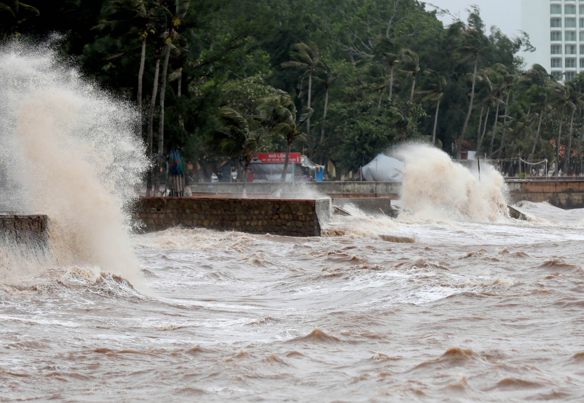
Storm No. 3 caused big waves in Do Son Ward, Hai Phong City early this morning, July 22.
PHOTO: NGOC DUONG
According to Mr. Mai Van Khiem, the storm's intensity when it makes landfall is still strong at level 8 - 9, gusting at level 11 - 12. The inland areas of the provinces and cities of Hai Phong, Hung Yen, Bac Ninh, Hanoi, Ninh Binh and Thanh Hoa have strong winds at level 5 - 6, gusting at level 7.
"The focus of strong winds will be the coastal areas of Hung Yen (former Thai Binh) and Ninh Binh (former Nam Dinh)," said Mr. Khiem.
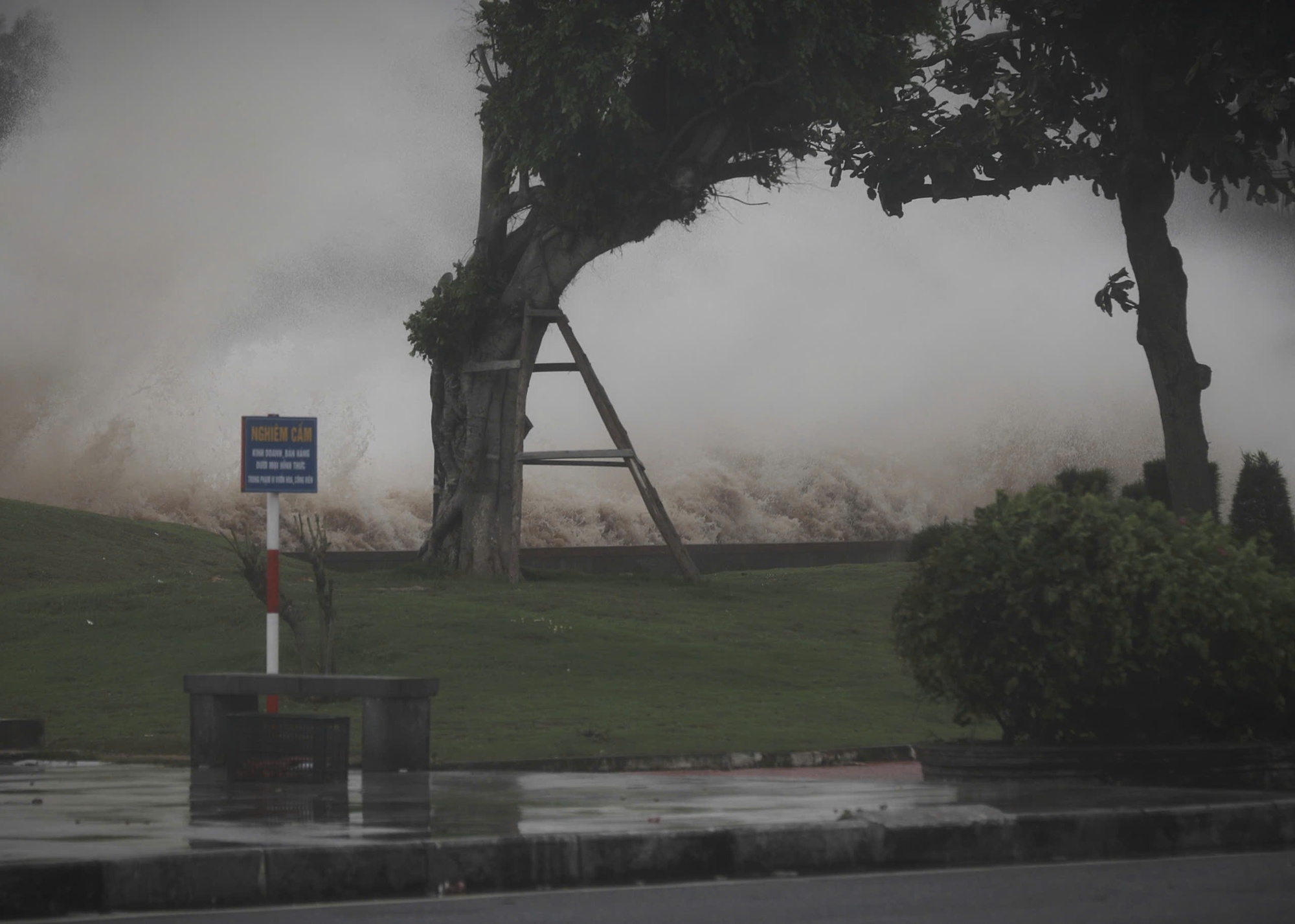
Coastal blockade before storm hits
On the morning of July 22, in Do Son ward - a locality directly affected by storm No. 3, the weather was temporarily sunny but there were strong gusts of wind and large waves.
On coastal routes, local authorities have mobilized many checkpoints along the coast since early morning to promptly handle the situation. People are asked to limit going out, only going out when absolutely necessary to ensure absolute safety.
Along the coast of Do Son Ward (Hai Phong City) this morning, waves were recorded, about to exceed the embankment.
PHOTO: NGOC DUONG
Mr. Pham Hoang Tuan, Chairman of Do Son Ward People's Committee, said that by the morning of July 22, the ward had completed the evacuation of households in dangerous areas to safe shelters.
"This is an area directly affected by the storm, so we have taken households in high-risk areas to storm shelters. Currently, about 150 people have been temporarily placed in safe areas. Storm response is still under control. The locality is always on high alert, absolutely putting people's safety first when the storm makes landfall," Mr. Tuan shared.
Thanh Nien 's records at 15/5 Square and beaches No. 1 and No. 2 show that the waves began to rise, many waves overflowed the embankments, offshore winds gusted to level 8-9, and thick dark clouds covered the area.
Thanhnien.vn
Source: https://thanhnien.vn/tam-bao-so-3-dang-do-bo-hung-yen-ninh-binh-185250722083421557.htm


![[Photo] National Assembly Chairman Tran Thanh Man visits Vietnamese Heroic Mother Ta Thi Tran](https://vphoto.vietnam.vn/thumb/1200x675/vietnam/resource/IMAGE/2025/7/20/765c0bd057dd44ad83ab89fe0255b783)


Comment (0)