
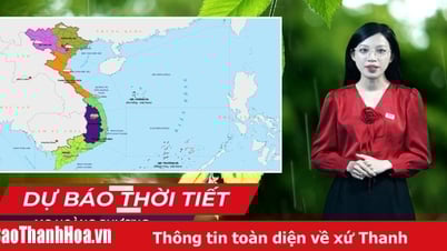
Regarding weather forecasting and natural disaster warning after the arrangement of administrative units according to the 2-level government model, Mr. Nguyen Thuong Hien - Director of the Department of Hydrometeorology ( Ministry of Agriculture and Environment ) said that this Department is building weather forecast bulletins on land, at sea, natural disaster warnings... in the direction of updating new administrative units. The subdivisions and regions are also adjusted to show the current status of new place names in an easy-to-understand and detailed way to help the recipients, the people and leaders of the new administrative area, grasp the information clearly to respond appropriately.
 |
Mr. Nguyen Thuong Hien - Director of the Department of Hydrometeorology, Ministry of Agriculture and Environment. Photo: Department of Hydrometeorology |
The forecast bulletin on land will add Ho Chi Minh City area.
The National Center for Hydro-Meteorological Forecasting will forecast for typical climate zones for the whole country, including 7 old zones and adding the Ho Chi Minh City area.
Areas adjusted according to the new administrative names include:
Northwestern region: Lai Chau, Dien Bien , Son La, Lao Cai, western region of Phu Tho province (formerly Hoa Binh province).
Northeastern region: Tuyen Quang, Cao Bang, Thai Nguyen, Lang Son, Bac Ninh, Bac Giang, Hai Phong, Hung Yen, Ninh Binh, Hanoi, northern region of Phu Tho province (former Vinh Phuc and Phu Tho provinces);
Thanh Hoa-Hue area;
South Central Coast region (Da Nang, Khanh Hoa and coastal provinces of Quang Ngai, Gia Lai, Dak Lak, Lam Dong);
Central Highlands region: West of Quang Ngai, Gia Lai, Dak Lak, Lam Dong provinces;
Southern region;
Hanoi area;
Ho Chi Minh City area.
Marine weather forecast bulletin
Northern Gulf of Tonkin area (Quang Ninh-Ninh Binh sea area); Southern Gulf of Tonkin area (Thanh Hoa-North Quang Tri sea area (former Quang Binh province sea area); Southern Quang Tri-Quang Ngai sea area (former Quang Tri-Quang Ngai sea area).
Gia Lai-Khanh Hoa sea area (formerly Binh Dinh-Ninh Thuan sea area); Lam Dong-Ca Mau sea area (formerly Binh Thuan-Ca Mau sea area); Ca Mau-An Giang sea area (formerly Ca Mau-Kien Giang sea area).
The Northern area of the East Sea (the sea area north of 15 degrees North latitude); The Central area of the East Sea (the sea area 10-15 degrees North latitude); The Southern area of the East Sea (the sea area 5-10 degrees North latitude); The Gulf of Thailand area; Hoang Sa Special Zone (the sea area of Hoang Sa archipelago); Truong Sa Special Zone (the sea area of Truong Sa archipelago).
Mr. Mai Van Khiem, Director of the National Center for Hydro-Meteorological Forecasting (Department of Hydro-Meteorology) said that weather forecasts will be developed in detail for each location and forecasted up to 10 days in advance.
"Along with that, to make it convenient for people, we are building a weather application for people to use on their phones, computers... The goal is to provide detailed information to communes and wards, updated 24/7 and forecast 10 days in advance. It is expected that in August 2025, we will complete the construction of this application. In addition to weather information, this application has information on natural disaster warnings such as flash floods, landslides, storms, tropical depressions, heavy rain, thunderstorms, tornadoes, lightning... And people can access it completely free of charge," Mr. Khiem added.
Source: https://baophapluat.vn/du-bao-thoi-tiet-theo-don-vi-hanh-chinh-2-cap-post553397.html


Comment (0)