

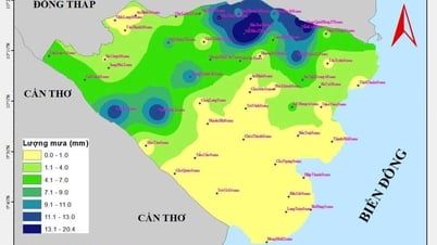
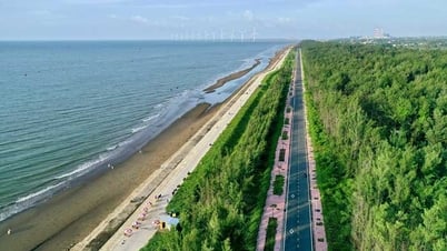
According to the provincial Hydrometeorological Station, on river banks and canals in the province, the highest daily peak water level tends to gradually increase from August 21 to 24, with little change on August 25 to 26, and slowly decrease from September 27 to 1.
Warning, the highest peak water level during the high tide from August 22-28 will appear on August 24-26 (July 2-4, lunar calendar): at My Thuan station, it is 9cm higher than alert level III, at Cho Lach and Ben Tre stations, it is approximately at alert level I, the remaining stations are lower than alert level I. The low tide water level will appear on August 21-22 (June 28-29, lunar calendar).
High tides are likely to flood low-lying areas upstream of the provinces along the Tien and Hau rivers. They are likely to have negative impacts on the environment, road and waterway traffic activities, and residential areas such as some roads in Thanh Duc ward; Phuoc Hau ward, Long Chau ward, Tan Ngai ward, Mo Cay commune, Cho Lach commune, National Highway 57, An Dinh-An Thoi commune... Especially other low-lying areas (aquaculture areas, livestock farms, orchards...), weak dyke areas outside the dyke, sandbanks, islands, and riverside areas.
NGUYEN KHANG
Source: https://baovinhlong.com.vn/thoi-su/202508/canh-bao-trieu-cuong-co-kha-nang-gay-ngap-lut-e6b1215/


![[Photo] Many people eagerly await the preliminary review despite heavy rain](https://vphoto.vietnam.vn/thumb/1200x675/vietnam/resource/IMAGE/2025/8/27/4dc782c65c1244b196890448bafa9b69)

![[Photo] Brilliant red of the exhibition 95 years of the Party Flag lighting the way before the opening](https://vphoto.vietnam.vn/thumb/1200x675/vietnam/resource/IMAGE/2025/8/27/e19d957d17f649648ca14ce6cc4d8dd4)
![[Photo] Prime Minister Pham Minh Chinh chairs meeting of National Steering Committee on International Integration](https://vphoto.vietnam.vn/thumb/1200x675/vietnam/resource/IMAGE/2025/8/26/9d34a506f9fb42ac90a48179fc89abb3)


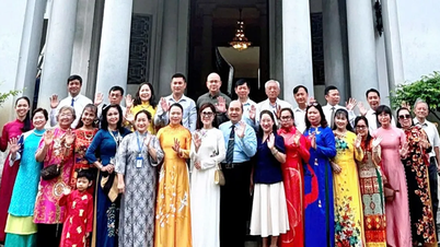


![[Photo] General Secretary To Lam attends Meeting with generations of National Assembly deputies](https://vphoto.vietnam.vn/thumb/402x226/vietnam/resource/IMAGE/2025/8/27/a79fc06e4aa744c9a4b7fa7dfef8a266)


Comment (0)