

It is forecasted that in the next 3-6 hours, storm No. 5 will move in a West-Northwest direction, making landfall in the North Ha Tinh - South Nghe An area. The risk of strong winds caused by storm No. 5 will continue.
At 4:00 p.m. on August 25, the center of the storm was located at approximately 18.4 degrees North latitude; 106.0 degrees East longitude, in the coastal waters of Nghe An - Ha Tinh. The strongest wind near the center of the storm was level 11-12 (103-133 km/h), gusting to level 14; moving in a West Northwest direction at a speed of 15-20 km/h.

According to SGGP Newspaper's reporter, from 11am to 2pm this afternoon, Hanoi and many places in the North had torrential rain, without stopping.
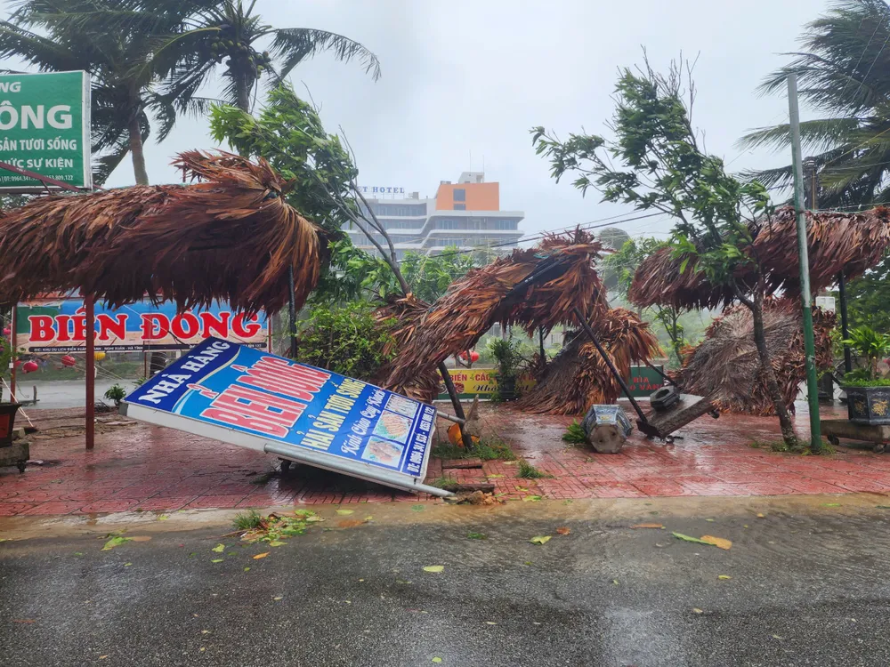
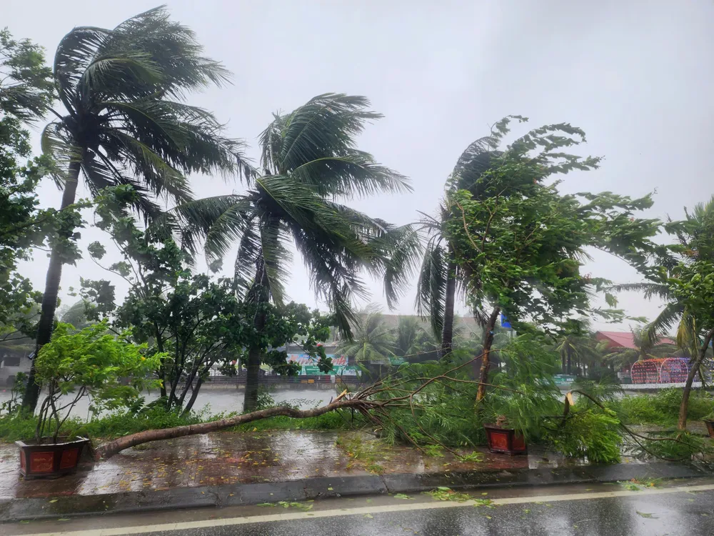
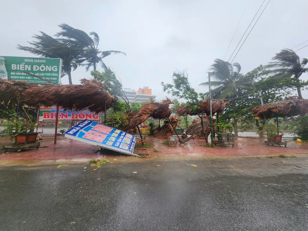
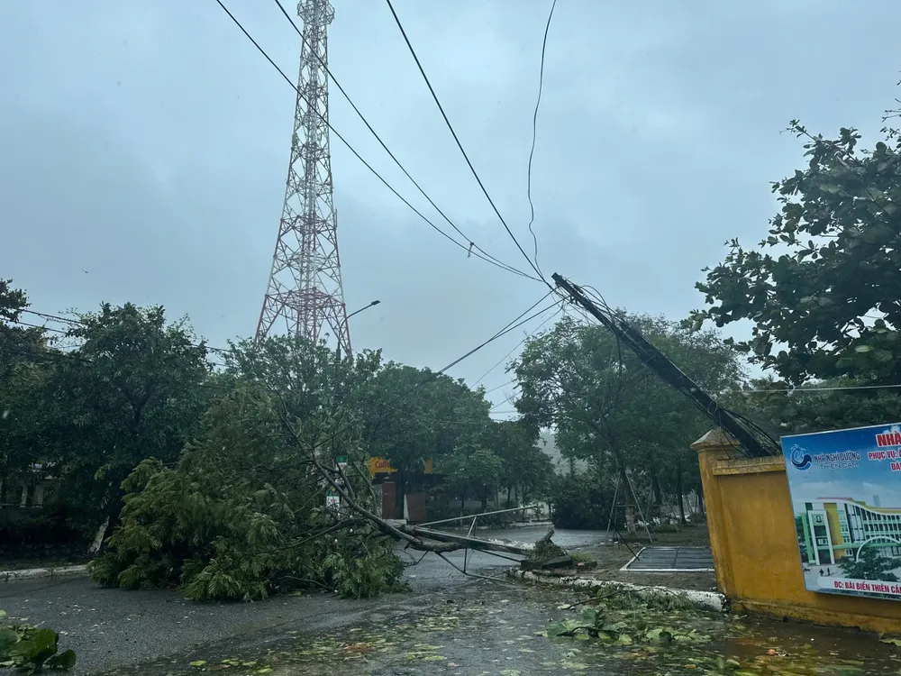
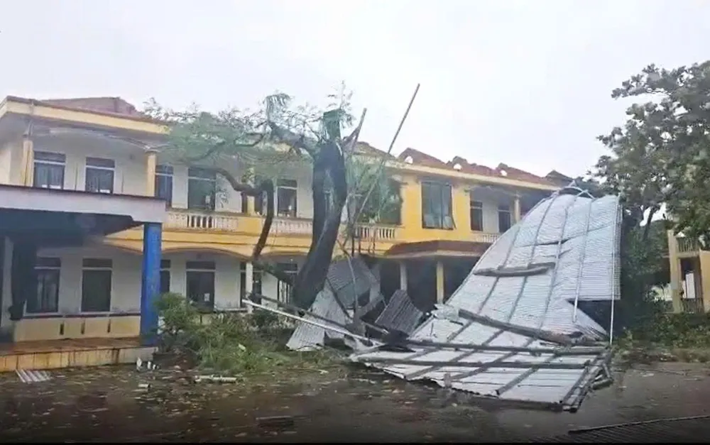
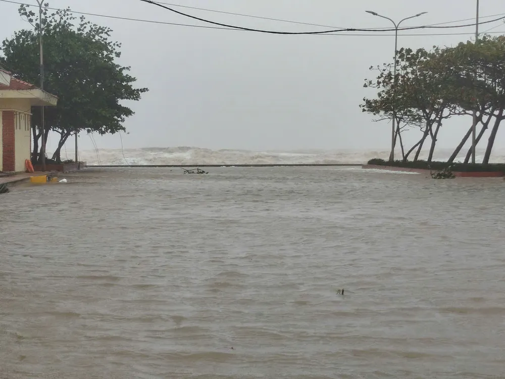
Due to the impact of storm No. 5, many coastal areas and the Northern Delta and North Central Coast have strong winds, heavy rain and high water.

* At 4:30 p.m., at Ben Thuy market area (Truong Vinh ward, Nghe An province), the wind started to blow again, whistling. Some advertising signs were torn apart.

At Bach Long Vi meteorological station (Hai Phong city), strong winds of level 7, gusts of level 9; Co To (Quang Ninh province) winds of level 7, gusts of level 10; Bai Chay (Quang Ninh province) winds of level 6, gusts of level 8; Van Ly (Ninh Binh province) winds of level 8, gusts of level 9. Nghe An province has strong winds of level 7, gusts of level 9 in Dien Chau; level 7, gusts of level 12 in Quynh Luu; level 8, gusts of level 11 in Hon Ngu.
Ha Tinh also had wind level 7, gusting to level 9 in Hoanh Son; level 7, gusting to level 11 in Ky Anh; wind level 8 in Cam Nhuong. On Con Co island (Quang Tri province), strong wind level 6, gusting to level 8.


Speaking to the press at noon on August 25, Mr. Mai Van Khiem, Director of the National Center for Hydro-Meteorological Forecasting, warned that after storm No. 5 made landfall, very heavy rain would cover the entire North and Central regions due to the large cloud disk brought inland by storm No. 5.
The National Center for Hydro-Meteorological Forecasting reported that heavy rains continued to cover many areas from the afternoon of August 25 to the end of August 26. The Northern Midlands and Delta, Lao Cai, Son La and provinces from Thanh Hoa to Quang Tri will have widespread rain with rainfall ranging from 70-150mm, many places over 250mm.

Particularly, the area from Thanh Hoa to Northern Quang Tri is forecast to have very heavy rain, total rainfall of 150-350mm, some places exceeding 500mm, with warnings of heavy rain over 200mm in 3 hours. In Hanoi on August 25 and 26, there will be moderate rain, heavy rain with thunderstorms; Da Nang will have occasional showers; Ho Chi Minh City will have rain and thunderstorms concentrated in the evening, with the potential risk of tornadoes and strong gusts of wind.
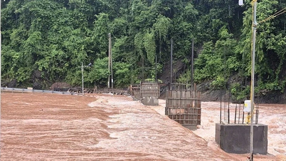
From the afternoon of August 25 to 27, the Upper Laos and Central Laos regions will have heavy rain with rainfall of 100-250mm, locally in Central Laos over 500mm, with a high risk of flash floods and inundation.

>> Images recorded in Nghe An, Ha Tinh:

Source: https://www.sggp.org.vn/bao-so-5-it-di-chuyen-cuong-do-giam-xuong-cap-12-giat-cap-14-post810085.html
![[Photo] General Secretary To Lam attends the 80th anniversary of Vietnam's diplomacy](https://vphoto.vietnam.vn/thumb/1200x675/vietnam/resource/IMAGE/2025/8/25/3dc715efdbf74937b6fe8072bac5cb30)


Comment (0)